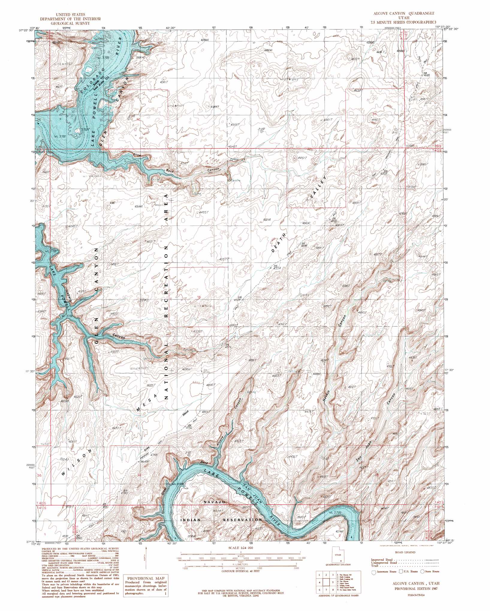
Alcove Canyon Topo Map Utah
To zoom in, hover over the map of Alcove Canyon
USGS Topo Quad 37110c6 - 1:24,000 scale
| Topo Map Name: | Alcove Canyon |
| USGS Topo Quad ID: | 37110c6 |
| Print Size: | ca. 21 1/4" wide x 27" high |
| Southeast Coordinates: | 37.25° N latitude / 110.625° W longitude |
| Map Center Coordinates: | 37.3125° N latitude / 110.6875° W longitude |
| U.S. State: | UT |
| Filename: | o37110c6.jpg |
| Download Map JPG Image: | Alcove Canyon topo map 1:24,000 scale |
| Map Type: | Topographic |
| Topo Series: | 7.5´ |
| Map Scale: | 1:24,000 |
| Source of Map Images: | United States Geological Survey (USGS) |
| Alternate Map Versions: |
Alcove Canyon UT 1987, updated 1987 Download PDF Buy paper map Alcove Canyon UT 2011 Download PDF Buy paper map Alcove Canyon UT 2014 Download PDF Buy paper map |
1:24,000 Topo Quads surrounding Alcove Canyon
Stevens Canyon North |
Hall Mesa |
Bullfrog |
Knowles Canyon |
Mancos Mesa |
Stevens Canyon South |
The Rincon Ne |
Halls Crossing |
Halls Crossing Ne |
Burnt Spring |
Davis Gulch |
The Rincon |
Alcove Canyon |
Nokai Dome |
Mikes Mesa |
Nasja Mesa |
Wilson Creek |
Deep Canyon North |
No Mans Mesa North |
Monitor Butte |
Rainbow Bridge |
Navajo Begay |
Deep Canyon South |
No Mans Mesa South |
Jacobs Monument |
> Back to 37110a1 at 1:100,000 scale
> Back to 37110a1 at 1:250,000 scale
> Back to U.S. Topo Maps home
Alcove Canyon topo map: Gazetteer
Alcove Canyon: Bends
Great Bend of the San Juan River elevation 1248m 4094′Alcove Canyon: Summits
Grey Mesa elevation 1478m 4849′Alcove Canyon: Valleys
Alcove Canyon elevation 1173m 3848′Navajo Canyon elevation 1130m 3707′
San Juan Canyon elevation 1129m 3704′
Slick Rock Canyon elevation 1129m 3704′
Alcove Canyon digital topo map on disk
Buy this Alcove Canyon topo map showing relief, roads, GPS coordinates and other geographical features, as a high-resolution digital map file on DVD: