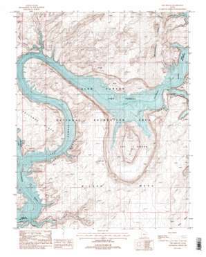
The Rincon Topo Map Utah
To zoom in, hover over the map of The Rincon
USGS Topo Quad 37110c7 - 1:24,000 scale
| Topo Map Name: | The Rincon |
| USGS Topo Quad ID: | 37110c7 |
| Print Size: | ca. 21 1/4" wide x 27" high |
| Southeast Coordinates: | 37.25° N latitude / 110.75° W longitude |
| Map Center Coordinates: | 37.3125° N latitude / 110.8125° W longitude |
| U.S. State: | UT |
| Filename: | o37110c7.jpg |
| Download Map JPG Image: | The Rincon topo map 1:24,000 scale |
| Map Type: | Topographic |
| Topo Series: | 7.5´ |
| Map Scale: | 1:24,000 |
| Source of Map Images: | United States Geological Survey (USGS) |
| Alternate Map Versions: |
The Rincon UT 1987, updated 1988 Download PDF Buy paper map The Rincon UT 1987, updated 1988 Download PDF Buy paper map The Rincon UT 2011 Download PDF Buy paper map The Rincon UT 2014 Download PDF Buy paper map |
1:24,000 Topo Quads surrounding The Rincon
> Back to 37110a1 at 1:100,000 scale
> Back to 37110a1 at 1:250,000 scale
> Back to U.S. Topo Maps home
The Rincon topo map: Gazetteer
The Rincon: Arches
Aleson Arch elevation 1389m 4557′Bell Tower Window elevation 1295m 4248′
Triple Arch elevation 1343m 4406′
The Rincon: Bars
Little Anna Bar (historical) elevation 1129m 3704′Oil Seep Bar (historical) elevation 1129m 3704′
The Rincon: Basins
The Rincon elevation 1400m 4593′The Rincon: Bays
Flying Eagle Cove elevation 1129m 3704′The Rincon: Benches
Jackass Bench (historical) elevation 1129m 3704′Pollywog Bench elevation 1264m 4146′
The Rincon: Oilfields
Bennetts Oil Field elevation 1129m 3704′The Rincon: Slopes
The Slope elevation 1374m 4507′The Rincon: Streams
Escalante River elevation 1129m 3704′Navajo Creek elevation 1131m 3710′
The Rincon: Summits
Wilson Mesa elevation 1451m 4760′The Rincon: Valleys
Bowns Canyon elevation 1156m 3792′Iceberg Canyon elevation 1129m 3704′
Long Canyon elevation 1129m 3704′
Ribbon Canyon elevation 1129m 3704′
The Rincon digital topo map on disk
Buy this The Rincon topo map showing relief, roads, GPS coordinates and other geographical features, as a high-resolution digital map file on DVD:


