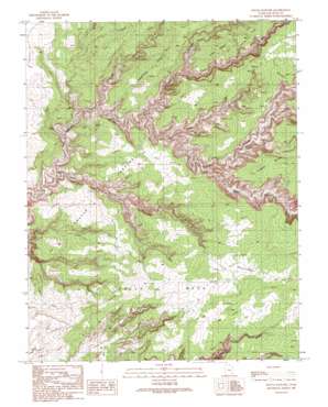
Pollys Pasture Topo Map Utah
To zoom in, hover over the map of Pollys Pasture
USGS Topo Quad 37110d1 - 1:24,000 scale
| Topo Map Name: | Pollys Pasture |
| USGS Topo Quad ID: | 37110d1 |
| Print Size: | ca. 21 1/4" wide x 27" high |
| Southeast Coordinates: | 37.375° N latitude / 110° W longitude |
| Map Center Coordinates: | 37.4375° N latitude / 110.0625° W longitude |
| U.S. State: | UT |
| Filename: | o37110d1.jpg |
| Download Map JPG Image: | Pollys Pasture topo map 1:24,000 scale |
| Map Type: | Topographic |
| Topo Series: | 7.5´ |
| Map Scale: | 1:24,000 |
| Source of Map Images: | United States Geological Survey (USGS) |
| Alternate Map Versions: |
Pollys Pasture UT 1989, updated 1989 Download PDF Buy paper map Pollys Pasture UT 2011 Download PDF Buy paper map Pollys Pasture UT 2014 Download PDF Buy paper map |
1:24,000 Topo Quads surrounding Pollys Pasture
> Back to 37110a1 at 1:100,000 scale
> Back to 37110a1 at 1:250,000 scale
> Back to U.S. Topo Maps home
Pollys Pasture topo map: Gazetteer
Pollys Pasture: Cliffs
Big Man Panel elevation 1559m 5114′Red House Cliffs elevation 1847m 6059′
Pollys Pasture: Falls
The Thumb Pour Off elevation 1693m 5554′Pollys Pasture: Flats
Hardscrabble elevation 1854m 6082′Pollys Pasture elevation 1650m 5413′
Pollys Pasture: Islands
Pollys Island elevation 1616m 5301′Pollys Pasture: Parks
Grand Gulch Primitive Area elevation 1707m 5600′Pollys Pasture: Ridges
Step Point elevation 1855m 6085′Pollys Pasture: Springs
Bullet Canyon Spring elevation 1642m 5387′Coyote Spring elevation 1787m 5862′
Deer Canyon Spring elevation 1536m 5039′
Green Canyon Spring elevation 1664m 5459′
Green Mash Spring elevation 1776m 5826′
Jailhouse Spring elevation 1692m 5551′
Pollys Spring elevation 1544m 5065′
Step Spring elevation 1713m 5620′
Pollys Pasture: Trails
Government Trail elevation 1604m 5262′Pollys Pasture: Valleys
Bullet Canyon elevation 1637m 5370′Cow Trail Canyon elevation 1580m 5183′
Coyote Canyon elevation 1687m 5534′
Dripping Canyon elevation 1584m 5196′
Pine Canyon elevation 1663m 5456′
Pollys Canyon elevation 1575m 5167′
Sheiks Canyon elevation 1668m 5472′
Steer Gulch elevation 1616m 5301′
Step Canyon elevation 1648m 5406′
Pollys Pasture digital topo map on disk
Buy this Pollys Pasture topo map showing relief, roads, GPS coordinates and other geographical features, as a high-resolution digital map file on DVD:


