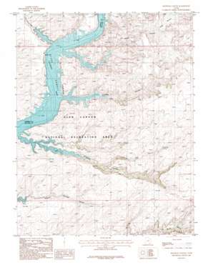
Knowles Canyon Topo Map Utah
To zoom in, hover over the map of Knowles Canyon
USGS Topo Quad 37110e5 - 1:24,000 scale
| Topo Map Name: | Knowles Canyon |
| USGS Topo Quad ID: | 37110e5 |
| Print Size: | ca. 21 1/4" wide x 27" high |
| Southeast Coordinates: | 37.5° N latitude / 110.5° W longitude |
| Map Center Coordinates: | 37.5625° N latitude / 110.5625° W longitude |
| U.S. State: | UT |
| Filename: | o37110e5.jpg |
| Download Map JPG Image: | Knowles Canyon topo map 1:24,000 scale |
| Map Type: | Topographic |
| Topo Series: | 7.5´ |
| Map Scale: | 1:24,000 |
| Source of Map Images: | United States Geological Survey (USGS) |
| Alternate Map Versions: |
Knowles Canyon UT 1987, updated 1988 Download PDF Buy paper map Knowles Canyon UT 2011 Download PDF Buy paper map Knowles Canyon UT 2014 Download PDF Buy paper map |
1:24,000 Topo Quads surrounding Knowles Canyon
> Back to 37110e1 at 1:100,000 scale
> Back to 37110a1 at 1:250,000 scale
> Back to U.S. Topo Maps home
Knowles Canyon topo map: Gazetteer
Knowles Canyon: Bars
Olympia Bar elevation 1129m 3704′Knowles Canyon: Cliffs
Tapestry Wall elevation 1329m 4360′Knowles Canyon: Slopes
Moki Stairs elevation 1141m 3743′Knowles Canyon: Springs
Lone Pine Spring elevation 1339m 4393′Lone Pine Spring elevation 1353m 4438′
Knowles Canyon: Streams
Warm Springs Creek elevation 1222m 4009′Knowles Canyon: Valleys
Cedar Canyon elevation 1135m 3723′Crystal Springs Canyon elevation 1131m 3710′
Forgotten Canyon elevation 1129m 3704′
Knowles Canyon elevation 1139m 3736′
Knowles Canyon elevation 1226m 4022′
Lone Pine Canyon elevation 1149m 3769′
Lone Pine Canyon elevation 1142m 3746′
Mancos Canyon elevation 1229m 4032′
Trail Canyon elevation 1231m 4038′
Warm Springs Canyon elevation 1208m 3963′
Knowles Canyon digital topo map on disk
Buy this Knowles Canyon topo map showing relief, roads, GPS coordinates and other geographical features, as a high-resolution digital map file on DVD:


