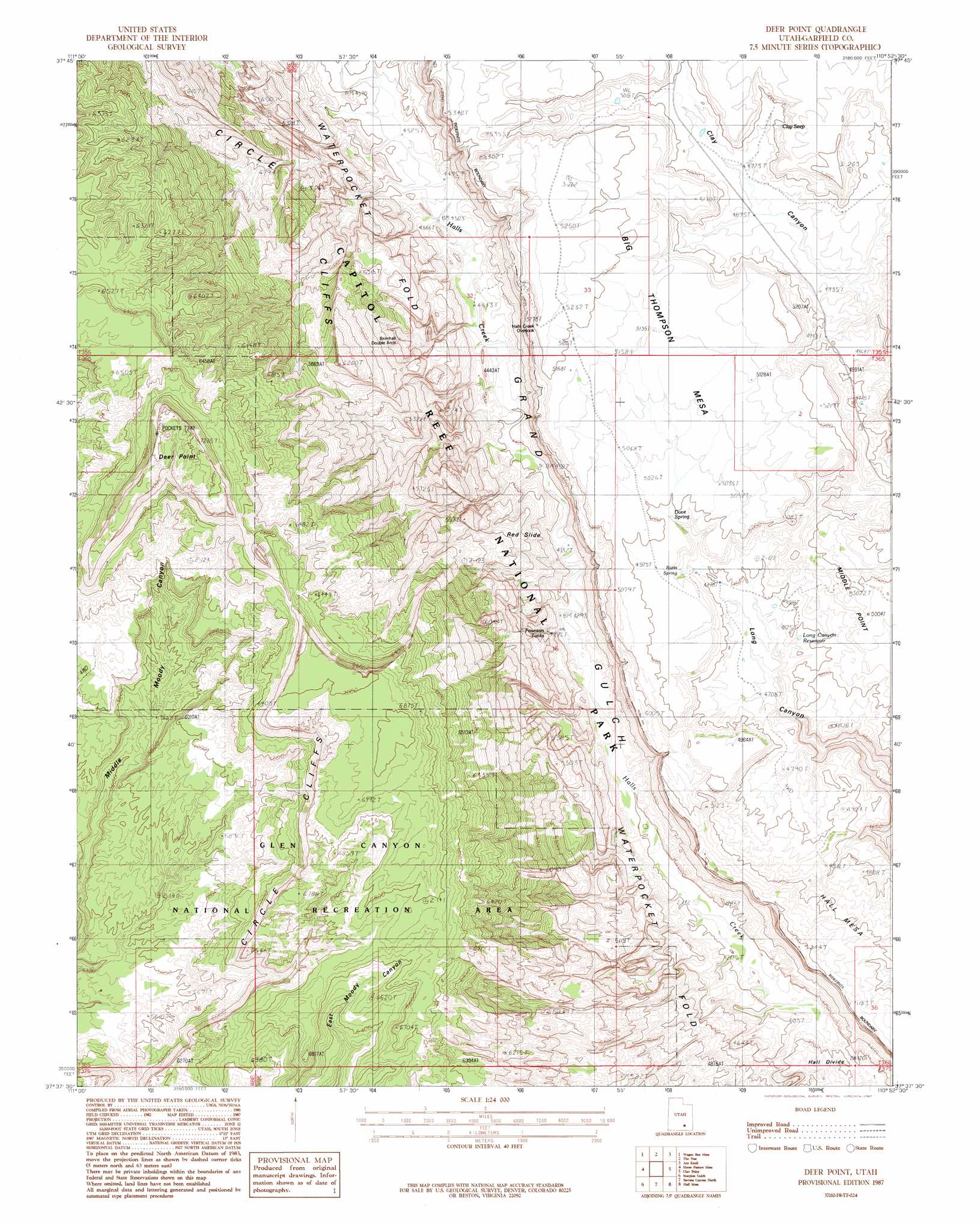
Deer Point Topo Map Utah
To zoom in, hover over the map of Deer Point
USGS Topo Quad 37110f8 - 1:24,000 scale
| Topo Map Name: | Deer Point |
| USGS Topo Quad ID: | 37110f8 |
| Print Size: | ca. 21 1/4" wide x 27" high |
| Southeast Coordinates: | 37.625° N latitude / 110.875° W longitude |
| Map Center Coordinates: | 37.6875° N latitude / 110.9375° W longitude |
| U.S. State: | UT |
| Filename: | o37110f8.jpg |
| Download Map JPG Image: | Deer Point topo map 1:24,000 scale |
| Map Type: | Topographic |
| Topo Series: | 7.5´ |
| Map Scale: | 1:24,000 |
| Source of Map Images: | United States Geological Survey (USGS) |
| Alternate Map Versions: |
Mt Pennell 3 NW UT 1953, updated 1954 Download PDF Buy paper map Deer Point UT 1987, updated 1987 Download PDF Buy paper map Deer Point UT 1987, updated 1987 Download PDF Buy paper map Deer Point UT 2011 Download PDF Buy paper map Deer Point UT 2014 Download PDF Buy paper map |
1:24,000 Topo Quads surrounding Deer Point
Lamp Stand |
Bitter Creek Divide |
Cave Flat |
Mount Pennell |
Cass Creek Peak |
Pioneer Mesa |
Wagon Box Mesa |
The Post |
Ant Knoll |
Copper Creek Benches |
Silver Falls Bench |
Horse Pasture Mesa |
Deer Point |
Clay Point |
Lost Spring |
Egypt |
Scorpion Gulch |
Stevens Canyon North |
Hall Mesa |
Bullfrog |
Big Hollow Wash |
King Mesa |
Stevens Canyon South |
The Rincon Ne |
Halls Crossing |
> Back to 37110e1 at 1:100,000 scale
> Back to 37110a1 at 1:250,000 scale
> Back to U.S. Topo Maps home
Deer Point topo map: Gazetteer
Deer Point: Arches
Brimhall Bridge elevation 1438m 4717′Deer Point: Cliffs
Deer Point elevation 2198m 7211′Deer Point: Gaps
Hall Divide elevation 1279m 4196′Deer Point: Springs
Clay Seep elevation 1520m 4986′Deer Point: Summits
Big Thomson Mesa elevation 1559m 5114′Deer Point digital topo map on disk
Buy this Deer Point topo map showing relief, roads, GPS coordinates and other geographical features, as a high-resolution digital map file on DVD: