Hite South Topo Map Utah
To zoom in, hover over the map of Hite South
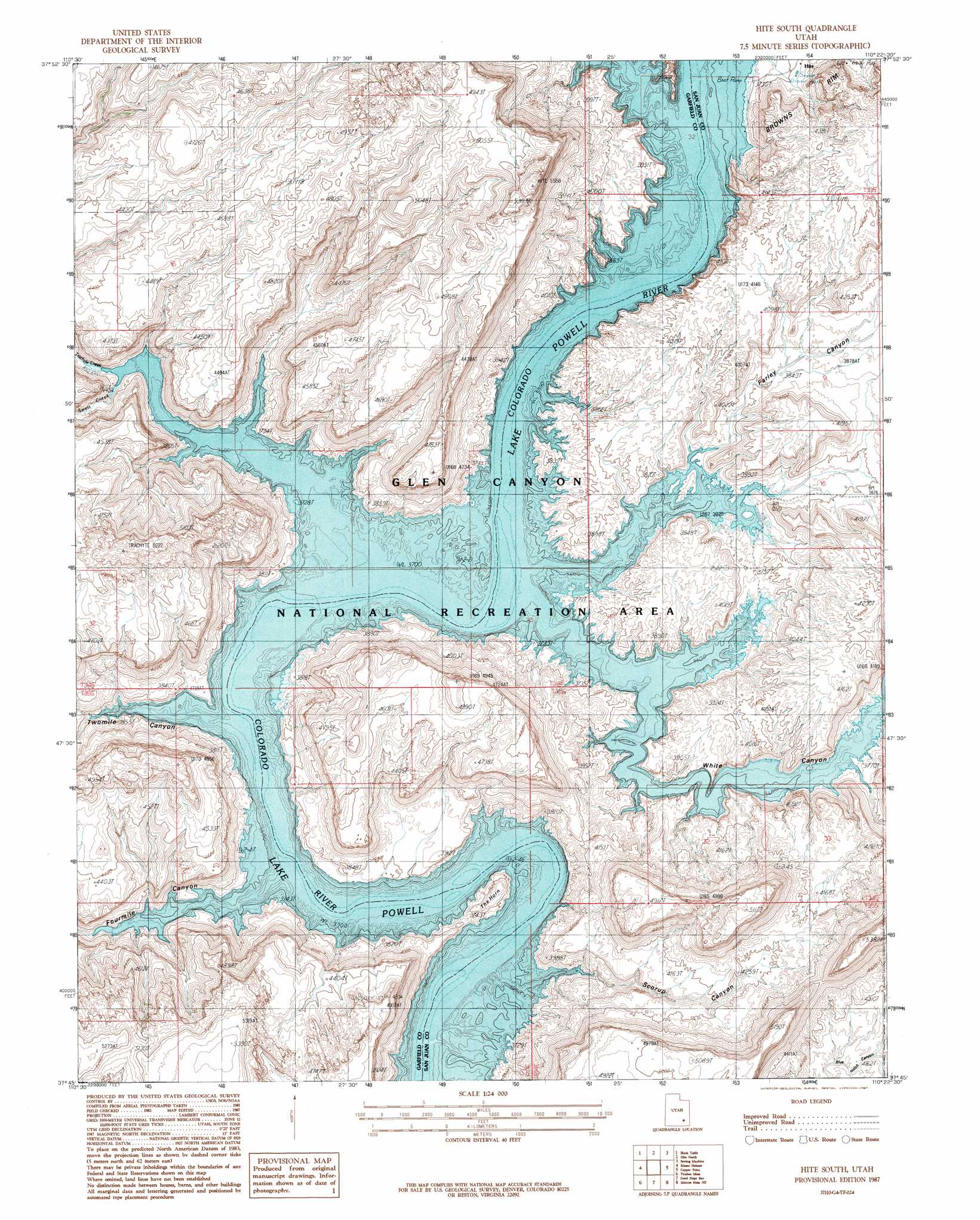
USGS Topo Quad 37110g4 - 1:24,000 scale
| Topo Map Name: | Hite South |
| USGS Topo Quad ID: | 37110g4 |
| Print Size: | ca. 21 1/4" wide x 27" high |
| Southeast Coordinates: | 37.75° N latitude / 110.375° W longitude |
| Map Center Coordinates: | 37.8125° N latitude / 110.4375° W longitude |
| U.S. State: | UT |
| Filename: | o37110g4.jpg |
| Download Map JPG Image: | Hite South topo map 1:24,000 scale |
| Map Type: | Topographic |
| Topo Series: | 7.5´ |
| Map Scale: | 1:24,000 |
| Source of Map Images: | United States Geological Survey (USGS) |
| Alternate Map Versions: |
White Canyon 2 SW UT 1954, updated 1954 Download PDF Buy paper map Hite South UT 1987, updated 1987 Download PDF Buy paper map Hite South UT 2011 Download PDF Buy paper map Hite South UT 2014 Download PDF Buy paper map |
1:24,000 Topo Quads surrounding Hite South
Raggy Canyon |
Turkey Knob |
Stair Canyon |
Fiddler Butte |
Clearwater Canyon |
Cass Creek Peak |
Black Table |
Hite North |
Sewing Machine |
Bowdie Canyon West |
Copper Creek Benches |
Mount Holmes |
Hite South |
Copper Point |
Indian Head Pass |
Lost Spring |
Ticaboo Mesa |
Good Hope Bay |
Mancos Mesa Ne |
Jacobs Chair |
Bullfrog |
Knowles Canyon |
Mancos Mesa |
Chocolate Drop |
Fry Spring |
> Back to 37110e1 at 1:100,000 scale
> Back to 37110a1 at 1:250,000 scale
> Back to U.S. Topo Maps home
Hite South topo map: Gazetteer
Hite South: Populated Places
Hite (historical) elevation 1129m 3704′White Canyon elevation 1129m 3704′
Hite South: Streams
Swett Creek elevation 1129m 3704′Trachyte Creek elevation 1129m 3704′
White Canyon Creek elevation 1129m 3704′
Hite South: Summits
Red Monument elevation 1399m 4589′The Horn elevation 1193m 3914′
Hite South: Valleys
Farley Canyon elevation 1129m 3704′Fourmile Canyon elevation 1129m 3704′
North Wash elevation 1129m 3704′
Scorup Canyon elevation 1129m 3704′
Twomile Canyon elevation 1129m 3704′
White Canyon elevation 1129m 3704′
Hite South digital topo map on disk
Buy this Hite South topo map showing relief, roads, GPS coordinates and other geographical features, as a high-resolution digital map file on DVD: