Smoky Hollow Topo Map Utah
To zoom in, hover over the map of Smoky Hollow
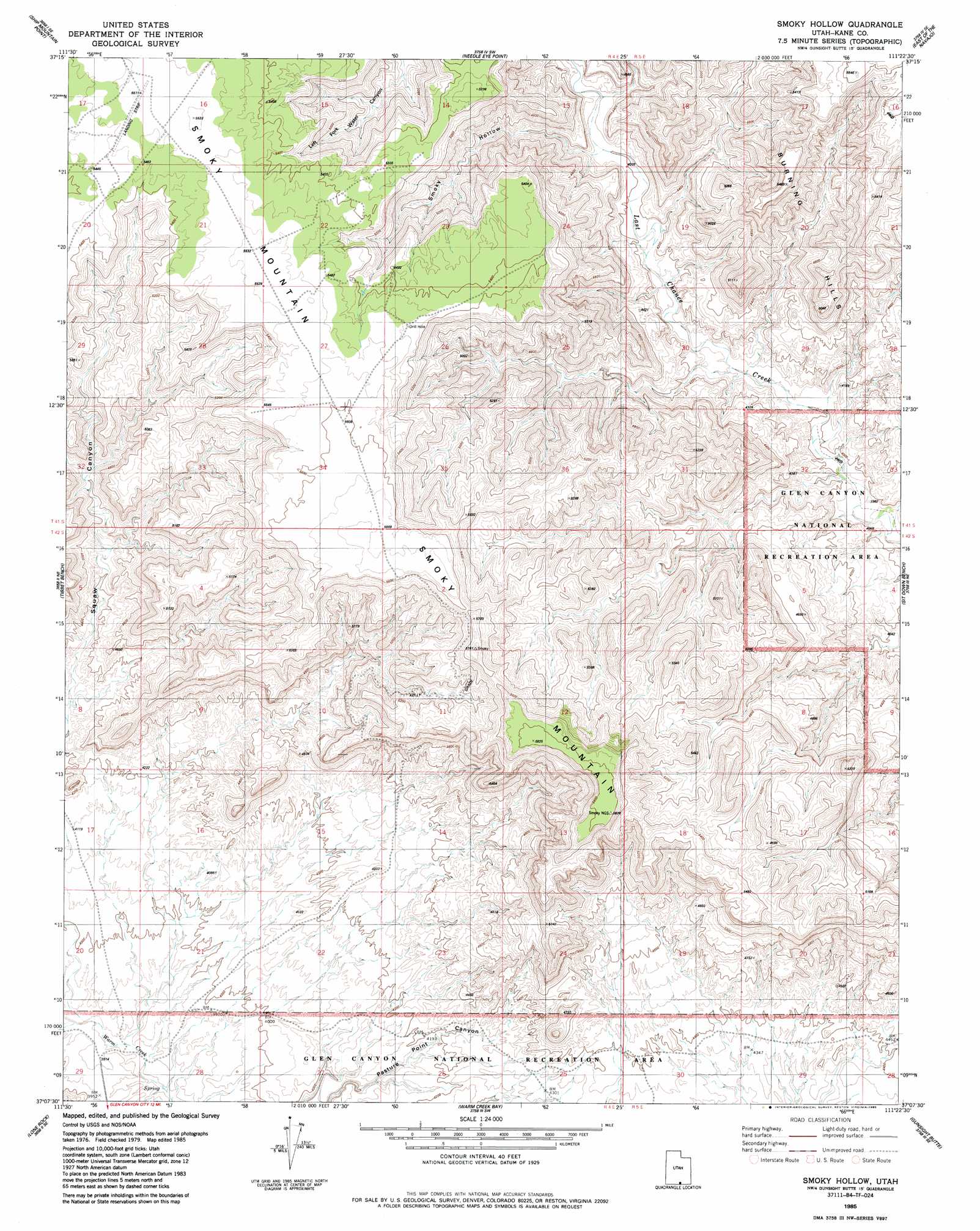
USGS Topo Quad 37111b4 - 1:24,000 scale
| Topo Map Name: | Smoky Hollow |
| USGS Topo Quad ID: | 37111b4 |
| Print Size: | ca. 21 1/4" wide x 27" high |
| Southeast Coordinates: | 37.125° N latitude / 111.375° W longitude |
| Map Center Coordinates: | 37.1875° N latitude / 111.4375° W longitude |
| U.S. State: | UT |
| Filename: | o37111b4.jpg |
| Download Map JPG Image: | Smoky Hollow topo map 1:24,000 scale |
| Map Type: | Topographic |
| Topo Series: | 7.5´ |
| Map Scale: | 1:24,000 |
| Source of Map Images: | United States Geological Survey (USGS) |
| Alternate Map Versions: |
Smoky Hollow UT 1985, updated 1985 Download PDF Buy paper map Smoky Hollow UT 2011 Download PDF Buy paper map Smoky Hollow UT 2014 Download PDF Buy paper map |
1:24,000 Topo Quads surrounding Smoky Hollow
Horse Mountain |
Petes Cove |
Collet Top |
Basin Canyon |
Big Hollow Wash |
Fourmile Bench |
Ship Mountain Point |
Needle Eye Point |
East Of The Navajo |
Blackburn Canyon |
Nipple Butte |
Tibbet Bench |
Smoky Hollow |
Sit Down Bench |
Mazuki Point |
Glen Canyon City |
Lone Rock |
Warm Creek Bay |
Gunsight Butte |
Gregory Butte |
Water Pockets |
Ferry Swale |
Page |
Wild Horse Mesa |
Face Canyon |
> Back to 37111a1 at 1:100,000 scale
> Back to 37110a1 at 1:250,000 scale
> Back to U.S. Topo Maps home
Smoky Hollow topo map: Gazetteer
Smoky Hollow: Ridges
Smoky Mountain elevation 1759m 5770′Smoky Hollow: Slopes
Kelly Grade elevation 1555m 5101′Smoky Hollow: Springs
Berry Springs elevation 1552m 5091′Smoky Hollow: Valleys
Smoky Hollow elevation 1287m 4222′Squaw Canyon elevation 1184m 3884′
Smoky Hollow digital topo map on disk
Buy this Smoky Hollow topo map showing relief, roads, GPS coordinates and other geographical features, as a high-resolution digital map file on DVD: