Needle Eye Point Topo Map Utah
To zoom in, hover over the map of Needle Eye Point
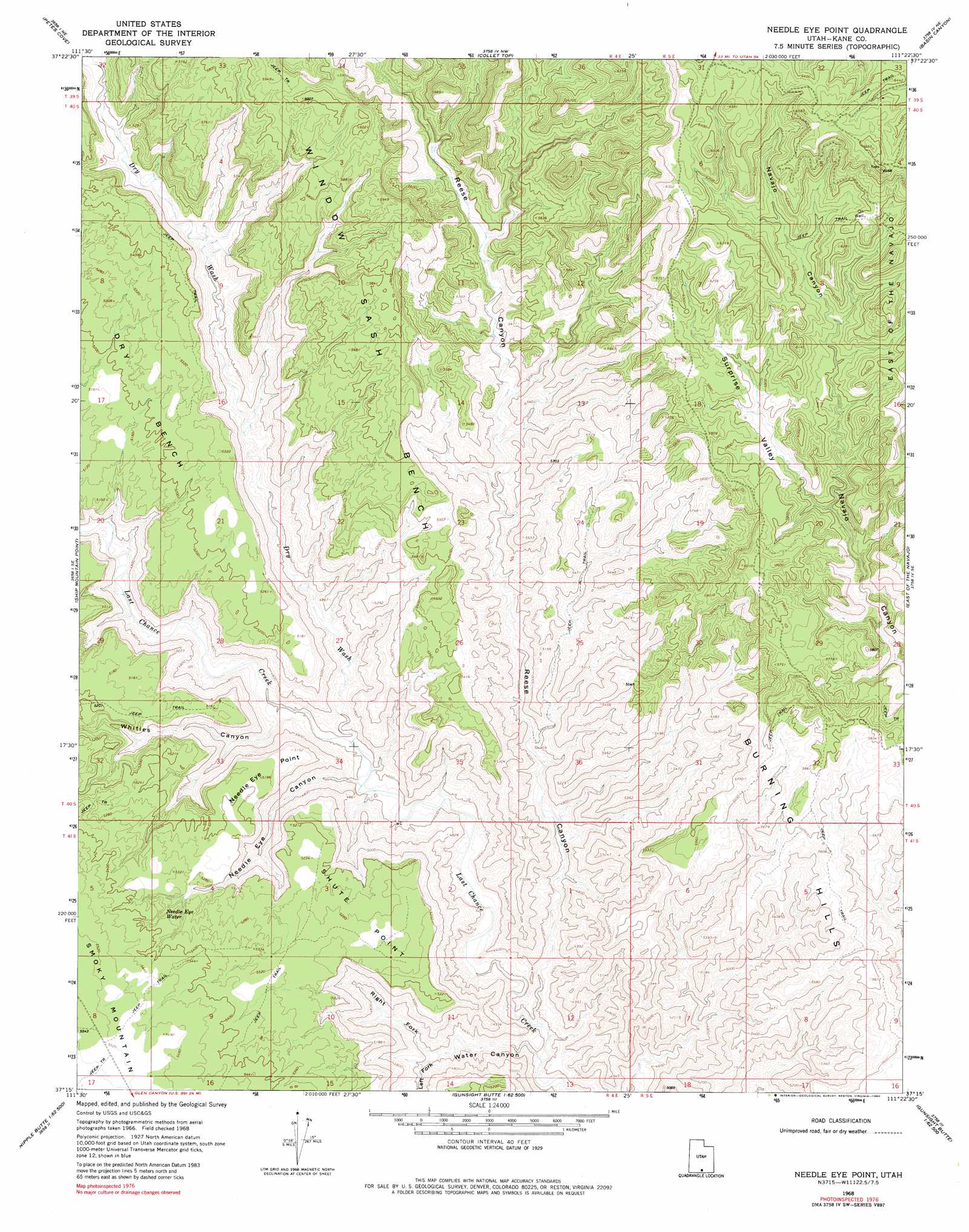
USGS Topo Quad 37111c4 - 1:24,000 scale
| Topo Map Name: | Needle Eye Point |
| USGS Topo Quad ID: | 37111c4 |
| Print Size: | ca. 21 1/4" wide x 27" high |
| Southeast Coordinates: | 37.25° N latitude / 111.375° W longitude |
| Map Center Coordinates: | 37.3125° N latitude / 111.4375° W longitude |
| U.S. State: | UT |
| Filename: | o37111c4.jpg |
| Download Map JPG Image: | Needle Eye Point topo map 1:24,000 scale |
| Map Type: | Topographic |
| Topo Series: | 7.5´ |
| Map Scale: | 1:24,000 |
| Source of Map Images: | United States Geological Survey (USGS) |
| Alternate Map Versions: |
Needle Eye Point UT 1968, updated 1971 Download PDF Buy paper map Needle Eye Point UT 1968, updated 1980 Download PDF Buy paper map Needle Eye Point UT 2011 Download PDF Buy paper map Needle Eye Point UT 2014 Download PDF Buy paper map |
1:24,000 Topo Quads surrounding Needle Eye Point
Death Ridge |
Carcass Canyon |
Seep Flat |
Sunset Flat |
Egypt |
Horse Mountain |
Petes Cove |
Collet Top |
Basin Canyon |
Big Hollow Wash |
Fourmile Bench |
Ship Mountain Point |
Needle Eye Point |
East Of The Navajo |
Blackburn Canyon |
Nipple Butte |
Tibbet Bench |
Smoky Hollow |
Sit Down Bench |
Mazuki Point |
Glen Canyon City |
Lone Rock |
Warm Creek Bay |
Gunsight Butte |
Gregory Butte |
> Back to 37111a1 at 1:100,000 scale
> Back to 37110a1 at 1:250,000 scale
> Back to U.S. Topo Maps home
Needle Eye Point topo map: Gazetteer
Needle Eye Point: Capes
Needle Eye Point elevation 1580m 5183′Shute Point elevation 1605m 5265′
Needle Eye Point: Springs
Needle Eye Water elevation 1603m 5259′Needle Eye Point: Streams
Bullberry Creek elevation 1576m 5170′Needle Eye Point: Valleys
Dry Wash elevation 1393m 4570′Left Fork Water Canyon elevation 1381m 4530′
Needle Eye Canyon elevation 1389m 4557′
Reese Canyon elevation 1341m 4399′
Right Fork Water Canyon elevation 1381m 4530′
Surprise Valley elevation 1682m 5518′
Water Canyon elevation 1322m 4337′
Whities Canyon elevation 1409m 4622′
Needle Eye Point digital topo map on disk
Buy this Needle Eye Point topo map showing relief, roads, GPS coordinates and other geographical features, as a high-resolution digital map file on DVD: