Basin Canyon Topo Map Utah
To zoom in, hover over the map of Basin Canyon
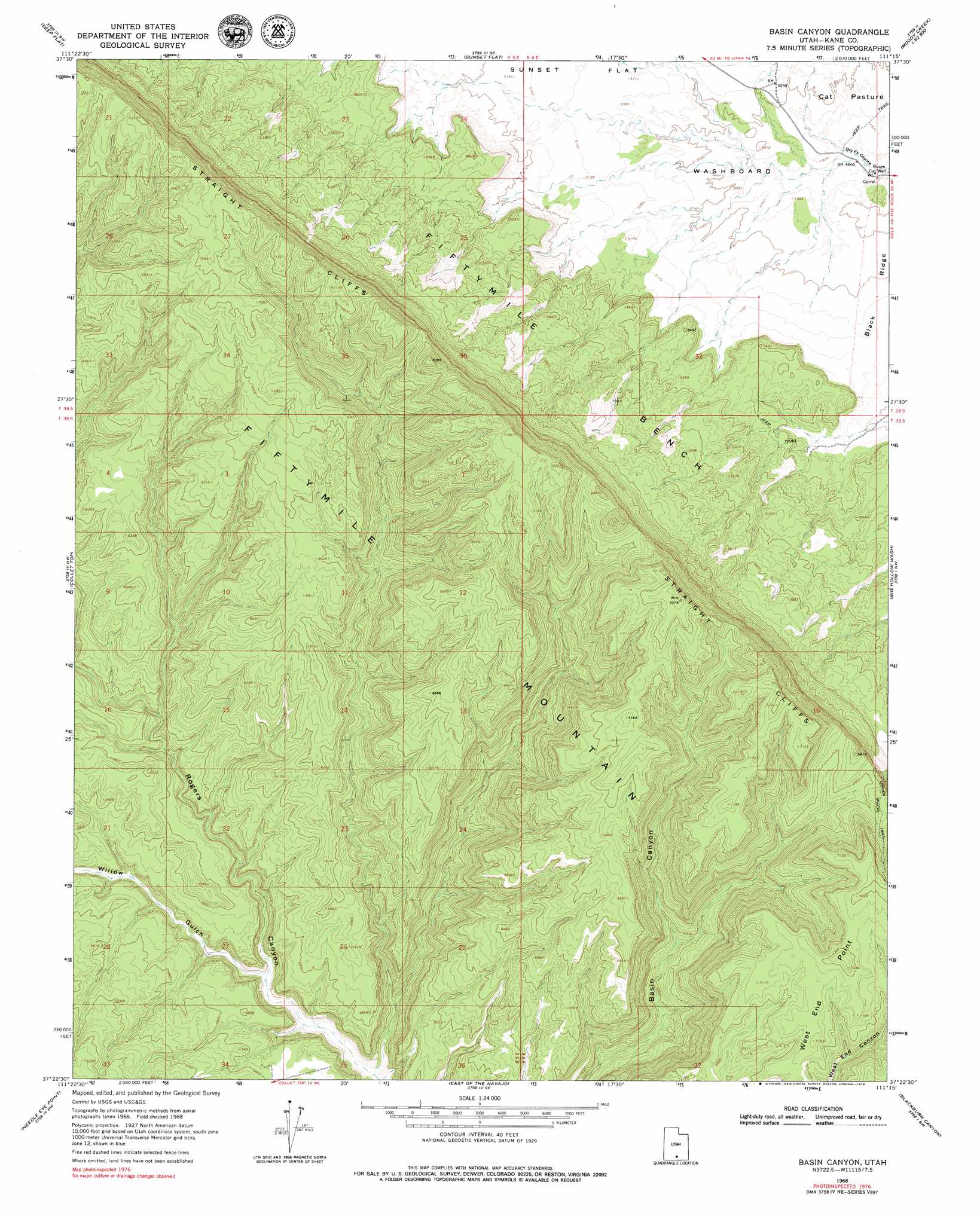
USGS Topo Quad 37111d3 - 1:24,000 scale
| Topo Map Name: | Basin Canyon |
| USGS Topo Quad ID: | 37111d3 |
| Print Size: | ca. 21 1/4" wide x 27" high |
| Southeast Coordinates: | 37.375° N latitude / 111.25° W longitude |
| Map Center Coordinates: | 37.4375° N latitude / 111.3125° W longitude |
| U.S. State: | UT |
| Filename: | o37111d3.jpg |
| Download Map JPG Image: | Basin Canyon topo map 1:24,000 scale |
| Map Type: | Topographic |
| Topo Series: | 7.5´ |
| Map Scale: | 1:24,000 |
| Source of Map Images: | United States Geological Survey (USGS) |
| Alternate Map Versions: |
Basin Canyon UT 1968, updated 1971 Download PDF Buy paper map Basin Canyon UT 2011 Download PDF Buy paper map Basin Canyon UT 2014 Download PDF Buy paper map |
1:24,000 Topo Quads surrounding Basin Canyon
Dave Canyon |
Tenmile Flat |
Red Breaks |
Silver Falls Bench |
Horse Pasture Mesa |
Carcass Canyon |
Seep Flat |
Sunset Flat |
Egypt |
Scorpion Gulch |
Petes Cove |
Collet Top |
Basin Canyon |
Big Hollow Wash |
King Mesa |
Ship Mountain Point |
Needle Eye Point |
East Of The Navajo |
Blackburn Canyon |
Sooner Bench |
Tibbet Bench |
Smoky Hollow |
Sit Down Bench |
Mazuki Point |
Navajo Point |
> Back to 37111a1 at 1:100,000 scale
> Back to 37110a1 at 1:250,000 scale
> Back to U.S. Topo Maps home
Basin Canyon topo map: Gazetteer
Basin Canyon: Areas
Washboard elevation 1525m 5003′Basin Canyon: Capes
West End Point elevation 2185m 7168′Basin Canyon: Ridges
Black Ridge elevation 1535m 5036′Basin Canyon: Valleys
Willow Gulch elevation 1630m 5347′Basin Canyon digital topo map on disk
Buy this Basin Canyon topo map showing relief, roads, GPS coordinates and other geographical features, as a high-resolution digital map file on DVD: