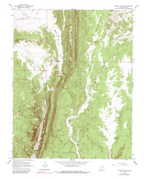
Butler Valley Topo Map Utah
To zoom in, hover over the map of Butler Valley
USGS Topo Quad 37111d7 - 1:24,000 scale
| Topo Map Name: | Butler Valley |
| USGS Topo Quad ID: | 37111d7 |
| Print Size: | ca. 21 1/4" wide x 27" high |
| Southeast Coordinates: | 37.375° N latitude / 111.75° W longitude |
| Map Center Coordinates: | 37.4375° N latitude / 111.8125° W longitude |
| U.S. State: | UT |
| Filename: | o37111d7.jpg |
| Download Map JPG Image: | Butler Valley topo map 1:24,000 scale |
| Map Type: | Topographic |
| Topo Series: | 7.5´ |
| Map Scale: | 1:24,000 |
| Source of Map Images: | United States Geological Survey (USGS) |
| Alternate Map Versions: |
Butler Valley UT 1964, updated 1966 Download PDF Buy paper map Butler Valley UT 1964, updated 1980 Download PDF Buy paper map Butler Valley UT 2011 Download PDF Buy paper map Butler Valley UT 2014 Download PDF Buy paper map |
1:24,000 Topo Quads surrounding Butler Valley
> Back to 37111a1 at 1:100,000 scale
> Back to 37110a1 at 1:250,000 scale
> Back to U.S. Topo Maps home
Butler Valley topo map: Gazetteer
Butler Valley: Arches
Grosvenor Arch elevation 1959m 6427′Butler Valley: Basins
Round Valley elevation 1977m 6486′Butler Valley: Capes
Butler Valley Neck elevation 1951m 6400′Butler Valley: Dams
Butler Valley Dam elevation 1927m 6322′Butler Valley: Flats
Long Flat elevation 1781m 5843′Butler Valley: Gaps
The Gut elevation 1924m 6312′Butler Valley: Reservoirs
Butler Valley Reservoir elevation 1927m 6322′Butler Valley: Springs
Headquarters Springs elevation 1842m 6043′Butler Valley: Streams
Cottonwood Creek elevation 1825m 5987′Butler Valley: Valleys
Blue Wash elevation 1736m 5695′Butler Valley elevation 1823m 5980′
Butler Valley Draw elevation 1823m 5980′
Headquarters Valley elevation 1841m 6040′
Butler Valley digital topo map on disk
Buy this Butler Valley topo map showing relief, roads, GPS coordinates and other geographical features, as a high-resolution digital map file on DVD:


