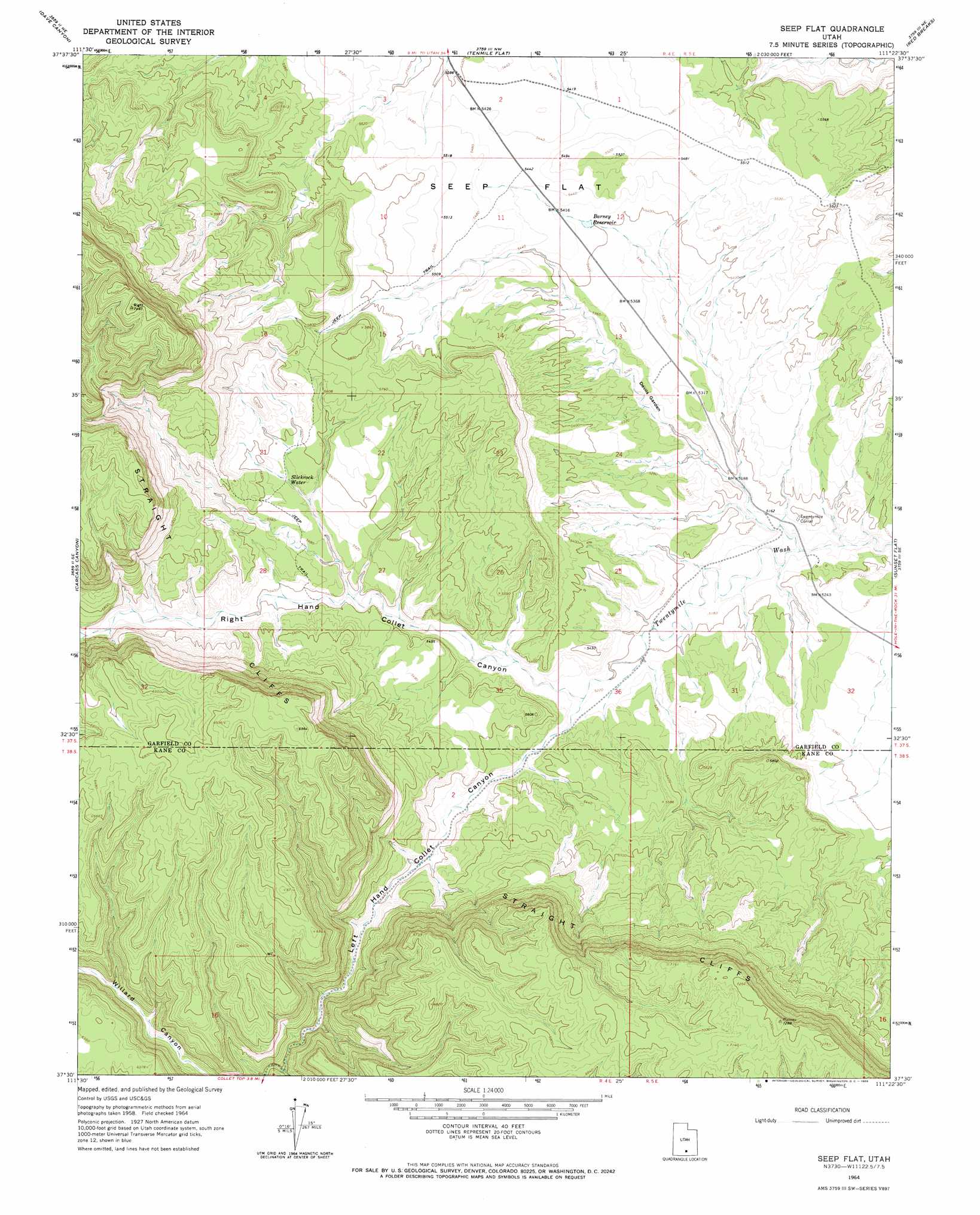
Seep Flat Topo Map Utah
To zoom in, hover over the map of Seep Flat
USGS Topo Quad 37111e4 - 1:24,000 scale
| Topo Map Name: | Seep Flat |
| USGS Topo Quad ID: | 37111e4 |
| Print Size: | ca. 21 1/4" wide x 27" high |
| Southeast Coordinates: | 37.5° N latitude / 111.375° W longitude |
| Map Center Coordinates: | 37.5625° N latitude / 111.4375° W longitude |
| U.S. State: | UT |
| Filename: | o37111e4.jpg |
| Download Map JPG Image: | Seep Flat topo map 1:24,000 scale |
| Map Type: | Topographic |
| Topo Series: | 7.5´ |
| Map Scale: | 1:24,000 |
| Source of Map Images: | United States Geological Survey (USGS) |
| Alternate Map Versions: |
Seep Flat UT 1964, updated 1966 Download PDF Buy paper map Seep Flat UT 1964, updated 1966 Download PDF Buy paper map Seep Flat UT 2011 Download PDF Buy paper map Seep Flat UT 2014 Download PDF Buy paper map |
1:24,000 Topo Quads surrounding Seep Flat
Wide Hollow Reservoir |
Escalante |
Calf Creek |
King Bench |
Pioneer Mesa |
Canaan Creek |
Dave Canyon |
Tenmile Flat |
Red Breaks |
Silver Falls Bench |
Death Ridge |
Carcass Canyon |
Seep Flat |
Sunset Flat |
Egypt |
Horse Mountain |
Petes Cove |
Collet Top |
Basin Canyon |
Big Hollow Wash |
Fourmile Bench |
Ship Mountain Point |
Needle Eye Point |
East Of The Navajo |
Blackburn Canyon |
> Back to 37111e1 at 1:100,000 scale
> Back to 37110a1 at 1:250,000 scale
> Back to U.S. Topo Maps home
Seep Flat topo map: Gazetteer
Seep Flat: Arches
Mano Arch elevation 1619m 5311′Metate Arch elevation 1618m 5308′
Seep Flat: Areas
Devils Garden elevation 1598m 5242′Devils Garden Outstanding Natural Area elevation 1607m 5272′
Seep Flat: Flats
Seep Flat elevation 1659m 5442′Seep Flat: Lakes
Slickrock Water elevation 1683m 5521′Seep Flat: Reservoirs
Barney Reservoir elevation 1647m 5403′Seep Flat: Valleys
Left Hand Collet Canyon elevation 1592m 5223′Right Hand Collet Canyon elevation 1592m 5223′
Seep Flat digital topo map on disk
Buy this Seep Flat topo map showing relief, roads, GPS coordinates and other geographical features, as a high-resolution digital map file on DVD: