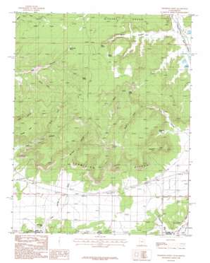
Thompson Point Topo Map Utah
To zoom in, hover over the map of Thompson Point
USGS Topo Quad 37112a4 - 1:24,000 scale
| Topo Map Name: | Thompson Point |
| USGS Topo Quad ID: | 37112a4 |
| Print Size: | ca. 21 1/4" wide x 27" high |
| Southeast Coordinates: | 37° N latitude / 112.375° W longitude |
| Map Center Coordinates: | 37.0625° N latitude / 112.4375° W longitude |
| U.S. States: | UT, AZ |
| Filename: | o37112a4.jpg |
| Download Map JPG Image: | Thompson Point topo map 1:24,000 scale |
| Map Type: | Topographic |
| Topo Series: | 7.5´ |
| Map Scale: | 1:24,000 |
| Source of Map Images: | United States Geological Survey (USGS) |
| Alternate Map Versions: |
Johnson SW UT 1954, updated 1956 Download PDF Buy paper map Thompson Point UT 1987, updated 1987 Download PDF Buy paper map Thompson Point UT 2011 Download PDF Buy paper map Thompson Point UT 2014 Download PDF Buy paper map |
1:24,000 Topo Quads surrounding Thompson Point
> Back to 37112a1 at 1:100,000 scale
> Back to 37112a1 at 1:250,000 scale
> Back to U.S. Topo Maps home
Thompson Point topo map: Gazetteer
Thompson Point: Capes
Thompson Point elevation 1825m 5987′Thompson Point: Gaps
Lost Spring Gap elevation 1494m 4901′Thompson Point: Plains
Kanab Plateau elevation 1530m 5019′Thompson Point: Springs
Hog Canyon Spring elevation 1769m 5803′Ram Spring elevation 1776m 5826′
Sheep Springs elevation 1782m 5846′
Toms Spring elevation 1822m 5977′
Willis Spring elevation 1722m 5649′
Thompson Point: Valleys
Dairy Canyon elevation 1636m 5367′Maringer Canyon elevation 1586m 5203′
Meadow Canyon elevation 1632m 5354′
North Fork Pugh Canyon elevation 1584m 5196′
North Fork Willis Canyon elevation 1643m 5390′
Sherman Cove elevation 1604m 5262′
South Fork Hog Canyon elevation 1634m 5360′
South Fork Willis Canyon elevation 1643m 5390′
Willis Canyon elevation 1601m 5252′
Thompson Point digital topo map on disk
Buy this Thompson Point topo map showing relief, roads, GPS coordinates and other geographical features, as a high-resolution digital map file on DVD:


