White Tower Topo Map Utah
To zoom in, hover over the map of White Tower
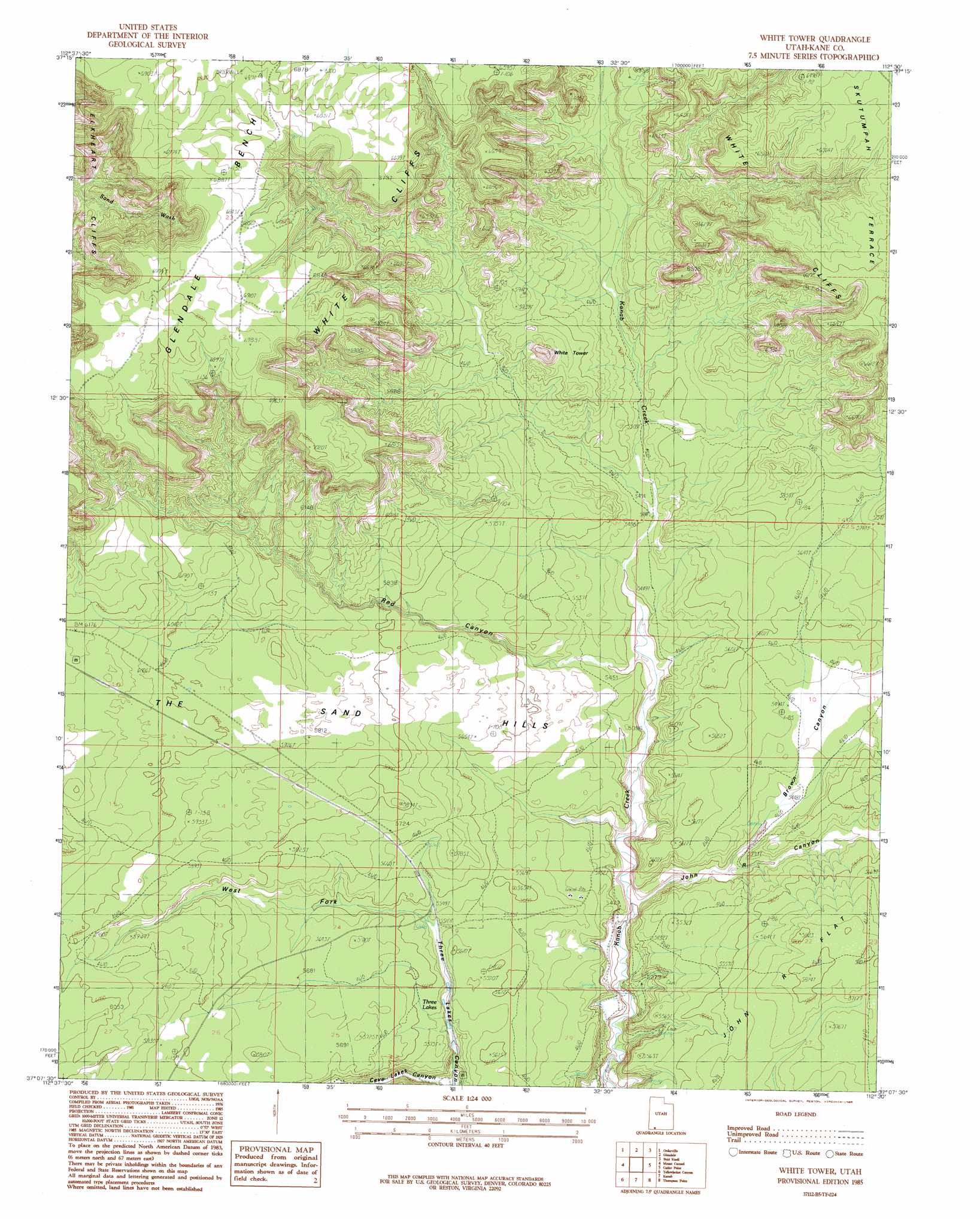
USGS Topo Quad 37112b5 - 1:24,000 scale
| Topo Map Name: | White Tower |
| USGS Topo Quad ID: | 37112b5 |
| Print Size: | ca. 21 1/4" wide x 27" high |
| Southeast Coordinates: | 37.125° N latitude / 112.5° W longitude |
| Map Center Coordinates: | 37.1875° N latitude / 112.5625° W longitude |
| U.S. State: | UT |
| Filename: | o37112b5.jpg |
| Download Map JPG Image: | White Tower topo map 1:24,000 scale |
| Map Type: | Topographic |
| Topo Series: | 7.5´ |
| Map Scale: | 1:24,000 |
| Source of Map Images: | United States Geological Survey (USGS) |
| Alternate Map Versions: |
White Tower UT 1985, updated 1985 Download PDF Buy paper map White Tower UT 2010 Download PDF Buy paper map White Tower UT 2014 Download PDF Buy paper map |
1:24,000 Topo Quads surrounding White Tower
Straight Canyon |
Strawberry Point |
Long Valley Junction |
Alton |
Podunk Creek |
Clear Creek Mountain |
Orderville |
Glendale |
Bald Knoll |
Skutumpah Creek |
The Barracks |
Mount Carmel |
White Tower |
Cutler Point |
Pine Point |
Elephant Butte |
Yellowjacket Canyon |
Kanab |
Thompson Point |
Johnson Lakes |
Moccasin |
Kaibab |
Fredonia |
Shinarump Point |
Muggins Flat |
> Back to 37112a1 at 1:100,000 scale
> Back to 37112a1 at 1:250,000 scale
> Back to U.S. Topo Maps home
White Tower topo map: Gazetteer
White Tower: Flats
John R Flat elevation 1772m 5813′White Tower: Lakes
Big Lake elevation 1641m 5383′Three Lakes elevation 1668m 5472′
White Tower: Summits
The Sand Hills elevation 1815m 5954′White Tower elevation 1792m 5879′
White Tower: Valleys
Brown Canyon elevation 1628m 5341′John R Canyon elevation 1602m 5255′
Red Canyon elevation 1634m 5360′
West Fork Three Lakes Canyon elevation 1685m 5528′
White Tower digital topo map on disk
Buy this White Tower topo map showing relief, roads, GPS coordinates and other geographical features, as a high-resolution digital map file on DVD: