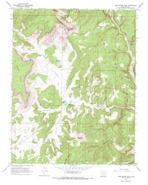
Deer Range Point Topo Map Utah
To zoom in, hover over the map of Deer Range Point
USGS Topo Quad 37112c1 - 1:24,000 scale
| Topo Map Name: | Deer Range Point |
| USGS Topo Quad ID: | 37112c1 |
| Print Size: | ca. 21 1/4" wide x 27" high |
| Southeast Coordinates: | 37.25° N latitude / 112° W longitude |
| Map Center Coordinates: | 37.3125° N latitude / 112.0625° W longitude |
| U.S. State: | UT |
| Filename: | o37112c1.jpg |
| Download Map JPG Image: | Deer Range Point topo map 1:24,000 scale |
| Map Type: | Topographic |
| Topo Series: | 7.5´ |
| Map Scale: | 1:24,000 |
| Source of Map Images: | United States Geological Survey (USGS) |
| Alternate Map Versions: |
Deer Range Point UT 1966, updated 1968 Download PDF Buy paper map Deer Range Point UT 2010 Download PDF Buy paper map Deer Range Point UT 2014 Download PDF Buy paper map |
1:24,000 Topo Quads surrounding Deer Range Point
> Back to 37112a1 at 1:100,000 scale
> Back to 37112a1 at 1:250,000 scale
> Back to U.S. Topo Maps home
Deer Range Point topo map: Gazetteer
Deer Range Point: Areas
Deer Trails elevation 1931m 6335′Deer Range Point: Basins
North Swag elevation 1789m 5869′South Swag elevation 1734m 5688′
West Swag elevation 1739m 5705′
Deer Range Point: Benches
Cad Bench elevation 1872m 6141′Deer Range Point: Capes
Kirbys Point elevation 1811m 5941′Deer Range Point: Cliffs
Deer Range Point elevation 2261m 7417′White Cliffs elevation 2089m 6853′
Deer Range Point: Lakes
Nipple Lake elevation 1691m 5547′Deer Range Point: Ridges
Pilot Ridge elevation 1987m 6519′Deer Range Point: Streams
Snake Creek elevation 1533m 5029′Deer Range Point: Summits
Mollies Nipple elevation 2214m 7263′No Mans Mesa elevation 2151m 7057′
Potters Butte elevation 1858m 6095′
Deer Range Point: Valleys
Deer Creek Canyon elevation 1593m 5226′Drip Tank Canyon elevation 1553m 5095′
Parley Hollow elevation 1633m 5357′
Starlight Canyon elevation 1524m 5000′
Wilsey Hollow elevation 1683m 5521′
Deer Range Point digital topo map on disk
Buy this Deer Range Point topo map showing relief, roads, GPS coordinates and other geographical features, as a high-resolution digital map file on DVD:


