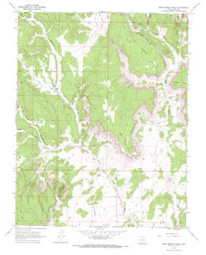
Deer Spring Point Topo Map Utah
To zoom in, hover over the map of Deer Spring Point
USGS Topo Quad 37112c2 - 1:24,000 scale
| Topo Map Name: | Deer Spring Point |
| USGS Topo Quad ID: | 37112c2 |
| Print Size: | ca. 21 1/4" wide x 27" high |
| Southeast Coordinates: | 37.25° N latitude / 112.125° W longitude |
| Map Center Coordinates: | 37.3125° N latitude / 112.1875° W longitude |
| U.S. State: | UT |
| Filename: | o37112c2.jpg |
| Download Map JPG Image: | Deer Spring Point topo map 1:24,000 scale |
| Map Type: | Topographic |
| Topo Series: | 7.5´ |
| Map Scale: | 1:24,000 |
| Source of Map Images: | United States Geological Survey (USGS) |
| Alternate Map Versions: |
Deer Spring Point UT 1966, updated 1968 Download PDF Buy paper map Deer Spring Point UT 2010 Download PDF Buy paper map Deer Spring Point UT 2014 Download PDF Buy paper map |
1:24,000 Topo Quads surrounding Deer Spring Point
> Back to 37112a1 at 1:100,000 scale
> Back to 37112a1 at 1:250,000 scale
> Back to U.S. Topo Maps home
Deer Spring Point topo map: Gazetteer
Deer Spring Point: Airports
Deer Springs Ranch Airport elevation 1959m 6427′Deer Spring Point: Capes
Calf Pasture Point elevation 2099m 6886′Deer Spring Point elevation 2210m 7250′
Deer Spring Point: Springs
Adams Springs elevation 1911m 6269′Sand Spring elevation 1805m 5921′
Deer Spring Point: Streams
Lower Podunk Creek elevation 1910m 6266′Deer Spring Point: Summits
Little No Mans Mesa elevation 2178m 7145′Deer Spring Point: Valleys
Adams Wash elevation 1817m 5961′Broad Hollow elevation 2023m 6637′
Bullrush Gorge elevation 1885m 6184′
Coal Canyon elevation 1904m 6246′
Corral Canyon elevation 1903m 6243′
Deer Range Canyon elevation 1851m 6072′
Dunhan Wash elevation 1891m 6204′
Lick Wash elevation 1817m 5961′
Meadow Canyon elevation 1890m 6200′
Meadow Canyon elevation 1951m 6400′
Slide Canyon elevation 1840m 6036′
Deer Spring Point digital topo map on disk
Buy this Deer Spring Point topo map showing relief, roads, GPS coordinates and other geographical features, as a high-resolution digital map file on DVD:


