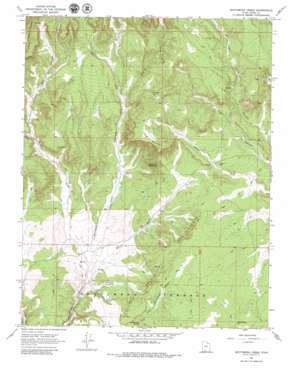
Skutumpah Creek Topo Map Utah
To zoom in, hover over the map of Skutumpah Creek
USGS Topo Quad 37112c3 - 1:24,000 scale
| Topo Map Name: | Skutumpah Creek |
| USGS Topo Quad ID: | 37112c3 |
| Print Size: | ca. 21 1/4" wide x 27" high |
| Southeast Coordinates: | 37.25° N latitude / 112.25° W longitude |
| Map Center Coordinates: | 37.3125° N latitude / 112.3125° W longitude |
| U.S. State: | UT |
| Filename: | o37112c3.jpg |
| Download Map JPG Image: | Skutumpah Creek topo map 1:24,000 scale |
| Map Type: | Topographic |
| Topo Series: | 7.5´ |
| Map Scale: | 1:24,000 |
| Source of Map Images: | United States Geological Survey (USGS) |
| Alternate Map Versions: |
Skutumpah Creek UT 1966, updated 1968 Download PDF Buy paper map Skutumpah Creek UT 1966, updated 1980 Download PDF Buy paper map Skutumpah Creek UT 2010 Download PDF Buy paper map Skutumpah Creek UT 2014 Download PDF Buy paper map |
1:24,000 Topo Quads surrounding Skutumpah Creek
> Back to 37112a1 at 1:100,000 scale
> Back to 37112a1 at 1:250,000 scale
> Back to U.S. Topo Maps home
Skutumpah Creek topo map: Gazetteer
Skutumpah Creek: Cliffs
Red Breaks elevation 1948m 6391′Skutumpah Creek: Springs
Cottonwood Spring elevation 1885m 6184′First Point Spring elevation 1851m 6072′
Old Corral Spring elevation 1842m 6043′
Skutumpah Creek: Streams
Birch Creek elevation 1995m 6545′Lick Creek elevation 1953m 6407′
Mill Creek elevation 1964m 6443′
Mineral Creek elevation 1966m 6450′
Skutumpah Creek elevation 1818m 5964′
Tenny Creek elevation 1982m 6502′
Thompson Creek elevation 1818m 5964′
Skutumpah Creek: Summits
Carly Knoll elevation 2069m 6788′Jodys Knoll elevation 2087m 6847′
Table Mountain elevation 2142m 7027′
Skutumpah Creek: Valleys
Bald Knoll Hollow elevation 1914m 6279′Oak Canyon elevation 1982m 6502′
Red Wash elevation 1791m 5875′
Skutumpah Creek digital topo map on disk
Buy this Skutumpah Creek topo map showing relief, roads, GPS coordinates and other geographical features, as a high-resolution digital map file on DVD:


