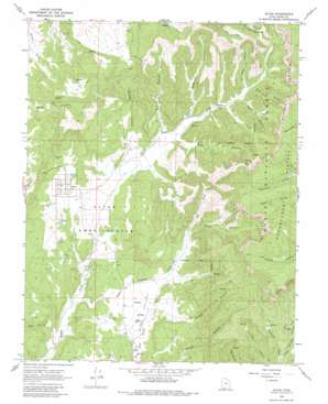
Alton Topo Map Utah
To zoom in, hover over the map of Alton
USGS Topo Quad 37112d4 - 1:24,000 scale
| Topo Map Name: | Alton |
| USGS Topo Quad ID: | 37112d4 |
| Print Size: | ca. 21 1/4" wide x 27" high |
| Southeast Coordinates: | 37.375° N latitude / 112.375° W longitude |
| Map Center Coordinates: | 37.4375° N latitude / 112.4375° W longitude |
| U.S. State: | UT |
| Filename: | o37112d4.jpg |
| Download Map JPG Image: | Alton topo map 1:24,000 scale |
| Map Type: | Topographic |
| Topo Series: | 7.5´ |
| Map Scale: | 1:24,000 |
| Source of Map Images: | United States Geological Survey (USGS) |
| Alternate Map Versions: |
Alton UT 1966, updated 1968 Download PDF Buy paper map Alton UT 1966, updated 1980 Download PDF Buy paper map Alton UT 2011 Download PDF Buy paper map Alton UT 2014 Download PDF Buy paper map |
| FStopo: | US Forest Service topo Alton is available: Download FStopo PDF Download FStopo TIF |
1:24,000 Topo Quads surrounding Alton
> Back to 37112a1 at 1:100,000 scale
> Back to 37112a1 at 1:250,000 scale
> Back to U.S. Topo Maps home
Alton topo map: Gazetteer
Alton: Basins
Alton Amphitheater elevation 2125m 6971′Alton: Plains
Paunsaugunt Plateau elevation 2768m 9081′Alton: Populated Places
Alton elevation 2146m 7040′Alton: Springs
Don Spring elevation 2678m 8786′Alton: Streams
Dry Fork elevation 2239m 7345′Lower Robinson Creek elevation 2035m 6676′
Alton: Valleys
Coal Hollow elevation 2013m 6604′Corral Canyon elevation 2320m 7611′
Dry Canyon elevation 2255m 7398′
Left Hand Canyon elevation 2376m 7795′
Lower Straight Canyon elevation 2210m 7250′
Reservoir Canyon elevation 2276m 7467′
Right Hand Canyon elevation 2391m 7844′
Roundy Canyon elevation 2219m 7280′
Rush Canyon elevation 2256m 7401′
Swapp Hollow elevation 2136m 7007′
Swapp Hollow Trough elevation 2368m 7769′
Water Canyon elevation 2269m 7444′
Water Canyon elevation 2353m 7719′
Alton digital topo map on disk
Buy this Alton topo map showing relief, roads, GPS coordinates and other geographical features, as a high-resolution digital map file on DVD:


