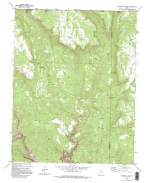
Cogswell Point Topo Map Utah
To zoom in, hover over the map of Cogswell Point
USGS Topo Quad 37112d8 - 1:24,000 scale
| Topo Map Name: | Cogswell Point |
| USGS Topo Quad ID: | 37112d8 |
| Print Size: | ca. 21 1/4" wide x 27" high |
| Southeast Coordinates: | 37.375° N latitude / 112.875° W longitude |
| Map Center Coordinates: | 37.4375° N latitude / 112.9375° W longitude |
| U.S. State: | UT |
| Filename: | o37112d8.jpg |
| Download Map JPG Image: | Cogswell Point topo map 1:24,000 scale |
| Map Type: | Topographic |
| Topo Series: | 7.5´ |
| Map Scale: | 1:24,000 |
| Source of Map Images: | United States Geological Survey (USGS) |
| Alternate Map Versions: |
Orderville Canyon NW UT 1954, updated 1956 Download PDF Buy paper map Cogswell Point UT 1980, updated 1982 Download PDF Buy paper map Cogswell Point UT 1980, updated 1995 Download PDF Buy paper map Cogswell Point UT 2010 Download PDF Buy paper map Cogswell Point UT 2014 Download PDF Buy paper map |
1:24,000 Topo Quads surrounding Cogswell Point
> Back to 37112a1 at 1:100,000 scale
> Back to 37112a1 at 1:250,000 scale
> Back to U.S. Topo Maps home
Cogswell Point topo map: Gazetteer
Cogswell Point: Basins
Oak Valley elevation 2118m 6948′Cogswell Point: Capes
Cogswell Point elevation 2452m 8044′Gordon Point elevation 2418m 7933′
Thorley Point elevation 2701m 8861′
Cogswell Point: Flats
Burnt Flat elevation 2132m 6994′Virgin Flats elevation 1968m 6456′
Cogswell Point: Streams
Bear Creek elevation 2284m 7493′Crystal Creek elevation 1782m 5846′
Fife Creek elevation 2184m 7165′
Oak Creek elevation 1772m 5813′
West Fork Deep Canyon elevation 2057m 6748′
Cogswell Point: Summits
Hogs Heaven elevation 1802m 5912′Little Mountain elevation 2516m 8254′
Volcano Knoll elevation 2050m 6725′
Cogswell Point: Valleys
Big Oak Wash elevation 1942m 6371′Box Canyon elevation 1584m 5196′
Corral Canyon elevation 1854m 6082′
O'Neil Gulch elevation 2062m 6765′
Puzzle Draw elevation 2378m 7801′
Spring Run Gulch elevation 2330m 7644′
Cogswell Point: Woods
Big Birch elevation 2144m 7034′Cogswell Point digital topo map on disk
Buy this Cogswell Point topo map showing relief, roads, GPS coordinates and other geographical features, as a high-resolution digital map file on DVD:


