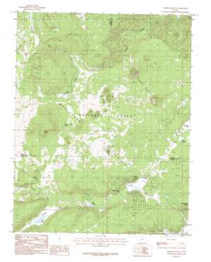
Henrie Knolls Topo Map Utah
To zoom in, hover over the map of Henrie Knolls
USGS Topo Quad 37112e6 - 1:24,000 scale
| Topo Map Name: | Henrie Knolls |
| USGS Topo Quad ID: | 37112e6 |
| Print Size: | ca. 21 1/4" wide x 27" high |
| Southeast Coordinates: | 37.5° N latitude / 112.625° W longitude |
| Map Center Coordinates: | 37.5625° N latitude / 112.6875° W longitude |
| U.S. State: | UT |
| Filename: | o37112e6.jpg |
| Download Map JPG Image: | Henrie Knolls topo map 1:24,000 scale |
| Map Type: | Topographic |
| Topo Series: | 7.5´ |
| Map Scale: | 1:24,000 |
| Source of Map Images: | United States Geological Survey (USGS) |
| Alternate Map Versions: |
Henrie Knolls UT 1985, updated 1985 Download PDF Buy paper map Henrie Knolls UT 1985, updated 1985 Download PDF Buy paper map Henrie Knolls UT 2002, updated 2005 Download PDF Buy paper map Henrie Knolls UT 2011 Download PDF Buy paper map Henrie Knolls UT 2014 Download PDF Buy paper map |
| FStopo: | US Forest Service topo Henrie Knolls is available: Download FStopo PDF Download FStopo TIF |
1:24,000 Topo Quads surrounding Henrie Knolls
> Back to 37112e1 at 1:100,000 scale
> Back to 37112a1 at 1:250,000 scale
> Back to U.S. Topo Maps home
Henrie Knolls topo map: Gazetteer
Henrie Knolls: Airports
Strawberry Valley Estates Airport elevation 2467m 8093′Henrie Knolls: Basins
Duck Creek Sinks elevation 2555m 8382′Henrie Knolls: Flats
Bowers Flat elevation 2510m 8234′Reed Valley elevation 2825m 9268′
Henrie Knolls: Lakes
Aspen-Mirror Lake elevation 2574m 8444′Cow Lake elevation 2686m 8812′
Henrie Knolls: Plains
Markagunt Plateau elevation 2833m 9294′Red Desert elevation 2945m 9662′
Henrie Knolls: Populated Places
Duck Creek Village elevation 2593m 8507′Henrie Knolls: Springs
Anderson Spring elevation 2937m 9635′Bowers Spring elevation 2517m 8257′
Dry Camp Valley Spring elevation 2784m 9133′
Duck Lake elevation 2605m 8546′
Henrie Knolls: Streams
Duck Creek elevation 2552m 8372′Ipson Creek elevation 2664m 8740′
Midway Creek elevation 2605m 8546′
Henrie Knolls: Summits
Henrie Knolls elevation 2816m 9238′Houston Mountain elevation 3060m 10039′
Strawberry Knolls elevation 2564m 8412′
Henrie Knolls: Valleys
Dry Valley elevation 2691m 8828′Red Valley elevation 2834m 9297′
Tippets Valley elevation 2725m 8940′
Henrie Knolls digital topo map on disk
Buy this Henrie Knolls topo map showing relief, roads, GPS coordinates and other geographical features, as a high-resolution digital map file on DVD:


