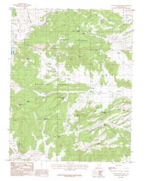
Haycock Mountain Topo Map Utah
To zoom in, hover over the map of Haycock Mountain
USGS Topo Quad 37112f5 - 1:24,000 scale
| Topo Map Name: | Haycock Mountain |
| USGS Topo Quad ID: | 37112f5 |
| Print Size: | ca. 21 1/4" wide x 27" high |
| Southeast Coordinates: | 37.625° N latitude / 112.5° W longitude |
| Map Center Coordinates: | 37.6875° N latitude / 112.5625° W longitude |
| U.S. State: | UT |
| Filename: | o37112f5.jpg |
| Download Map JPG Image: | Haycock Mountain topo map 1:24,000 scale |
| Map Type: | Topographic |
| Topo Series: | 7.5´ |
| Map Scale: | 1:24,000 |
| Source of Map Images: | United States Geological Survey (USGS) |
| Alternate Map Versions: |
Haycock Mountain UT 1985, updated 1985 Download PDF Buy paper map Haycock Mountain UT 2002, updated 2005 Download PDF Buy paper map Haycock Mountain UT 2011 Download PDF Buy paper map Haycock Mountain UT 2014 Download PDF Buy paper map |
| FStopo: | US Forest Service topo Haycock Mountain is available: Download FStopo PDF Download FStopo TIF |
1:24,000 Topo Quads surrounding Haycock Mountain
> Back to 37112e1 at 1:100,000 scale
> Back to 37112a1 at 1:250,000 scale
> Back to U.S. Topo Maps home
Haycock Mountain topo map: Gazetteer
Haycock Mountain: Cliffs
Jump-up elevation 2397m 7864′Haycock Mountain: Gaps
The Pass elevation 2510m 8234′Haycock Mountain: Lakes
Dry Lake elevation 2439m 8001′Haycock Mountain: Populated Places
Juniper Park Resort elevation 2519m 8264′Lake View Resort elevation 2514m 8248′
Haycock Mountain: Springs
Birch Spring elevation 2494m 8182′Coal Pit Springs elevation 2579m 8461′
Judd Spring elevation 2391m 7844′
Lake Hollow Spring elevation 2356m 7729′
Limerock Spring elevation 2442m 8011′
Lyle Spring elevation 2477m 8126′
Miller Seep elevation 2387m 7831′
Mud Seep elevation 2545m 8349′
Rock Spring elevation 2564m 8412′
Serviceberry Spring elevation 2418m 7933′
Haycock Mountain: Streams
Haycock Creek elevation 2465m 8087′Pass Creek elevation 2325m 7627′
Haycock Mountain: Summits
Birch Spring Knoll elevation 2674m 8772′Cooper Knoll elevation 2723m 8933′
Hatch Mountain elevation 2637m 8651′
Haycock Mountain elevation 2682m 8799′
Mahogany Hill elevation 2477m 8126′
Stud Knoll elevation 2603m 8540′
Haycock Mountain: Tunnels
Cameron Troughs elevation 2591m 8500′John Cameron Troughs elevation 2400m 7874′
Haycock Mountain: Valleys
Black Rock Valley elevation 2403m 7883′Cameron Wash elevation 2365m 7759′
Lake Hollow elevation 2311m 7582′
Little Coal Pit Wash elevation 2314m 7591′
Mexican Hollow elevation 2357m 7732′
Pine Hollow elevation 2484m 8149′
Williams Hollow elevation 2465m 8087′
Haycock Mountain digital topo map on disk
Buy this Haycock Mountain topo map showing relief, roads, GPS coordinates and other geographical features, as a high-resolution digital map file on DVD:


