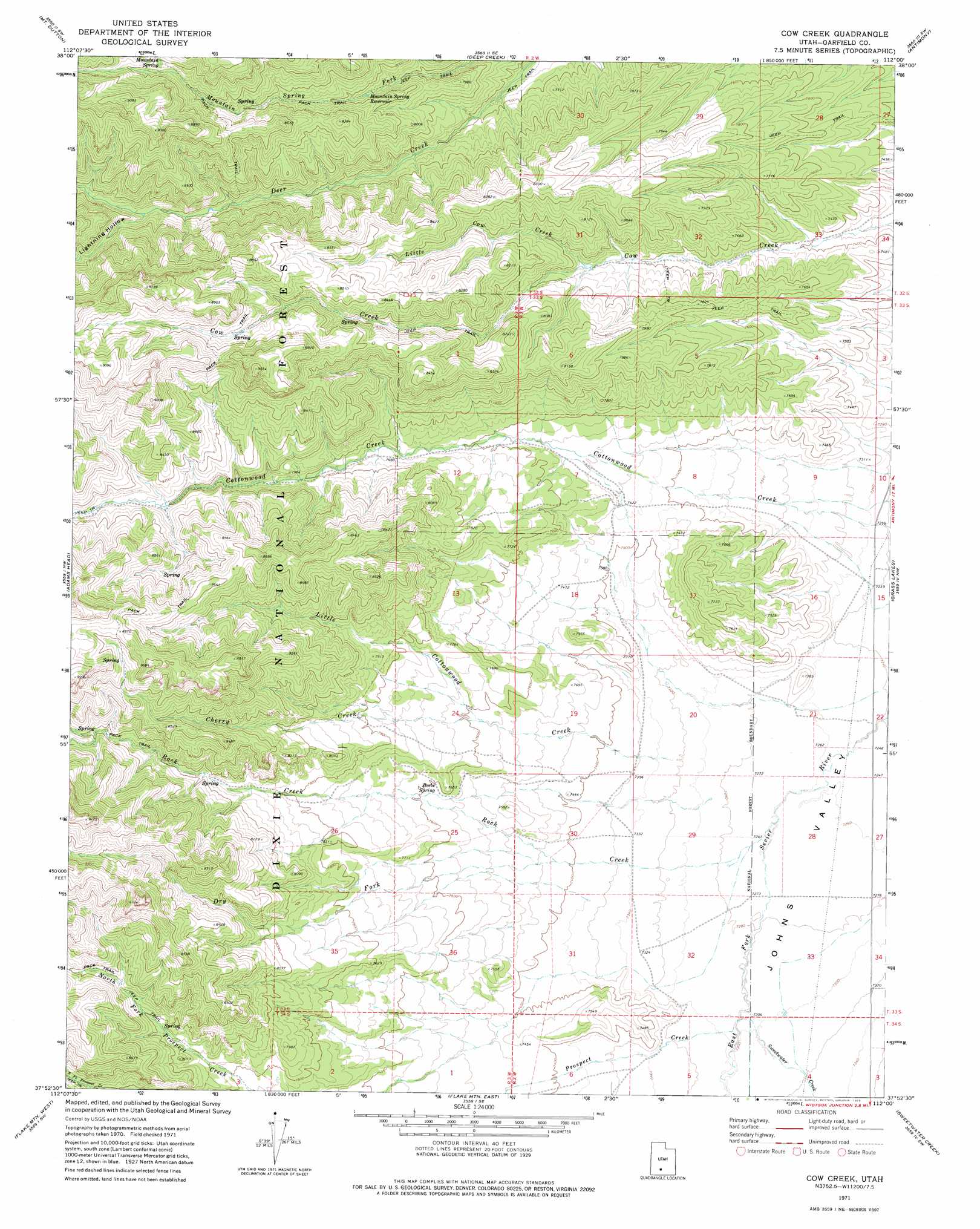
Cow Creek Topo Map Utah
To zoom in, hover over the map of Cow Creek
USGS Topo Quad 37112h1 - 1:24,000 scale
| Topo Map Name: | Cow Creek |
| USGS Topo Quad ID: | 37112h1 |
| Print Size: | ca. 21 1/4" wide x 27" high |
| Southeast Coordinates: | 37.875° N latitude / 112° W longitude |
| Map Center Coordinates: | 37.9375° N latitude / 112.0625° W longitude |
| U.S. State: | UT |
| Filename: | o37112h1.jpg |
| Download Map JPG Image: | Cow Creek topo map 1:24,000 scale |
| Map Type: | Topographic |
| Topo Series: | 7.5´ |
| Map Scale: | 1:24,000 |
| Source of Map Images: | United States Geological Survey (USGS) |
| Alternate Map Versions: |
Cow Creek UT 1971, updated 1975 Download PDF Buy paper map Cow Creek UT 2002, updated 2005 Download PDF Buy paper map Cow Creek UT 2011 Download PDF Buy paper map Cow Creek UT 2014 Download PDF Buy paper map |
| FStopo: | US Forest Service topo Cow Creek is available: Download FStopo PDF Download FStopo TIF |
1:24,000 Topo Quads surrounding Cow Creek
Circleville |
Junction |
Phonolite Hill |
Angle |
Flossie Knoll |
Bull Rush Peak |
Mount Dutton |
Deep Creek |
Antimony |
Pollywog Lake |
Blind Spring Mountain |
Adams Head |
Cow Creek |
Grass Lakes |
Barker Reservoir |
Casto Canyon |
Flake Mountain West |
Flake Mountain East |
Sweetwater Creek |
Griffin Point |
Wilson Peak |
Bryce Canyon |
Tropic Canyon |
Pine Lake |
Upper Valley |
> Back to 37112e1 at 1:100,000 scale
> Back to 37112a1 at 1:250,000 scale
> Back to U.S. Topo Maps home
Cow Creek topo map: Gazetteer
Cow Creek: Reservoirs
Mountain Spring Reservoir elevation 2415m 7923′Cow Creek: Springs
Beebe Spring elevation 2312m 7585′Mountain Spring elevation 2618m 8589′
Cow Creek: Streams
Cherry Creek elevation 2308m 7572′Dry Fork Rock Creek elevation 2263m 7424′
Little Cottonwood Creek elevation 2234m 7329′
Little Cow Creek elevation 2352m 7716′
Prospect Creek elevation 2220m 7283′
Rock Creek elevation 2215m 7267′
Sweetwater Creek elevation 2220m 7283′
Cow Creek: Valleys
Lightning Hollow elevation 2464m 8083′Cow Creek digital topo map on disk
Buy this Cow Creek topo map showing relief, roads, GPS coordinates and other geographical features, as a high-resolution digital map file on DVD: