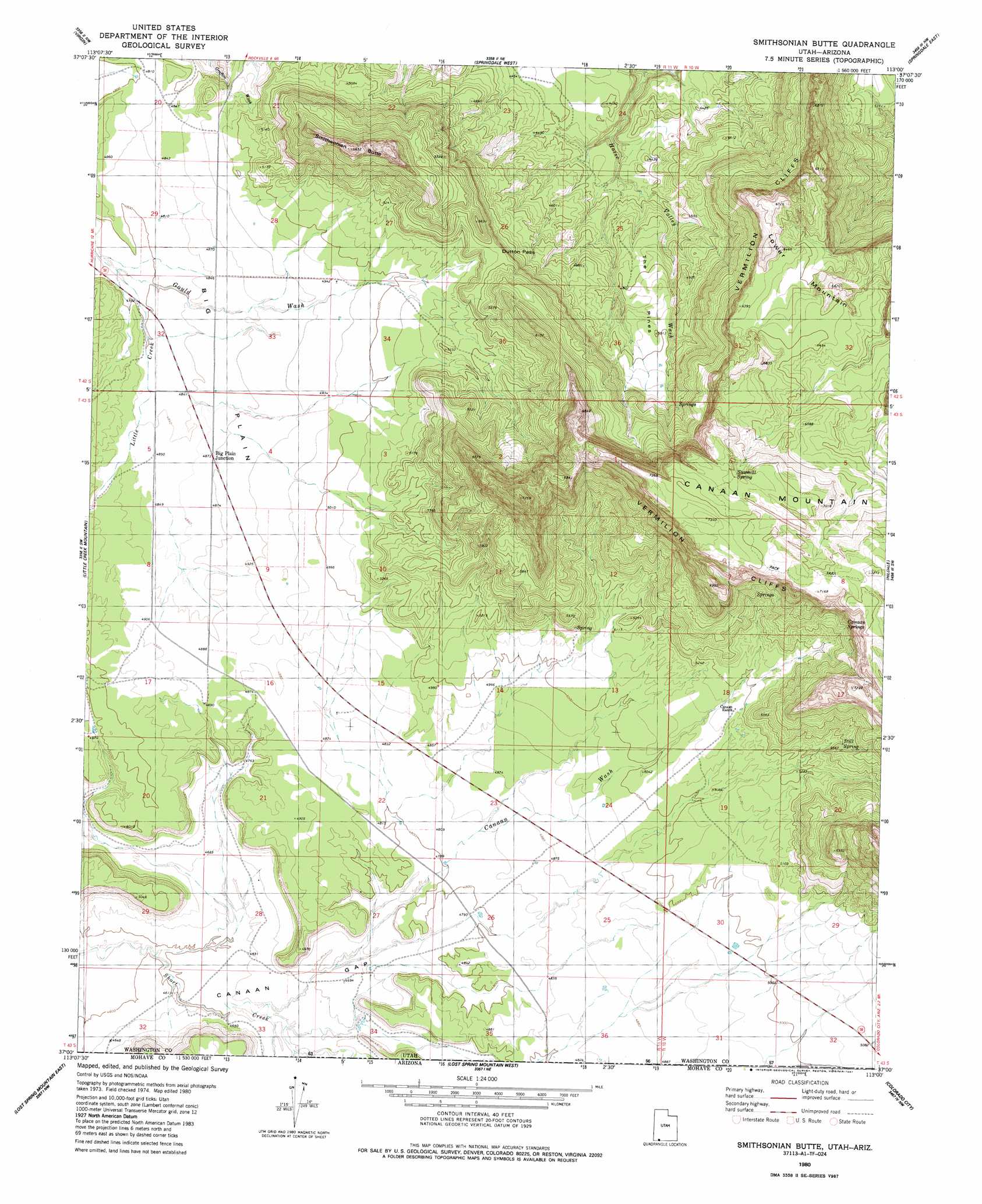
Smithsonian Butte Topo Map Utah
To zoom in, hover over the map of Smithsonian Butte
USGS Topo Quad 37113a1 - 1:24,000 scale
| Topo Map Name: | Smithsonian Butte |
| USGS Topo Quad ID: | 37113a1 |
| Print Size: | ca. 21 1/4" wide x 27" high |
| Southeast Coordinates: | 37° N latitude / 113° W longitude |
| Map Center Coordinates: | 37.0625° N latitude / 113.0625° W longitude |
| U.S. States: | UT, AZ |
| Filename: | o37113a1.jpg |
| Download Map JPG Image: | Smithsonian Butte topo map 1:24,000 scale |
| Map Type: | Topographic |
| Topo Series: | 7.5´ |
| Map Scale: | 1:24,000 |
| Source of Map Images: | United States Geological Survey (USGS) |
| Alternate Map Versions: |
La Verkin 4 SE UT 1954 Download PDF Buy paper map La Verkin 4 SE UT 1954, updated 1956 Download PDF Buy paper map Smithsonian Butte UT 1980, updated 1981 Download PDF Buy paper map Smithsonian Butte UT 1980, updated 1987 Download PDF Buy paper map Smithsonian Butte UT 2011 Download PDF Buy paper map Smithsonian Butte UT 2014 Download PDF Buy paper map |
1:24,000 Topo Quads surrounding Smithsonian Butte
Pintura |
Smith Mesa |
The Guardian Angels |
Temple Of Sinawava |
Clear Creek Mountain |
Hurricane |
Virgin |
Springdale West |
Springdale East |
The Barracks |
The Divide |
Little Creek Mountain |
Smithsonian Butte |
Hildale |
Elephant Butte |
Rock Canyon |
Lost Spring Mountain West |
Lost Spring Mountain East |
Colorado City |
Moccasin |
Gyp Pocket |
White Pockets |
Formaster Well |
Maroney Well |
Pipe Valley |
> Back to 37113a1 at 1:100,000 scale
> Back to 37112a1 at 1:250,000 scale
> Back to U.S. Topo Maps home
Smithsonian Butte topo map: Gazetteer
Smithsonian Butte: Benches
Moccasin Terrace elevation 1463m 4799′Smithsonian Butte: Capes
Overlook point elevation 1665m 5462′Smithsonian Butte: Flats
Big Plain elevation 1478m 4849′Smithsonian Butte: Gaps
Canaan Gap elevation 1401m 4596′Dutton Pass elevation 1474m 4835′
Smithsonian Butte: Populated Places
Apple Valley elevation 1506m 4940′Big Plain Junction elevation 1493m 4898′
Smithsonian Butte: Springs
Canaan Springs elevation 1736m 5695′Sawmill Spring elevation 2127m 6978′
Still Spring elevation 1650m 5413′
Smithsonian Butte: Streams
Little Creek elevation 1452m 4763′Smithsonian Butte: Summits
Canaan Mountain elevation 1980m 6496′Lower Mountain elevation 2026m 6646′
Smithsonian Butte elevation 2049m 6722′
The Pines elevation 1525m 5003′
Smithsonian Butte: Valleys
Canaan Wash elevation 1413m 4635′Smithsonian Butte digital topo map on disk
Buy this Smithsonian Butte topo map showing relief, roads, GPS coordinates and other geographical features, as a high-resolution digital map file on DVD: