White Hills Topo Map Utah
To zoom in, hover over the map of White Hills
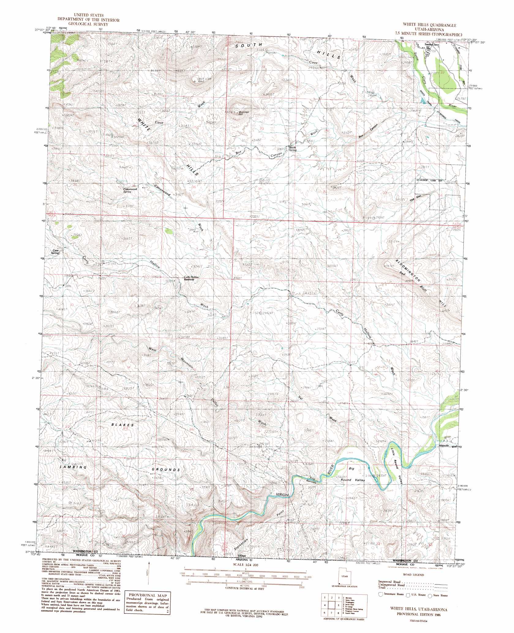
USGS Topo Quad 37113a6 - 1:24,000 scale
| Topo Map Name: | White Hills |
| USGS Topo Quad ID: | 37113a6 |
| Print Size: | ca. 21 1/4" wide x 27" high |
| Southeast Coordinates: | 37° N latitude / 113.625° W longitude |
| Map Center Coordinates: | 37.0625° N latitude / 113.6875° W longitude |
| U.S. State: | UT |
| Filename: | o37113a6.jpg |
| Download Map JPG Image: | White Hills topo map 1:24,000 scale |
| Map Type: | Topographic |
| Topo Series: | 7.5´ |
| Map Scale: | 1:24,000 |
| Source of Map Images: | United States Geological Survey (USGS) |
| Alternate Map Versions: |
St. George SW UT 1956, updated 1956 Download PDF Buy paper map White Hills UT 1986, updated 1987 Download PDF Buy paper map White Hills UT 1986, updated 1987 Download PDF Buy paper map White Hills UT 2011 Download PDF Buy paper map White Hills UT 2014 Download PDF Buy paper map |
1:24,000 Topo Quads surrounding White Hills
Motoqua |
Gunlock |
Veyo |
Saddle Mountain |
Signal Peak |
West Mountain Peak |
Shivwits |
Santa Clara |
Washington |
Harrisburg Junction |
Castle Cliff |
Jarvis Peak |
White Hills |
Saint George |
Washington Dome |
Littlefield |
Mountain Sheep Spring |
Purgatory Canyon |
Lizard Point |
Yellowhorse Flat |
Elbow Canyon |
Mount Bangs |
Wolf Hole Mountain West |
Wolf Hole Mountain East |
Hole-N-Wall Canyon |
> Back to 37113a1 at 1:100,000 scale
> Back to 37112a1 at 1:250,000 scale
> Back to U.S. Topo Maps home
White Hills topo map: Gazetteer
White Hills: Areas
Blakes Lambing Grounds elevation 1250m 4101′White Hills: Basins
Big Round Valley elevation 745m 2444′Little Round Valley elevation 749m 2457′
White Hills: Capes
Starvation Point elevation 906m 2972′White Hills: Cliffs
Red Bluff elevation 964m 3162′White Hills: Gaps
First Narrows elevation 736m 2414′The Gap elevation 888m 2913′
White Hills: Populated Places
Atkinville elevation 759m 2490′White Hills: Reservoirs
Curley Hollow Reservoir elevation 975m 3198′White Hills: Springs
Cave Spring elevation 1156m 3792′Cottonwood Spring elevation 1035m 3395′
Stucki Spring elevation 938m 3077′
White Hills: Summits
Boomer Hill elevation 1150m 3772′South Hills elevation 1026m 3366′
White Hills elevation 1096m 3595′
White Hills: Valleys
Atkinville Wash elevation 754m 2473′Box Canyon elevation 838m 2749′
Box Canyon Wash elevation 837m 2746′
Cottonwood Wash elevation 877m 2877′
Cove Wash elevation 814m 2670′
Curly Hollow Wash elevation 754m 2473′
Sand Hollow elevation 816m 2677′
Val Wash elevation 744m 2440′
West Mountain Valley Wash elevation 745m 2444′
White Hills digital topo map on disk
Buy this White Hills topo map showing relief, roads, GPS coordinates and other geographical features, as a high-resolution digital map file on DVD: