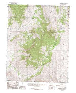
Jarvis Peak Topo Map Utah
To zoom in, hover over the map of Jarvis Peak
USGS Topo Quad 37113a7 - 1:24,000 scale
| Topo Map Name: | Jarvis Peak |
| USGS Topo Quad ID: | 37113a7 |
| Print Size: | ca. 21 1/4" wide x 27" high |
| Southeast Coordinates: | 37° N latitude / 113.75° W longitude |
| Map Center Coordinates: | 37.0625° N latitude / 113.8125° W longitude |
| U.S. State: | UT |
| Filename: | o37113a7.jpg |
| Download Map JPG Image: | Jarvis Peak topo map 1:24,000 scale |
| Map Type: | Topographic |
| Topo Series: | 7.5´ |
| Map Scale: | 1:24,000 |
| Source of Map Images: | United States Geological Survey (USGS) |
| Alternate Map Versions: |
Beaver Dam Mts SE UT 1954, updated 1956 Download PDF Buy paper map Jarvis Peak UT 1983, updated 1983 Download PDF Buy paper map Jarvis Peak UT 2011 Download PDF Buy paper map Jarvis Peak UT 2014 Download PDF Buy paper map |
1:24,000 Topo Quads surrounding Jarvis Peak
> Back to 37113a1 at 1:100,000 scale
> Back to 37112a1 at 1:250,000 scale
> Back to U.S. Topo Maps home
Jarvis Peak topo map: Gazetteer
Jarvis Peak: Gaps
Bulldog Pass elevation 1438m 4717′Jarvis Peak: Mines
Apex Mine elevation 1597m 5239′Black Warrior Mine elevation 1861m 6105′
Paymaster Mine Shaft elevation 1704m 5590′
Westside Mine elevation 1742m 5715′
Jarvis Peak: Ranges
Bulldog Knolls elevation 1026m 3366′Cedar Pockets elevation 1375m 4511′
Jarvis Peak: Reservoirs
Laub Reservoir elevation 1140m 3740′Mine Valley Reservoir elevation 1360m 4461′
Quail Reservoir elevation 1290m 4232′
Reef Reservoir elevation 1309m 4294′
Jarvis Peak: Springs
Summit Spring elevation 1396m 4580′Jarvis Peak: Summits
Jarvis Peak elevation 1989m 6525′Tabeau Peak elevation 1300m 4265′
Tahoari elevation 1673m 5488′
Jarvis Peak: Valleys
Bulldog Canyon elevation 1013m 3323′Mine Valley elevation 1382m 4534′
Summit Spring Wash elevation 1231m 4038′
Jarvis Peak digital topo map on disk
Buy this Jarvis Peak topo map showing relief, roads, GPS coordinates and other geographical features, as a high-resolution digital map file on DVD:


