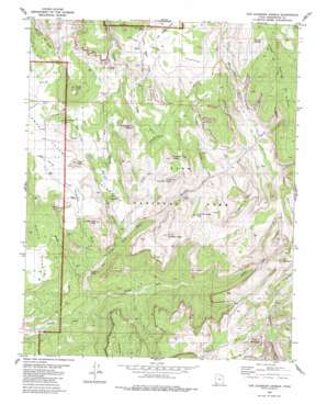
The Guardian Angels Topo Map Utah
To zoom in, hover over the map of The Guardian Angels
USGS Topo Quad 37113c1 - 1:24,000 scale
| Topo Map Name: | The Guardian Angels |
| USGS Topo Quad ID: | 37113c1 |
| Print Size: | ca. 21 1/4" wide x 27" high |
| Southeast Coordinates: | 37.25° N latitude / 113° W longitude |
| Map Center Coordinates: | 37.3125° N latitude / 113.0625° W longitude |
| U.S. State: | UT |
| Filename: | o37113c1.jpg |
| Download Map JPG Image: | The Guardian Angels topo map 1:24,000 scale |
| Map Type: | Topographic |
| Topo Series: | 7.5´ |
| Map Scale: | 1:24,000 |
| Source of Map Images: | United States Geological Survey (USGS) |
| Alternate Map Versions: |
The Guardian Angels UT 1980, updated 1980 Download PDF Buy paper map The Guardian Angels UT 1980, updated 1986 Download PDF Buy paper map The Guardian Angels UT 1980, updated 1986 Download PDF Buy paper map The Guardian Angels UT 1996, updated 2002 Download PDF Buy paper map The Guardian Angels UT 2011 Download PDF Buy paper map The Guardian Angels UT 2014 Download PDF Buy paper map |
1:24,000 Topo Quads surrounding The Guardian Angels
> Back to 37113a1 at 1:100,000 scale
> Back to 37112a1 at 1:250,000 scale
> Back to U.S. Topo Maps home
The Guardian Angels topo map: Gazetteer
The Guardian Angels: Basins
Little Creek Sinks elevation 2322m 7618′The Guardian Angels: Crossings
The Subway elevation 1682m 5518′The Guardian Angels: Falls
Double Falls elevation 1459m 4786′The Guardian Angels: Gaps
Guardian Angel Pass elevation 1798m 5898′The Guardian Angels: Parks
Zion National Park elevation 1877m 6158′The Guardian Angels: Post Offices
Zion National Park Post Office (historical) elevation 1877m 6158′The Guardian Angels: Springs
Grapevine Spring elevation 1397m 4583′Sawmill Springs elevation 2184m 7165′
The Guardian Angels: Streams
Blue Creek elevation 1831m 6007′Left Fork North Creek elevation 1277m 4189′
Little Creek elevation 1466m 4809′
Right Fork North Creek elevation 1277m 4189′
The Guardian Angels: Summits
Cave Knoll elevation 1920m 6299′Firepit Knoll elevation 2202m 7224′
Greatheart Mesa elevation 2232m 7322′
Inclined Temple elevation 2162m 7093′
Ivins Mountain elevation 2084m 6837′
Jobs Head elevation 2215m 7267′
Lambs Knoll elevation 1908m 6259′
North Guardian Angel elevation 2249m 7378′
Northgate Peaks elevation 2173m 7129′
Pine Valley Peak elevation 2170m 7119′
Pocket Mesa elevation 2235m 7332′
South Guardian Angel elevation 2156m 7073′
Spendlove Knoll elevation 2086m 6843′
Tabernacle Dome elevation 1942m 6371′
The Bishopric elevation 2112m 6929′
The Guardian Angels: Trails
Lava Point Trail elevation 2229m 7312′The Guardian Angels: Valleys
Cave Valley elevation 1848m 6062′Grapevine Wash elevation 1363m 4471′
Great West Canyon elevation 1319m 4327′
Lee Valley elevation 1753m 5751′
Little Creek Valley elevation 2313m 7588′
Oak Spring Valley elevation 2388m 7834′
Pine Spring Wash elevation 1453m 4767′
Pine Valley elevation 1956m 6417′
Russell Gulch elevation 1771m 5810′
Trail Canyon elevation 1317m 4320′
Wildcat Canyon elevation 1841m 6040′
Wolf Spring Wash elevation 1783m 5849′
Wolf Springs Wash elevation 1794m 5885′
The Guardian Angels digital topo map on disk
Buy this The Guardian Angels topo map showing relief, roads, GPS coordinates and other geographical features, as a high-resolution digital map file on DVD:


