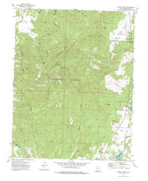
Central West Topo Map Utah
To zoom in, hover over the map of Central West
USGS Topo Quad 37113d6 - 1:24,000 scale
| Topo Map Name: | Central West |
| USGS Topo Quad ID: | 37113d6 |
| Print Size: | ca. 21 1/4" wide x 27" high |
| Southeast Coordinates: | 37.375° N latitude / 113.625° W longitude |
| Map Center Coordinates: | 37.4375° N latitude / 113.6875° W longitude |
| U.S. State: | UT |
| Filename: | o37113d6.jpg |
| Download Map JPG Image: | Central West topo map 1:24,000 scale |
| Map Type: | Topographic |
| Topo Series: | 7.5´ |
| Map Scale: | 1:24,000 |
| Source of Map Images: | United States Geological Survey (USGS) |
| Alternate Map Versions: |
Central West UT 1972, updated 1976 Download PDF Buy paper map Central West UT 2002, updated 2005 Download PDF Buy paper map Central West UT 2011 Download PDF Buy paper map Central West UT 2014 Download PDF Buy paper map |
| FStopo: | US Forest Service topo Central West is available: Download FStopo PDF Download FStopo TIF |
1:24,000 Topo Quads surrounding Central West
> Back to 37113a1 at 1:100,000 scale
> Back to 37112a1 at 1:250,000 scale
> Back to U.S. Topo Maps home
Central West topo map: Gazetteer
Central West: Airports
Dixie Deer Airport elevation 1594m 5229′Central West: Basins
Ox Valley elevation 1910m 6266′Central West: Dams
Baker Reservoir Dam elevation 1482m 4862′Central West: Parks
Baker Reservoir Recreation Area elevation 1493m 4898′Mountain Meadow elevation 1721m 5646′
Central West: Reservoirs
Baker Reservoir elevation 1482m 4862′Central West: Springs
Abe Spring elevation 1782m 5846′Blue Spring elevation 1785m 5856′
Gardner Spring elevation 1773m 5816′
Hardscramble Spring elevation 1988m 6522′
Hiway Spring elevation 1806m 5925′
Joe Spring elevation 1974m 6476′
Maple Spring elevation 2017m 6617′
Mud Spring elevation 1976m 6482′
Red Bank Spring elevation 1955m 6414′
Central West: Streams
Dan Sill Creek elevation 1677m 5501′Central West: Summits
Dan Sill Hill elevation 1806m 5925′Red Butte elevation 1770m 5807′
Central West: Trails
Red Hardscrabble Trail elevation 1961m 6433′Shinbone Trail elevation 1927m 6322′
Central West: Valleys
Bellas Canyon elevation 1474m 4835′California Hollow elevation 1630m 5347′
Deep Canyon elevation 1692m 5551′
Gardner Draw elevation 1378m 4520′
Hardscrabble Hollow elevation 1717m 5633′
Kane Spring Draw elevation 1521m 4990′
Valley Canyon elevation 1932m 6338′
Central West digital topo map on disk
Buy this Central West topo map showing relief, roads, GPS coordinates and other geographical features, as a high-resolution digital map file on DVD:


