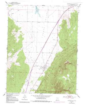
Kanarraville Topo Map Utah
To zoom in, hover over the map of Kanarraville
USGS Topo Quad 37113e2 - 1:24,000 scale
| Topo Map Name: | Kanarraville |
| USGS Topo Quad ID: | 37113e2 |
| Print Size: | ca. 21 1/4" wide x 27" high |
| Southeast Coordinates: | 37.5° N latitude / 113.125° W longitude |
| Map Center Coordinates: | 37.5625° N latitude / 113.1875° W longitude |
| U.S. State: | UT |
| Filename: | o37113e2.jpg |
| Download Map JPG Image: | Kanarraville topo map 1:24,000 scale |
| Map Type: | Topographic |
| Topo Series: | 7.5´ |
| Map Scale: | 1:24,000 |
| Source of Map Images: | United States Geological Survey (USGS) |
| Alternate Map Versions: |
Kanarraville UT 1950 Download PDF Buy paper map Kanarraville UT 1950, updated 1957 Download PDF Buy paper map Kanarraville UT 1950, updated 1979 Download PDF Buy paper map Kanarraville UT 1950, updated 1991 Download PDF Buy paper map Kanarraville UT 1950, updated 1991 Download PDF Buy paper map Kanarraville UT 1951 Download PDF Buy paper map Kanarraville UT 2011 Download PDF Buy paper map Kanarraville UT 2014 Download PDF Buy paper map |
1:24,000 Topo Quads surrounding Kanarraville
> Back to 37113e1 at 1:100,000 scale
> Back to 37112a1 at 1:250,000 scale
> Back to U.S. Topo Maps home
Kanarraville topo map: Gazetteer
Kanarraville: Basins
The Saucer elevation 2393m 7851′Kanarraville: Dams
Harris Gubler Dam elevation 1626m 5334′Kanarraville: Parks
Escalante Interpretive Site elevation 1657m 5436′Kanarraville: Populated Places
Hamiltons Fort elevation 1696m 5564′Kanarraville elevation 1689m 5541′
Kanarraville: Reservoirs
Harris Gubler Reservoir elevation 1626m 5334′Kanarraville: Springs
Mud Springs elevation 1665m 5462′Sweetwater Spring elevation 2313m 7588′
Kanarraville: Streams
Groves Creek elevation 1717m 5633′Murie Creek elevation 1682m 5518′
Quichapa Creek elevation 1669m 5475′
Spring Creek elevation 1662m 5452′
Kanarraville: Summits
North Hills elevation 1928m 6325′Kanarraville: Valleys
Sweetwater Gulch elevation 2017m 6617′Kanarraville digital topo map on disk
Buy this Kanarraville topo map showing relief, roads, GPS coordinates and other geographical features, as a high-resolution digital map file on DVD:


