Enterprise Topo Map Utah
To zoom in, hover over the map of Enterprise
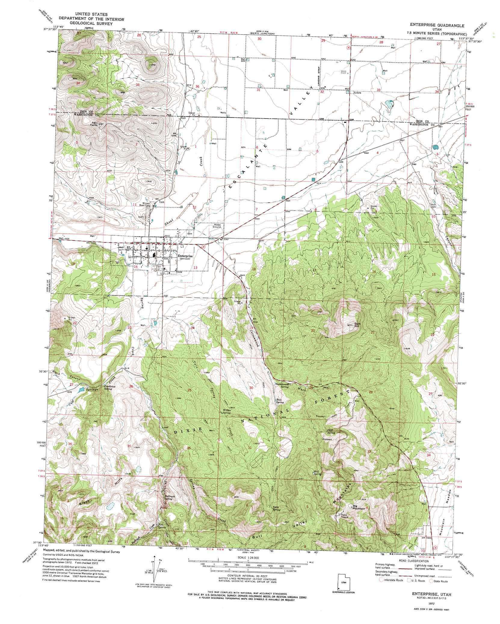
USGS Topo Quad 37113e6 - 1:24,000 scale
| Topo Map Name: | Enterprise |
| USGS Topo Quad ID: | 37113e6 |
| Print Size: | ca. 21 1/4" wide x 27" high |
| Southeast Coordinates: | 37.5° N latitude / 113.625° W longitude |
| Map Center Coordinates: | 37.5625° N latitude / 113.6875° W longitude |
| U.S. State: | UT |
| Filename: | o37113e6.jpg |
| Download Map JPG Image: | Enterprise topo map 1:24,000 scale |
| Map Type: | Topographic |
| Topo Series: | 7.5´ |
| Map Scale: | 1:24,000 |
| Source of Map Images: | United States Geological Survey (USGS) |
| Alternate Map Versions: |
Enterprise UT 1972, updated 1976 Download PDF Buy paper map Enterprise UT 2002, updated 2005 Download PDF Buy paper map Enterprise UT 2011 Download PDF Buy paper map Enterprise UT 2014 Download PDF Buy paper map |
| FStopo: | US Forest Service topo Enterprise is available: Download FStopo PDF Download FStopo TIF |
1:24,000 Topo Quads surrounding Enterprise
Modena |
Heist |
Yale Crossing |
Clark Farm |
Antelope Peak |
Mount Escalante |
Pinon Point |
Beryl Junction |
Newcastle |
Silver Peak |
Water Canyon Peak |
Hebron |
Enterprise |
Pinto |
Page Ranch |
Goldstrike |
Maple Ridge |
Central West |
Central East |
Grass Valley |
Motoqua |
Gunlock |
Veyo |
Saddle Mountain |
Signal Peak |
> Back to 37113e1 at 1:100,000 scale
> Back to 37112a1 at 1:250,000 scale
> Back to U.S. Topo Maps home
Enterprise topo map: Gazetteer
Enterprise: Dams
Gary and Joyce Holt Reservoir Dam elevation 1684m 5524′Enterprise: Populated Places
Enterprise elevation 1621m 5318′Enterprise: Post Offices
Enterprise Post Office elevation 1621m 5318′Enterprise: Reservoirs
Gary and Joyce Holt Reservoir elevation 1684m 5524′Enterprise: Springs
Bullrush Spring elevation 1758m 5767′Cliff Spring elevation 1843m 6046′
Cottonwood Spring elevation 1745m 5725′
Mud Spring elevation 1958m 6423′
Pendleton Spring elevation 1665m 5462′
Rose Spring elevation 1754m 5754′
Tom Spring elevation 1798m 5898′
Twin Spring elevation 1939m 6361′
Willow Spring elevation 1739m 5705′
Enterprise: Streams
Bullrush Creek elevation 1787m 5862′Calf Springs Creek elevation 1651m 5416′
Shinbone Creek elevation 1709m 5606′
Spring Creek elevation 1620m 5314′
Twin Spring Creek elevation 1638m 5374′
Enterprise: Summits
Big Mountain elevation 2203m 7227′Gum Hill elevation 2003m 6571′
Enterprise: Valleys
Black Canyon elevation 1676m 5498′Cottonwood Wash elevation 1617m 5305′
Holt Canyon elevation 1642m 5387′
Enterprise digital topo map on disk
Buy this Enterprise topo map showing relief, roads, GPS coordinates and other geographical features, as a high-resolution digital map file on DVD: