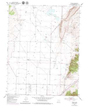
Enoch Topo Map Utah
To zoom in, hover over the map of Enoch
USGS Topo Quad 37113g1 - 1:24,000 scale
| Topo Map Name: | Enoch |
| USGS Topo Quad ID: | 37113g1 |
| Print Size: | ca. 21 1/4" wide x 27" high |
| Southeast Coordinates: | 37.75° N latitude / 113° W longitude |
| Map Center Coordinates: | 37.8125° N latitude / 113.0625° W longitude |
| U.S. State: | UT |
| Filename: | o37113g1.jpg |
| Download Map JPG Image: | Enoch topo map 1:24,000 scale |
| Map Type: | Topographic |
| Topo Series: | 7.5´ |
| Map Scale: | 1:24,000 |
| Source of Map Images: | United States Geological Survey (USGS) |
| Alternate Map Versions: |
Enoch UT 1950, updated 1952 Download PDF Buy paper map Enoch UT 1950, updated 1977 Download PDF Buy paper map Enoch UT 1950, updated 1979 Download PDF Buy paper map Enoch UT 2011 Download PDF Buy paper map Enoch UT 2014 Download PDF Buy paper map |
1:24,000 Topo Quads surrounding Enoch
> Back to 37113e1 at 1:100,000 scale
> Back to 37112a1 at 1:250,000 scale
> Back to U.S. Topo Maps home
Enoch topo map: Gazetteer
Enoch: Airports
Clark Airport elevation 1675m 5495′Enoch: Lakes
Rush Lake elevation 1642m 5387′Enoch: Parks
Cedar City Upland State Game Sanctuary elevation 1677m 5501′Enoch: Populated Places
Enoch elevation 1690m 5544′Fort Johnson elevation 1669m 5475′
Enoch: Reservoirs
North Spring Reservoir elevation 1671m 5482′Enoch: Springs
Bell Spring elevation 1708m 5603′Clarks Spring elevation 1725m 5659′
Jones Spring elevation 1708m 5603′
Enoch: Streams
Braffits Creek elevation 1644m 5393′Johnson Creek elevation 1648m 5406′
Enoch: Summits
Black Point elevation 1734m 5688′Enoch: Valleys
Cedar Valley elevation 1644m 5393′Clarks Canyon elevation 1689m 5541′
Winn Hollow elevation 1705m 5593′
Enoch digital topo map on disk
Buy this Enoch topo map showing relief, roads, GPS coordinates and other geographical features, as a high-resolution digital map file on DVD:


