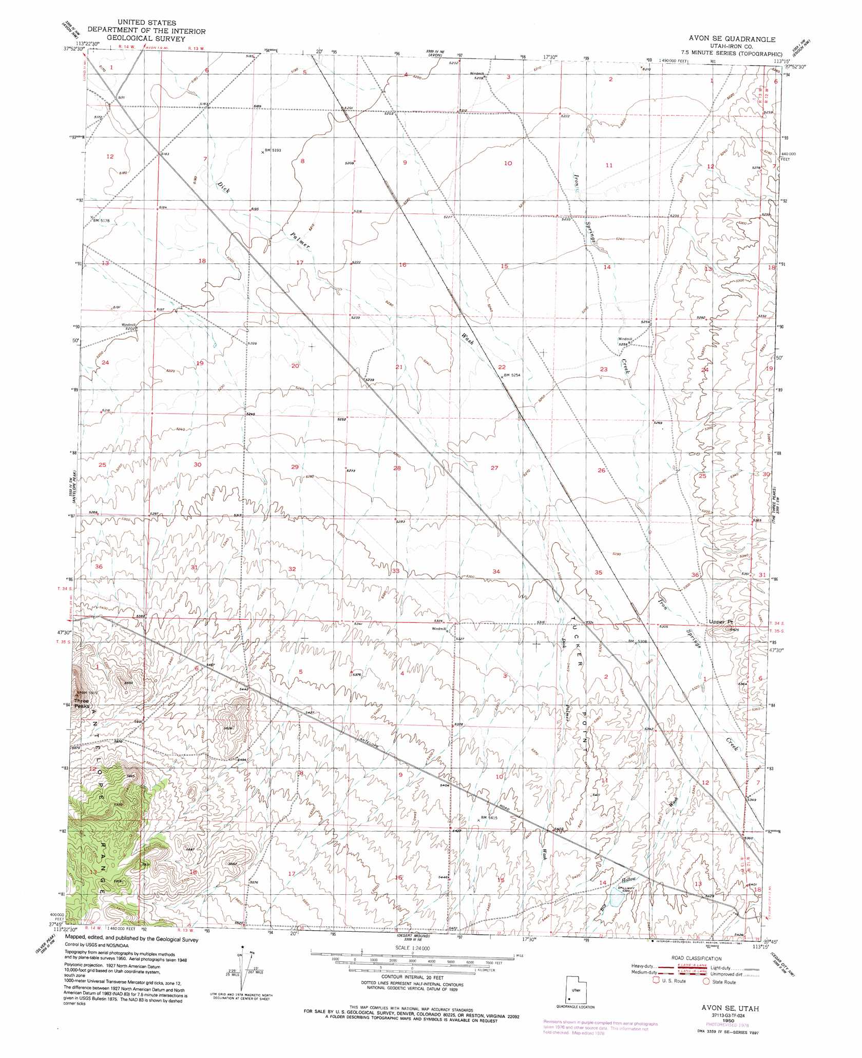
Avon Se Topo Map Utah
To zoom in, hover over the map of Avon Se
USGS Topo Quad 37113g3 - 1:24,000 scale
| Topo Map Name: | Avon Se |
| USGS Topo Quad ID: | 37113g3 |
| Print Size: | ca. 21 1/4" wide x 27" high |
| Southeast Coordinates: | 37.75° N latitude / 113.25° W longitude |
| Map Center Coordinates: | 37.8125° N latitude / 113.3125° W longitude |
| U.S. State: | UT |
| Filename: | o37113g3.jpg |
| Download Map JPG Image: | Avon Se topo map 1:24,000 scale |
| Map Type: | Topographic |
| Topo Series: | 7.5´ |
| Map Scale: | 1:24,000 |
| Source of Map Images: | United States Geological Survey (USGS) |
| Alternate Map Versions: |
Avon SE UT 1950, updated 1979 Download PDF Buy paper map Avon SE UT 1950, updated 1991 Download PDF Buy paper map Avon SE UT 1951 Download PDF Buy paper map Avon SE UT 2011 Download PDF Buy paper map Avon SE UT 2014 Download PDF Buy paper map |
1:24,000 Topo Quads surrounding Avon Se
Mountain Spring Peak |
Lund |
Latimer |
Badger Peak |
Baboon Peak |
Zane |
Avon Nw |
Avon |
Enoch Nw |
Enoch Ne |
Clark Farm |
Antelope Peak |
Avon Se |
The Three Peaks |
Enoch |
Newcastle |
Silver Peak |
Desert Mound |
Cedar City Nw |
Cedar City |
Pinto |
Page Ranch |
Stoddard Mountain |
Kanarraville |
Cedar Mountain |
> Back to 37113e1 at 1:100,000 scale
> Back to 37112a1 at 1:250,000 scale
> Back to U.S. Topo Maps home
Avon Se topo map: Gazetteer
Avon Se: Capes
Tucker Point elevation 1628m 5341′Upper Point elevation 1653m 5423′
Avon Se: Summits
Three Peaks elevation 1811m 5941′Avon Se: Valleys
Big Hollow Wash elevation 1627m 5337′Avon Se digital topo map on disk
Buy this Avon Se topo map showing relief, roads, GPS coordinates and other geographical features, as a high-resolution digital map file on DVD: