Heist Topo Map Utah
To zoom in, hover over the map of Heist
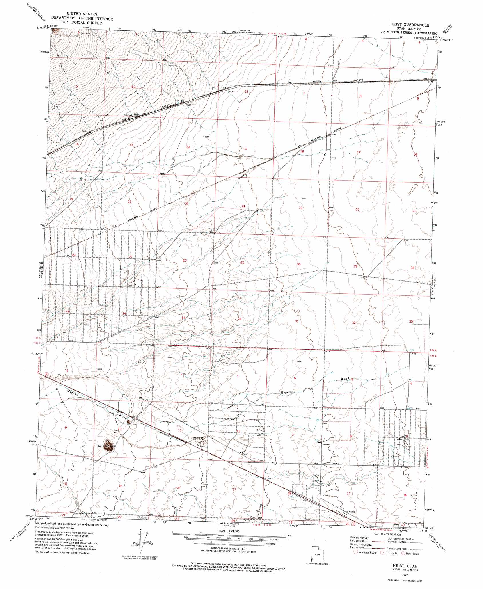
USGS Topo Quad 37113g7 - 1:24,000 scale
| Topo Map Name: | Heist |
| USGS Topo Quad ID: | 37113g7 |
| Print Size: | ca. 21 1/4" wide x 27" high |
| Southeast Coordinates: | 37.75° N latitude / 113.75° W longitude |
| Map Center Coordinates: | 37.8125° N latitude / 113.8125° W longitude |
| U.S. State: | UT |
| Filename: | o37113g7.jpg |
| Download Map JPG Image: | Heist topo map 1:24,000 scale |
| Map Type: | Topographic |
| Topo Series: | 7.5´ |
| Map Scale: | 1:24,000 |
| Source of Map Images: | United States Geological Survey (USGS) |
| Alternate Map Versions: |
Heist UT 1972, updated 1976 Download PDF Buy paper map Heist UT 2011 Download PDF Buy paper map Heist UT 2014 Download PDF Buy paper map |
1:24,000 Topo Quads surrounding Heist
Rice Mountain |
Steamboat Mountain Sw |
Steamboat Mountain |
Bible Spring |
Mountain Spring Peak |
Deer Lodge Canyon |
Eightmile Spring |
Bannion Spring |
Beryl |
Zane |
Prohibition Flat |
Modena |
Heist |
Yale Crossing |
Clark Farm |
Uvada |
Mount Escalante |
Pinon Point |
Beryl Junction |
Newcastle |
Pine Park |
Water Canyon Peak |
Hebron |
Enterprise |
Pinto |
> Back to 37113e1 at 1:100,000 scale
> Back to 37112a1 at 1:250,000 scale
> Back to U.S. Topo Maps home
Heist topo map: Gazetteer
Heist: Populated Places
Heist elevation 1618m 5308′Heist: Summits
Gray Knoll elevation 1649m 5410′Heist digital topo map on disk
Buy this Heist topo map showing relief, roads, GPS coordinates and other geographical features, as a high-resolution digital map file on DVD: