Tule Spring Topo Map Nevada
To zoom in, hover over the map of Tule Spring
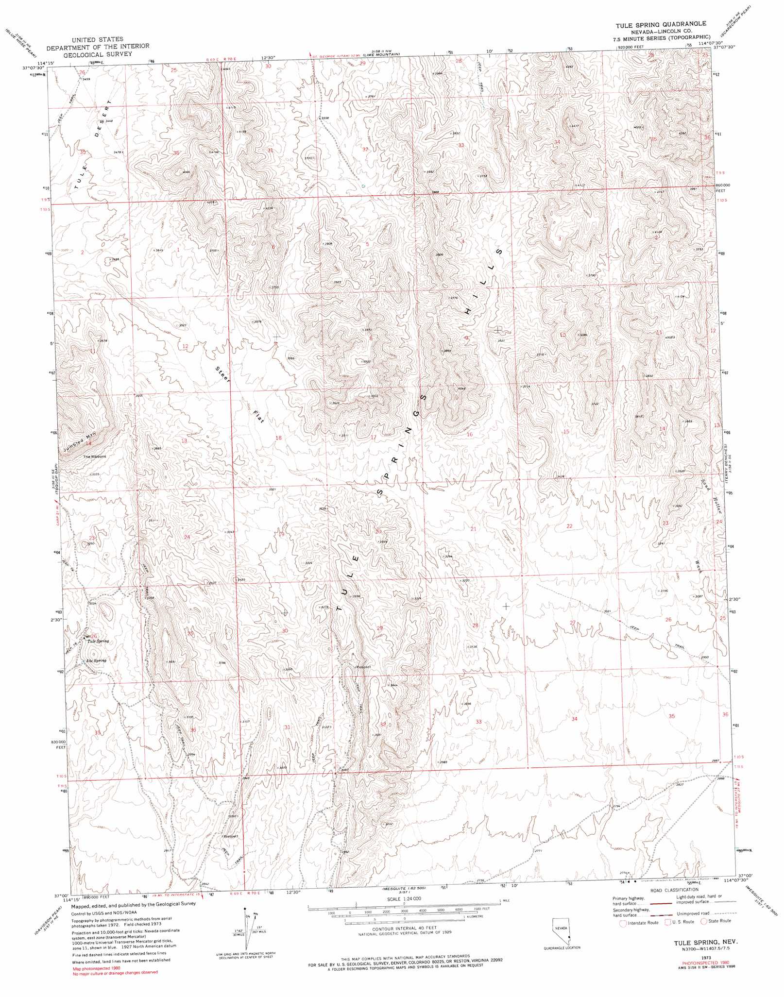
USGS Topo Quad 37114a2 - 1:24,000 scale
| Topo Map Name: | Tule Spring |
| USGS Topo Quad ID: | 37114a2 |
| Print Size: | ca. 21 1/4" wide x 27" high |
| Southeast Coordinates: | 37° N latitude / 114.125° W longitude |
| Map Center Coordinates: | 37.0625° N latitude / 114.1875° W longitude |
| U.S. State: | NV |
| Filename: | o37114a2.jpg |
| Download Map JPG Image: | Tule Spring topo map 1:24,000 scale |
| Map Type: | Topographic |
| Topo Series: | 7.5´ |
| Map Scale: | 1:24,000 |
| Source of Map Images: | United States Geological Survey (USGS) |
| Alternate Map Versions: |
Tule Spring NV 1973, updated 1976 Download PDF Buy paper map Tule Spring NV 1973, updated 1990 Download PDF Buy paper map Tule Spring NV 2012 Download PDF Buy paper map Tule Spring NV 2014 Download PDF Buy paper map |
1:24,000 Topo Quads surrounding Tule Spring
Leith |
Garden Spring |
Jacks Mountain |
Dodge Spring |
Motoqua |
Lyman Crossing |
Blue Nose Peak |
Lime Mountain |
Scarecrow Peak |
West Mountain Peak |
Carp |
Toquop Gap |
Tule Spring |
Terry Benches |
Castle Cliff |
Moapa Peak Nw |
Davidson Peak |
Mesquite Nw |
Mesquite Ne |
Littlefield |
Moapa Peak |
Moapa Peak Se |
Flat Top Mesa |
Mesquite |
Elbow Canyon |
> Back to 37114a1 at 1:100,000 scale
> Back to 37114a1 at 1:250,000 scale
> Back to U.S. Topo Maps home
Tule Spring topo map: Gazetteer
Tule Spring: Cliffs
The Ribbons elevation 1085m 3559′Tule Spring: Flats
Steer Flat elevation 1015m 3330′Tule Spring: Ranges
Tule Springs Hills elevation 1137m 3730′Tule Spring: Springs
Abe Spring elevation 914m 2998′Tule Spring elevation 921m 3021′
Tule Spring digital topo map on disk
Buy this Tule Spring topo map showing relief, roads, GPS coordinates and other geographical features, as a high-resolution digital map file on DVD: