Blue Nose Peak Topo Map Nevada
To zoom in, hover over the map of Blue Nose Peak
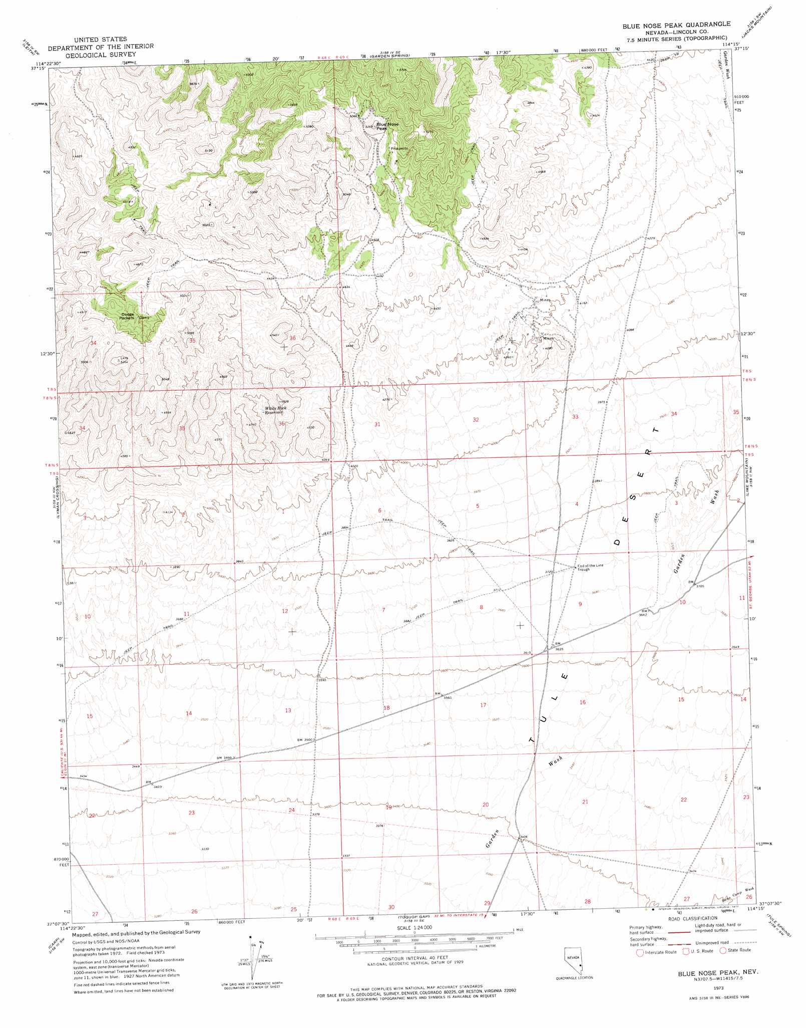
USGS Topo Quad 37114b3 - 1:24,000 scale
| Topo Map Name: | Blue Nose Peak |
| USGS Topo Quad ID: | 37114b3 |
| Print Size: | ca. 21 1/4" wide x 27" high |
| Southeast Coordinates: | 37.125° N latitude / 114.25° W longitude |
| Map Center Coordinates: | 37.1875° N latitude / 114.3125° W longitude |
| U.S. State: | NV |
| Filename: | o37114b3.jpg |
| Download Map JPG Image: | Blue Nose Peak topo map 1:24,000 scale |
| Map Type: | Topographic |
| Topo Series: | 7.5´ |
| Map Scale: | 1:24,000 |
| Source of Map Images: | United States Geological Survey (USGS) |
| Alternate Map Versions: |
Blue Nose Peak NV 1973, updated 1977 Download PDF Buy paper map Blue Nose Peak NV 2012 Download PDF Buy paper map Blue Nose Peak NV 2014 Download PDF Buy paper map |
1:24,000 Topo Quads surrounding Blue Nose Peak
Elgin Ne |
Ella Mountain |
Fife Mountain |
Bunker Peak |
Docs Pass |
Elgin |
Leith |
Garden Spring |
Jacks Mountain |
Dodge Spring |
Vigo Ne |
Lyman Crossing |
Blue Nose Peak |
Lime Mountain |
Scarecrow Peak |
Vigo |
Carp |
Toquop Gap |
Tule Spring |
Terry Benches |
Rox Ne |
Moapa Peak Nw |
Davidson Peak |
Mesquite Nw |
Mesquite Ne |
> Back to 37114a1 at 1:100,000 scale
> Back to 37114a1 at 1:250,000 scale
> Back to U.S. Topo Maps home
Blue Nose Peak topo map: Gazetteer
Blue Nose Peak: Basins
Dodge Pockets elevation 1422m 4665′Blue Nose Peak: Canals
Garden Springs Pipe Line elevation 1305m 4281′Blue Nose Peak: Dams
Dodge Pockets Dams elevation 1425m 4675′Blue Nose Peak: Flats
Tule Desert elevation 1115m 3658′Blue Nose Peak: Mines
Crystal Mine elevation 1495m 4904′Johnnie Mine elevation 1401m 4596′
Pittsburg Mine elevation 1438m 4717′
Wells Cargo Mine elevation 1283m 4209′
Blue Nose Peak: Reservoirs
Dodge Pocket Reservoir elevation 1375m 4511′End of the Line Trough elevation 1136m 3727′
White Rock Reservoir elevation 1323m 4340′
Blue Nose Peak: Summits
Blue Nose Peak elevation 1572m 5157′Blue Nose Peak digital topo map on disk
Buy this Blue Nose Peak topo map showing relief, roads, GPS coordinates and other geographical features, as a high-resolution digital map file on DVD: