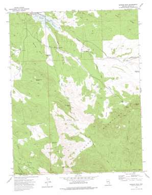
Bunker Peak Topo Map Nevada
To zoom in, hover over the map of Bunker Peak
USGS Topo Quad 37114d2 - 1:24,000 scale
| Topo Map Name: | Bunker Peak |
| USGS Topo Quad ID: | 37114d2 |
| Print Size: | ca. 21 1/4" wide x 27" high |
| Southeast Coordinates: | 37.375° N latitude / 114.125° W longitude |
| Map Center Coordinates: | 37.4375° N latitude / 114.1875° W longitude |
| U.S. State: | NV |
| Filename: | o37114d2.jpg |
| Download Map JPG Image: | Bunker Peak topo map 1:24,000 scale |
| Map Type: | Topographic |
| Topo Series: | 7.5´ |
| Map Scale: | 1:24,000 |
| Source of Map Images: | United States Geological Survey (USGS) |
| Alternate Map Versions: |
Bunker Peak NV 1973, updated 1977 Download PDF Buy paper map Bunker Peak NV 2012 Download PDF Buy paper map Bunker Peak NV 2014 Download PDF Buy paper map |
1:24,000 Topo Quads surrounding Bunker Peak
> Back to 37114a1 at 1:100,000 scale
> Back to 37114a1 at 1:250,000 scale
> Back to U.S. Topo Maps home
Bunker Peak topo map: Gazetteer
Bunker Peak: Dams
Mathews Canyon Dam elevation 1660m 5446′Bunker Peak: Flats
Bunker Flat elevation 1788m 5866′Bunker Peak: Gaps
Bunker Pass elevation 1793m 5882′Jacks Pass elevation 2076m 6811′
Mud Springs Saddle elevation 1804m 5918′
Bunker Peak: Reservoirs
Jacks Canyon Reservoir elevation 1903m 6243′Mahogany Knoll Reservoir elevation 1807m 5928′
Marble Reservoir elevation 1730m 5675′
Mathews Canyon Reservoir elevation 1660m 5446′
Middle Pass Reservoir elevation 1787m 5862′
Rolling Hills Reservoir elevation 1701m 5580′
Bunker Peak: Springs
Bunker Spring elevation 1724m 5656′Mathews Spring elevation 1656m 5433′
Mud Springs elevation 1688m 5538′
Quaking Aspen Spring elevation 1948m 6391′
Bunker Peak: Streams
East Pine Wash elevation 1672m 5485′Bunker Peak: Summits
Bunker Peak elevation 1939m 6361′Rolling Hills elevation 1731m 5679′
Bunker Peak: Valleys
East Pass Canyon elevation 1866m 6122′Little Rock Canyon elevation 1709m 5606′
Quaking Aspen Canyon elevation 1856m 6089′
Rock Canyon elevation 1658m 5439′
Bunker Peak: Wells
Barclay Well elevation 1705m 5593′Rock Canyon Well elevation 1709m 5606′
Bunker Peak digital topo map on disk
Buy this Bunker Peak topo map showing relief, roads, GPS coordinates and other geographical features, as a high-resolution digital map file on DVD:


