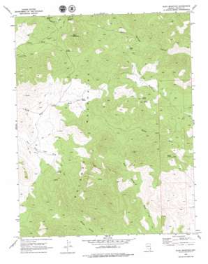
Slidy Mountain Topo Map Nevada
To zoom in, hover over the map of Slidy Mountain
USGS Topo Quad 37114d6 - 1:24,000 scale
| Topo Map Name: | Slidy Mountain |
| USGS Topo Quad ID: | 37114d6 |
| Print Size: | ca. 21 1/4" wide x 27" high |
| Southeast Coordinates: | 37.375° N latitude / 114.625° W longitude |
| Map Center Coordinates: | 37.4375° N latitude / 114.6875° W longitude |
| U.S. State: | NV |
| Filename: | o37114d6.jpg |
| Download Map JPG Image: | Slidy Mountain topo map 1:24,000 scale |
| Map Type: | Topographic |
| Topo Series: | 7.5´ |
| Map Scale: | 1:24,000 |
| Source of Map Images: | United States Geological Survey (USGS) |
| Alternate Map Versions: |
Slidy Mountain NV 1969, updated 1973 Download PDF Buy paper map Slidy Mountain NV 1969, updated 1979 Download PDF Buy paper map Slidy Mountain NV 2012 Download PDF Buy paper map Slidy Mountain NV 2014 Download PDF Buy paper map |
1:24,000 Topo Quads surrounding Slidy Mountain
> Back to 37114a1 at 1:100,000 scale
> Back to 37114a1 at 1:250,000 scale
> Back to U.S. Topo Maps home
Slidy Mountain topo map: Gazetteer
Slidy Mountain: Basins
Indian Basin elevation 1756m 5761′Slidy Mountain: Gaps
Applewhite Summit elevation 2148m 7047′Denton Summit elevation 2107m 6912′
Slidy Mountain: Mines
Robb Mine elevation 2286m 7500′Slidy Mountain: Springs
Abandoned Spring elevation 2023m 6637′Bishop Spring elevation 1712m 5616′
Blyth Spring elevation 1892m 6207′
Bull Spring elevation 1865m 6118′
Gordon Spring elevation 1560m 5118′
Horn Spring elevation 1926m 6318′
Joshua Spring elevation 1853m 6079′
Lone Willow Spring elevation 1920m 6299′
Lower Indian Spring elevation 1775m 5823′
Lower Willow Creek Spring elevation 1967m 6453′
Mona Spring elevation 1879m 6164′
Tunnel Number One Spring elevation 1814m 5951′
Tunnel Number Three Spring elevation 1782m 5846′
Tunnel Number Two Spring elevation 1805m 5921′
Tunnel Spring elevation 1878m 6161′
Upper Indian Spring elevation 1784m 5853′
Upper Riggs Spring elevation 1745m 5725′
Upper Willow Creek Spring elevation 1928m 6325′
Willow Creek Spring elevation 1788m 5866′
Slidy Mountain: Summits
Slidy Mountain elevation 2349m 7706′Slidy Mountain: Wells
China Well elevation 2029m 6656′Slidy Mountain digital topo map on disk
Buy this Slidy Mountain topo map showing relief, roads, GPS coordinates and other geographical features, as a high-resolution digital map file on DVD:


