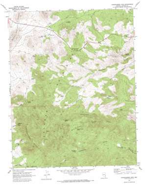
Chokecherry Mountain Topo Map Nevada
To zoom in, hover over the map of Chokecherry Mountain
USGS Topo Quad 37114e6 - 1:24,000 scale
| Topo Map Name: | Chokecherry Mountain |
| USGS Topo Quad ID: | 37114e6 |
| Print Size: | ca. 21 1/4" wide x 27" high |
| Southeast Coordinates: | 37.5° N latitude / 114.625° W longitude |
| Map Center Coordinates: | 37.5625° N latitude / 114.6875° W longitude |
| U.S. State: | NV |
| Filename: | o37114e6.jpg |
| Download Map JPG Image: | Chokecherry Mountain topo map 1:24,000 scale |
| Map Type: | Topographic |
| Topo Series: | 7.5´ |
| Map Scale: | 1:24,000 |
| Source of Map Images: | United States Geological Survey (USGS) |
| Alternate Map Versions: |
Chokecherry Mtn. NV 1970, updated 1973 Download PDF Buy paper map Chokecherry Mtn. NV 1970, updated 1973 Download PDF Buy paper map Chokecherry Mountain NV 2012 Download PDF Buy paper map Chokecherry Mountain NV 2014 Download PDF Buy paper map |
1:24,000 Topo Quads surrounding Chokecherry Mountain
> Back to 37114e1 at 1:100,000 scale
> Back to 37114a1 at 1:250,000 scale
> Back to U.S. Topo Maps home
Chokecherry Mountain topo map: Gazetteer
Chokecherry Mountain: Gaps
Oak Springs Summit elevation 1904m 6246′Chokecherry Mountain: Mines
Taylor Mine elevation 1670m 5479′Chokecherry Mountain: Springs
Applewhite Spring elevation 1889m 6197′Balm of Gilead Spring elevation 1954m 6410′
Bird Spring elevation 2044m 6706′
Buckboard Spring elevation 1687m 5534′
Canyon Number Two Spring elevation 2023m 6637′
Canyon Spring elevation 1988m 6522′
Chalk Spring elevation 1596m 5236′
Chokecherry Spring elevation 1963m 6440′
Colburn Spring elevation 1702m 5583′
Cottonwood Spring elevation 2061m 6761′
Coyote Spring elevation 2001m 6564′
Cylone Spring elevation 1904m 6246′
Moon Spring elevation 1919m 6295′
Mule Spring elevation 1853m 6079′
Nelson Spring elevation 1842m 6043′
Oak Spring elevation 1802m 5912′
Pine Spring elevation 1990m 6528′
Robinson Seep elevation 2040m 6692′
South Willow Spring elevation 2025m 6643′
Taylor Mine Spring elevation 1682m 5518′
Tyler Spring elevation 1865m 6118′
West Oak Spring elevation 1794m 5885′
Willow Spring elevation 1950m 6397′
Chokecherry Mountain: Summits
Chokecherry Mountain elevation 2439m 8001′Chokecherry Mountain: Valleys
Applewhite Canyon elevation 1729m 5672′Balm of Gilead Canyon elevation 1679m 5508′
Chokecherry Mountain digital topo map on disk
Buy this Chokecherry Mountain topo map showing relief, roads, GPS coordinates and other geographical features, as a high-resolution digital map file on DVD:


