Pahroc Spring Ne Topo Map Nevada
To zoom in, hover over the map of Pahroc Spring Ne
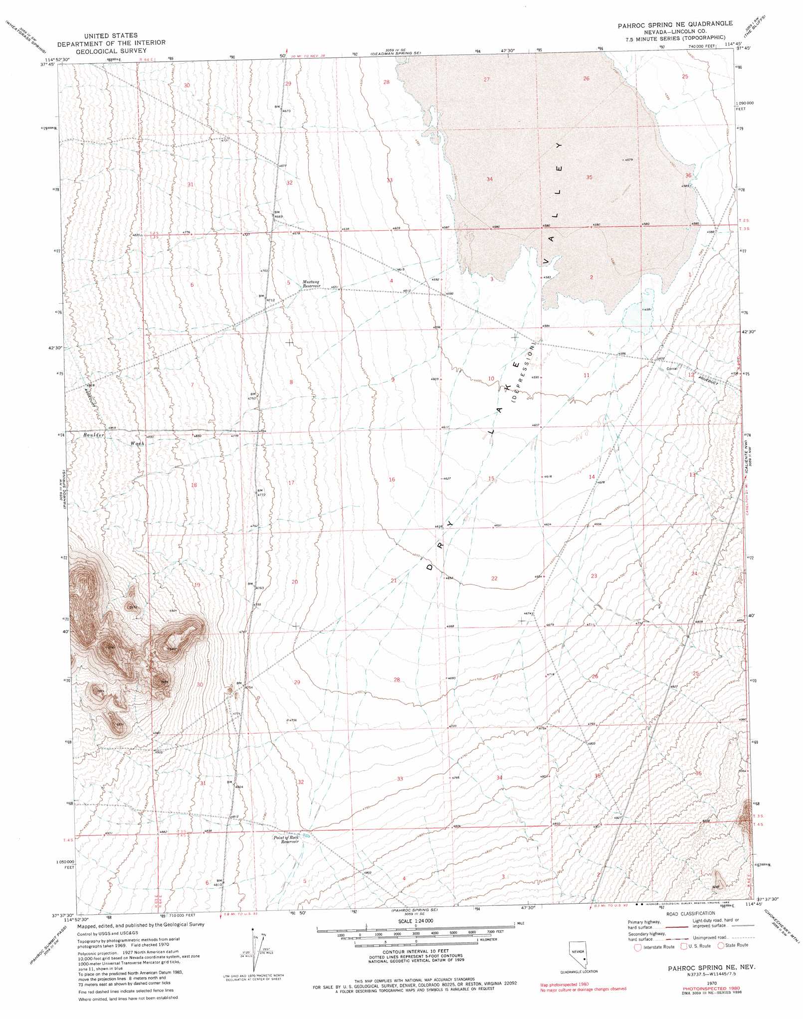
USGS Topo Quad 37114f7 - 1:24,000 scale
| Topo Map Name: | Pahroc Spring Ne |
| USGS Topo Quad ID: | 37114f7 |
| Print Size: | ca. 21 1/4" wide x 27" high |
| Southeast Coordinates: | 37.625° N latitude / 114.75° W longitude |
| Map Center Coordinates: | 37.6875° N latitude / 114.8125° W longitude |
| U.S. State: | NV |
| Filename: | o37114f7.jpg |
| Download Map JPG Image: | Pahroc Spring Ne topo map 1:24,000 scale |
| Map Type: | Topographic |
| Topo Series: | 7.5´ |
| Map Scale: | 1:24,000 |
| Source of Map Images: | United States Geological Survey (USGS) |
| Alternate Map Versions: |
Pahroc Spring NE NV 1970, updated 1973 Download PDF Buy paper map Pahroc Spring NE NV 1970, updated 1983 Download PDF Buy paper map Pahroc Spring NE NV 2012 Download PDF Buy paper map Pahroc Spring NE NV 2014 Download PDF Buy paper map |
1:24,000 Topo Quads surrounding Pahroc Spring Ne
Weepah Spring |
Deadman Spring |
Deadman Spring Ne |
Ely Springs |
Highland Peak |
White River Narrows |
Wheatgrass Spring |
Deadman Spring Se |
The Bluffs |
Bennett Pass |
Hiko Ne |
Pahroc Spring |
Pahroc Spring Ne |
Caliente Nw |
Chief Mountain |
Hiko Se |
Pahroc Summit Pass |
Pahroc Spring Se |
Chokecherry Mountain |
Caliente |
Alamo Ne |
Delamar Nw |
Delamar |
Slidy Mountain |
Elgin Ne |
> Back to 37114e1 at 1:100,000 scale
> Back to 37114a1 at 1:250,000 scale
> Back to U.S. Topo Maps home
Pahroc Spring Ne topo map: Gazetteer
Pahroc Spring Ne: Reservoirs
Bristol Lake Number Four elevation 1413m 4635′Bristol Lake Number One elevation 1397m 4583′
Bristol Lake Number Three elevation 1405m 4609′
Cliff Reservoir elevation 1398m 4586′
Mustang Reservoir elevation 1428m 4685′
Point of Rock Reservoir elevation 1451m 4760′
Pahroc Spring Ne: Springs
Long Point Spring elevation 1483m 4865′Pahroc Spring Ne: Streams
Boulder Wash elevation 1397m 4583′Red Rock Wash elevation 1458m 4783′
Pahroc Spring Ne digital topo map on disk
Buy this Pahroc Spring Ne topo map showing relief, roads, GPS coordinates and other geographical features, as a high-resolution digital map file on DVD: