Condor Canyon Topo Map Nevada
To zoom in, hover over the map of Condor Canyon
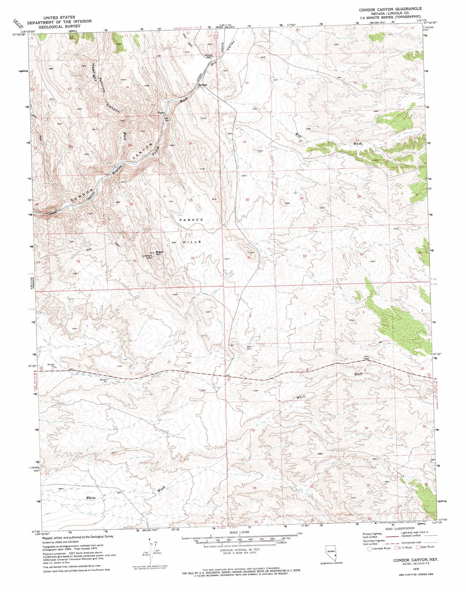
USGS Topo Quad 37114g3 - 1:24,000 scale
| Topo Map Name: | Condor Canyon |
| USGS Topo Quad ID: | 37114g3 |
| Print Size: | ca. 21 1/4" wide x 27" high |
| Southeast Coordinates: | 37.75° N latitude / 114.25° W longitude |
| Map Center Coordinates: | 37.8125° N latitude / 114.3125° W longitude |
| U.S. State: | NV |
| Filename: | o37114g3.jpg |
| Download Map JPG Image: | Condor Canyon topo map 1:24,000 scale |
| Map Type: | Topographic |
| Topo Series: | 7.5´ |
| Map Scale: | 1:24,000 |
| Source of Map Images: | United States Geological Survey (USGS) |
| Alternate Map Versions: |
Condor Canyon NV 1970, updated 1973 Download PDF Buy paper map Condor Canyon NV 2012 Download PDF Buy paper map Condor Canyon NV 2014 Download PDF Buy paper map |
1:24,000 Topo Quads surrounding Condor Canyon
Bristol Range Se |
Mount Wilson Sw |
Pierson Summit |
Eagle Valley Reservoir |
Rice Mountain |
Highland Peak |
Pioche |
Rose Valley |
Ursine |
Deer Lodge Canyon |
Bennett Pass |
Panaca |
Condor Canyon |
Panaca Summit |
Prohibition Flat |
Chief Mountain |
Indian Cove |
Mosey Mountain |
Dow Mountain |
Uvada |
Caliente |
Eccles |
Islen |
Acoma |
Pine Park |
> Back to 37114e1 at 1:100,000 scale
> Back to 37114a1 at 1:250,000 scale
> Back to U.S. Topo Maps home
Condor Canyon topo map: Gazetteer
Condor Canyon: Areas
Panaca Hills elevation 1678m 5505′Condor Canyon: Populated Places
Delmues (historical) elevation 1559m 5114′Condor Canyon: Reservoirs
Big Flat Reservoir elevation 1638m 5374′Condor Canyon: Springs
Delmues Springs elevation 1555m 5101′Meadow Valley Spring elevation 1635m 5364′
Condor Canyon: Streams
Kiln Wash elevation 1549m 5082′Patterson Wash elevation 1512m 4960′
Condor Canyon: Summits
Black Hill elevation 1760m 5774′Condor Canyon: Valleys
Condar Ravine elevation 1492m 4895′Dry Valley elevation 1549m 5082′
Hamlight Canyon elevation 1512m 4960′
Condor Canyon digital topo map on disk
Buy this Condor Canyon topo map showing relief, roads, GPS coordinates and other geographical features, as a high-resolution digital map file on DVD: