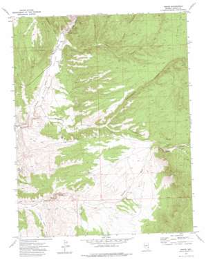
Ursine Topo Map Nevada
To zoom in, hover over the map of Ursine
USGS Topo Quad 37114h2 - 1:24,000 scale
| Topo Map Name: | Ursine |
| USGS Topo Quad ID: | 37114h2 |
| Print Size: | ca. 21 1/4" wide x 27" high |
| Southeast Coordinates: | 37.875° N latitude / 114.125° W longitude |
| Map Center Coordinates: | 37.9375° N latitude / 114.1875° W longitude |
| U.S. State: | NV |
| Filename: | o37114h2.jpg |
| Download Map JPG Image: | Ursine topo map 1:24,000 scale |
| Map Type: | Topographic |
| Topo Series: | 7.5´ |
| Map Scale: | 1:24,000 |
| Source of Map Images: | United States Geological Survey (USGS) |
| Alternate Map Versions: |
Ursine NV 1972, updated 1975 Download PDF Buy paper map Ursine NV 2012 Download PDF Buy paper map Ursine NV 2014 Download PDF Buy paper map |
1:24,000 Topo Quads surrounding Ursine
> Back to 37114e1 at 1:100,000 scale
> Back to 37114a1 at 1:250,000 scale
> Back to U.S. Topo Maps home
Ursine topo map: Gazetteer
Ursine: Gaps
Little Summit elevation 1954m 6410′Ursine: Populated Places
Ursine elevation 1704m 5590′Ursine: Post Offices
Ursine Post Office (historical) elevation 1704m 5590′Ursine: Springs
Flatnose Ranch Spring elevation 1684m 5524′Ursine: Streams
Gleason Canyon Wash elevation 1647m 5403′Immigration Wash elevation 1660m 5446′
Ursine: Valleys
Deer Lodge Canyon elevation 1917m 6289′Deer Lodge Canyon elevation 1881m 6171′
Dry Canyon elevation 1710m 5610′
Eagle Valley elevation 1663m 5456′
Eagle Valley Canyon elevation 1707m 5600′
Fulman Canyon elevation 1789m 5869′
Horsethief Canyon elevation 1719m 5639′
Serviceberry Canyon elevation 1785m 5856′
Ursine digital topo map on disk
Buy this Ursine topo map showing relief, roads, GPS coordinates and other geographical features, as a high-resolution digital map file on DVD:


