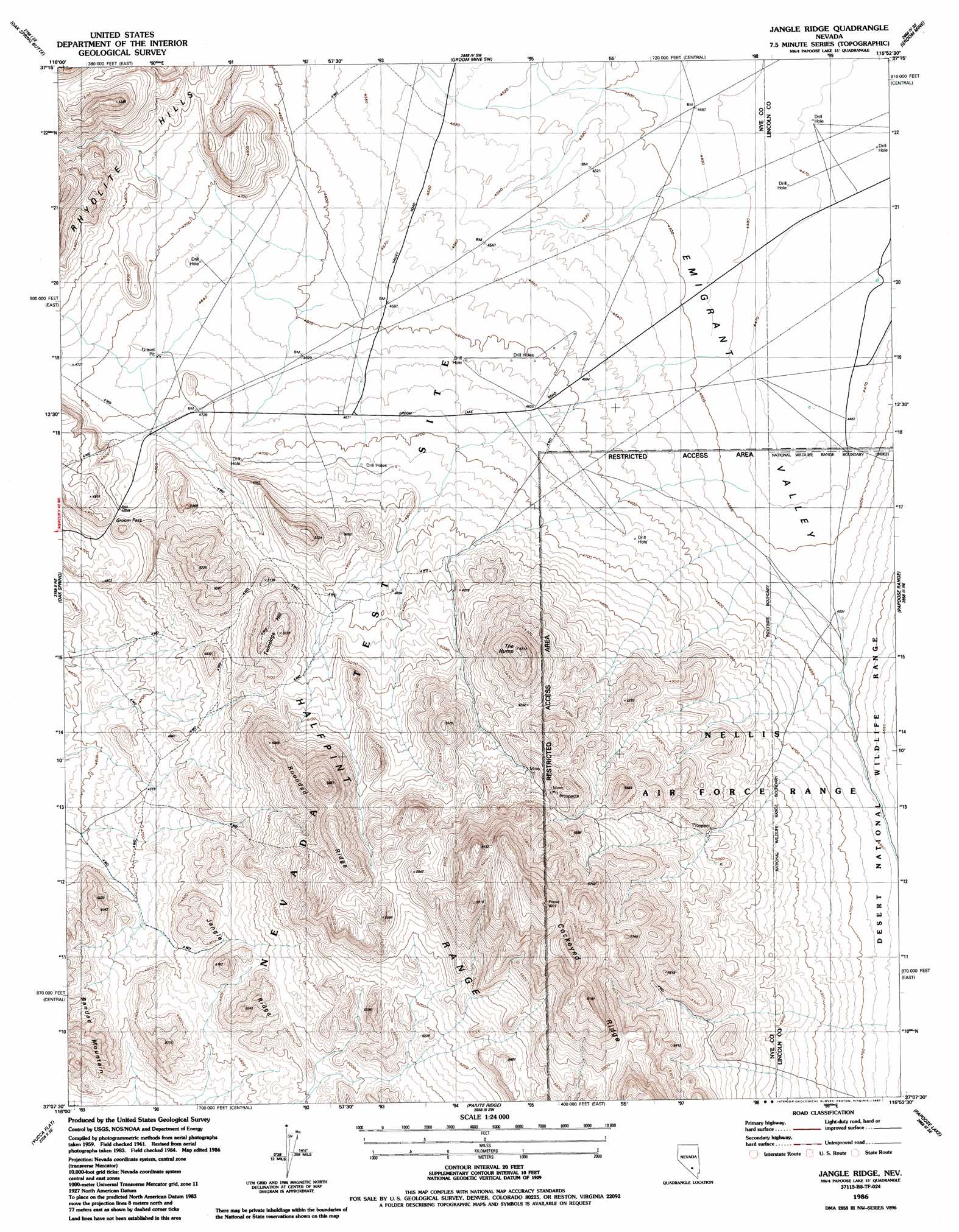
Jangle Ridge Topo Map Nevada
To zoom in, hover over the map of Jangle Ridge
USGS Topo Quad 37115b8 - 1:24,000 scale
| Topo Map Name: | Jangle Ridge |
| USGS Topo Quad ID: | 37115b8 |
| Print Size: | ca. 21 1/4" wide x 27" high |
| Southeast Coordinates: | 37.125° N latitude / 115.875° W longitude |
| Map Center Coordinates: | 37.1875° N latitude / 115.9375° W longitude |
| U.S. State: | NV |
| Filename: | o37115b8.jpg |
| Download Map JPG Image: | Jangle Ridge topo map 1:24,000 scale |
| Map Type: | Topographic |
| Topo Series: | 7.5´ |
| Map Scale: | 1:24,000 |
| Source of Map Images: | United States Geological Survey (USGS) |
| Alternate Map Versions: |
Jangle Ridge NV 1961, updated 1962 Download PDF Buy paper map Jangle Ridge NV 1961, updated 1975 Download PDF Buy paper map Jangle Ridge NV 1961, updated 1984 Download PDF Buy paper map Jangle Ridge NV 1986, updated 1987 Download PDF Buy paper map |
1:24,000 Topo Quads surrounding Jangle Ridge
Sundown Reservoir |
Wheelbarrow Peak |
Groom Mine Nw |
Cattle Spring |
Groom Range |
Quartet Dome |
Oak Spring Butte |
Groom Mine Sw |
Groom Mine |
Groom Range Sw |
Rainier Mesa |
Oak Spring |
Jangle Ridge |
Papoose Range |
Fallout Hills Nw |
Tippipah Spring |
Yucca Flat |
Paiute Ridge |
Papoose Lake |
Fallout Hills |
Mine Mountain |
Yucca Lake |
Plutonium Valley |
Aysees Peak |
Quartz Peak Nw |
> Back to 37115a1 at 1:100,000 scale
> Back to 37114a1 at 1:250,000 scale
> Back to U.S. Topo Maps home
Jangle Ridge topo map: Gazetteer
Jangle Ridge: Gaps
Groom Pass elevation 1470m 4822′Jangle Ridge: Ranges
Halfpint Range elevation 1767m 5797′Jangle Ridge: Ridges
Cockeyed Ridge elevation 1904m 6246′Jangle Ridge elevation 1508m 4947′
Rounded Ridge elevation 1734m 5688′
Jangle Ridge: Summits
The Hump elevation 1740m 5708′Twinridge Hill elevation 1615m 5298′
Jangle Ridge digital topo map on disk
Buy this Jangle Ridge topo map showing relief, roads, GPS coordinates and other geographical features, as a high-resolution digital map file on DVD: