Hancock Summit Topo Map Nevada
To zoom in, hover over the map of Hancock Summit
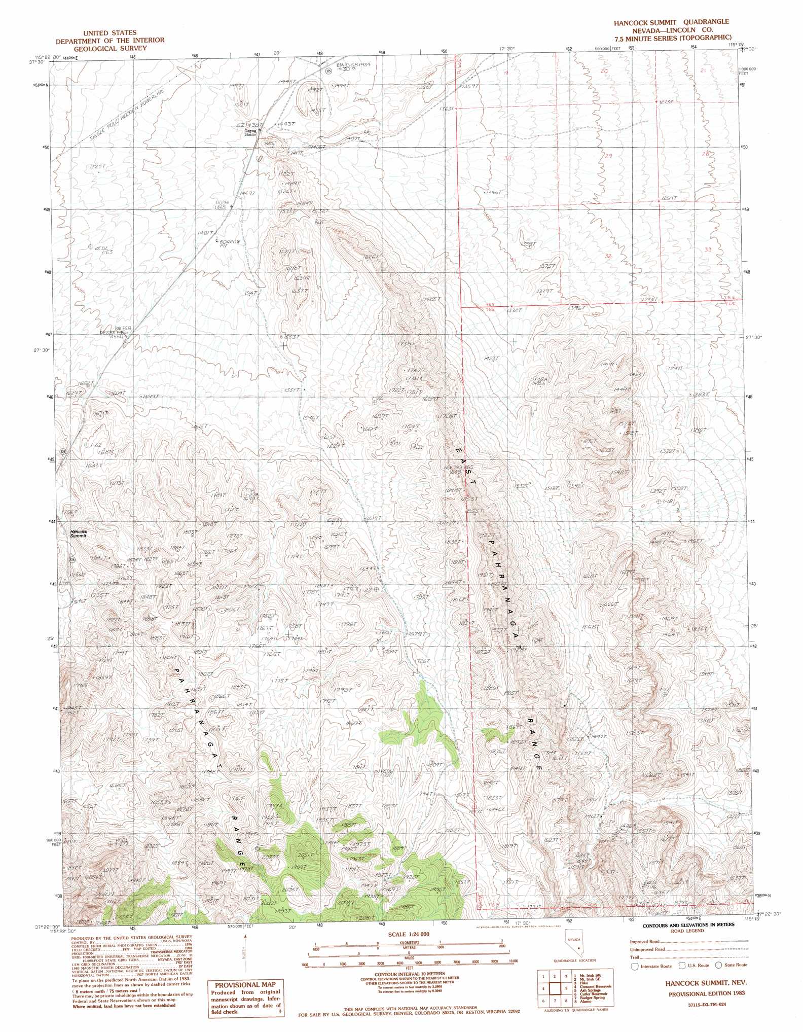
USGS Topo Quad 37115d3 - 1:24,000 scale
| Topo Map Name: | Hancock Summit |
| USGS Topo Quad ID: | 37115d3 |
| Print Size: | ca. 21 1/4" wide x 27" high |
| Southeast Coordinates: | 37.375° N latitude / 115.25° W longitude |
| Map Center Coordinates: | 37.4375° N latitude / 115.3125° W longitude |
| U.S. State: | NV |
| Filename: | o37115d3.jpg |
| Download Map JPG Image: | Hancock Summit topo map 1:24,000 scale |
| Map Type: | Topographic |
| Topo Series: | 7.5´ |
| Map Scale: | 1:24,000 |
| Source of Map Images: | United States Geological Survey (USGS) |
| Alternate Map Versions: |
Hancock Summit NV 1983, updated 1983 Download PDF Buy paper map Hancock Summit NV 2012 Download PDF Buy paper map Hancock Summit NV 2015 Download PDF Buy paper map |
1:24,000 Topo Quads surrounding Hancock Summit
Monte Mountain |
Mount Irish |
Mail Summit |
Fossil Peak |
Hiko Ne |
Tempiute Mountain Se |
Crescent Spring |
Mount Irish Se |
Hiko |
Hiko Se |
Groom Range Ne |
Crescent Reservoir |
Hancock Summit |
Ash Springs |
Alamo Ne |
Groom Range Se |
Cutler Reservoir |
Badger Spring |
Alamo |
Alamo Se |
Fallout Hills Ne |
Desert Hills Nw |
Desert Hills Ne |
Lower Pahranagat Lake Nw |
Lower Pahranagat Lake |
> Back to 37115a1 at 1:100,000 scale
> Back to 37114a1 at 1:250,000 scale
> Back to U.S. Topo Maps home
Hancock Summit topo map: Gazetteer
Hancock Summit: Ranges
Mount Irish Range elevation 1694m 5557′Hancock Summit: Springs
Cow Camp Spring elevation 1559m 5114′Hancock Summit digital topo map on disk
Buy this Hancock Summit topo map showing relief, roads, GPS coordinates and other geographical features, as a high-resolution digital map file on DVD: