Mount Irish Se Topo Map Nevada
To zoom in, hover over the map of Mount Irish Se
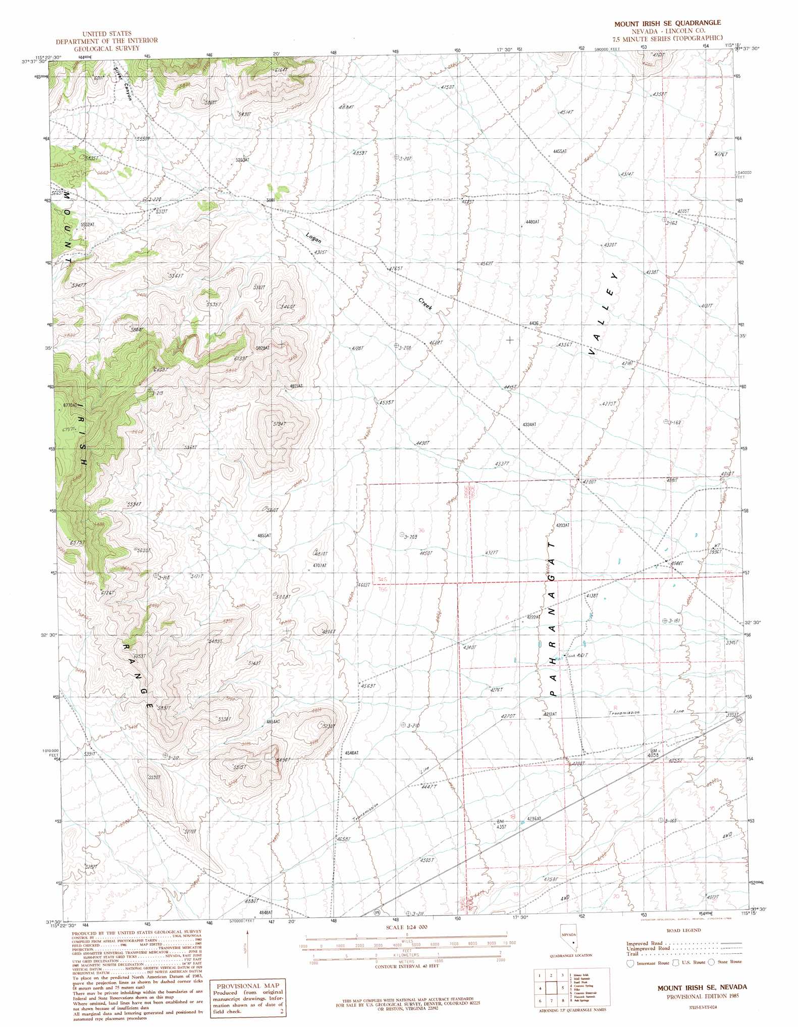
USGS Topo Quad 37115e3 - 1:24,000 scale
| Topo Map Name: | Mount Irish Se |
| USGS Topo Quad ID: | 37115e3 |
| Print Size: | ca. 21 1/4" wide x 27" high |
| Southeast Coordinates: | 37.5° N latitude / 115.25° W longitude |
| Map Center Coordinates: | 37.5625° N latitude / 115.3125° W longitude |
| U.S. State: | NV |
| Filename: | o37115e3.jpg |
| Download Map JPG Image: | Mount Irish Se topo map 1:24,000 scale |
| Map Type: | Topographic |
| Topo Series: | 7.5´ |
| Map Scale: | 1:24,000 |
| Source of Map Images: | United States Geological Survey (USGS) |
| Alternate Map Versions: |
Mount Irish SE NV 1985, updated 1986 Download PDF Buy paper map Mount Irish SE NV 2012 Download PDF Buy paper map Mount Irish SE NV 2014 Download PDF Buy paper map |
1:24,000 Topo Quads surrounding Mount Irish Se
Meeker Peak |
Murphy Gap |
Murphy Gap Se |
Seaman Wash |
White River Narrows |
Monte Mountain |
Mount Irish |
Mail Summit |
Fossil Peak |
Hiko Ne |
Tempiute Mountain Se |
Crescent Spring |
Mount Irish Se |
Hiko |
Hiko Se |
Groom Range Ne |
Crescent Reservoir |
Hancock Summit |
Ash Springs |
Alamo Ne |
Groom Range Se |
Cutler Reservoir |
Badger Spring |
Alamo |
Alamo Se |
> Back to 37115e1 at 1:100,000 scale
> Back to 37114a1 at 1:250,000 scale
> Back to U.S. Topo Maps home
Mount Irish Se topo map: Gazetteer
Mount Irish Se: Valleys
Logan Canyon elevation 1582m 5190′Silver Canyon elevation 1714m 5623′
Mount Irish Se digital topo map on disk
Buy this Mount Irish Se topo map showing relief, roads, GPS coordinates and other geographical features, as a high-resolution digital map file on DVD: