Tempiute Mountain Se Topo Map Nevada
To zoom in, hover over the map of Tempiute Mountain Se
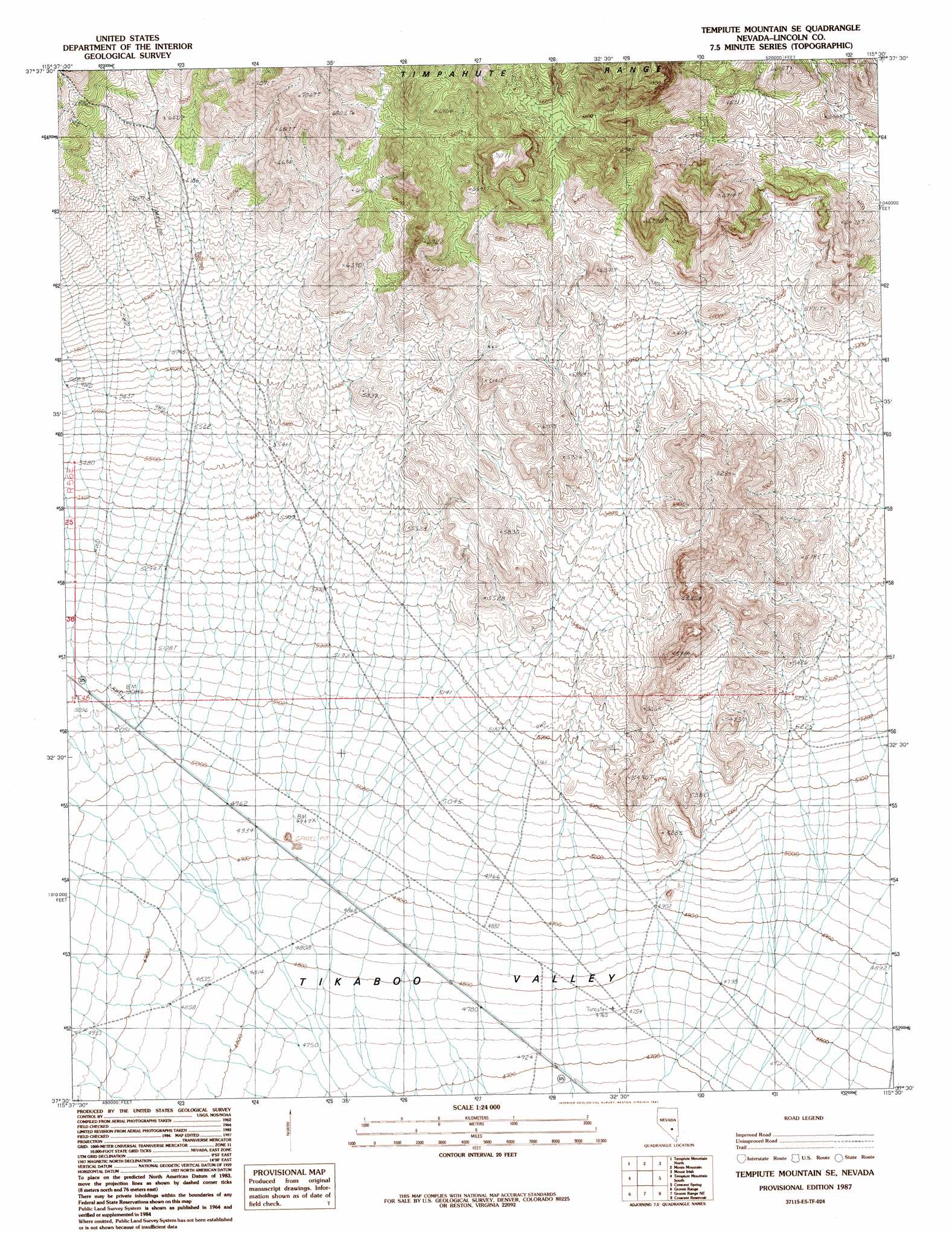
USGS Topo Quad 37115e5 - 1:24,000 scale
| Topo Map Name: | Tempiute Mountain Se |
| USGS Topo Quad ID: | 37115e5 |
| Print Size: | ca. 21 1/4" wide x 27" high |
| Southeast Coordinates: | 37.5° N latitude / 115.5° W longitude |
| Map Center Coordinates: | 37.5625° N latitude / 115.5625° W longitude |
| U.S. State: | NV |
| Filename: | o37115e5.jpg |
| Download Map JPG Image: | Tempiute Mountain Se topo map 1:24,000 scale |
| Map Type: | Topographic |
| Topo Series: | 7.5´ |
| Map Scale: | 1:24,000 |
| Source of Map Images: | United States Geological Survey (USGS) |
| Alternate Map Versions: |
Tempiute Mountain SE NV 1987, updated 1987 Download PDF Buy paper map Tempiute Mountain SE NV 2012 Download PDF Buy paper map Tempiute Mountain SE NV 2015 Download PDF Buy paper map |
1:24,000 Topo Quads surrounding Tempiute Mountain Se
Honest John Well |
Worthington Peak Sw |
Meeker Peak |
Murphy Gap |
Murphy Gap Se |
White Blotch Springs Ne |
Timpiute Mountain North |
Monte Mountain |
Mount Irish |
Mail Summit |
White Blotch Springs Se |
Tempiute Mountain South |
Tempiute Mountain Se |
Crescent Spring |
Mount Irish Se |
Cattle Spring |
Groom Range |
Groom Range Ne |
Crescent Reservoir |
Hancock Summit |
Groom Mine |
Groom Range Sw |
Groom Range Se |
Cutler Reservoir |
Badger Spring |
> Back to 37115e1 at 1:100,000 scale
> Back to 37114a1 at 1:250,000 scale
> Back to U.S. Topo Maps home
No gazetteer data is available for the Tempiute Mountain Se topo map sheet.
Tempiute Mountain Se digital topo map on disk
Buy this Tempiute Mountain Se topo map showing relief, roads, GPS coordinates and other geographical features, as a high-resolution digital map file on DVD: