White Blotch Springs Se Topo Map Nevada
To zoom in, hover over the map of White Blotch Springs Se
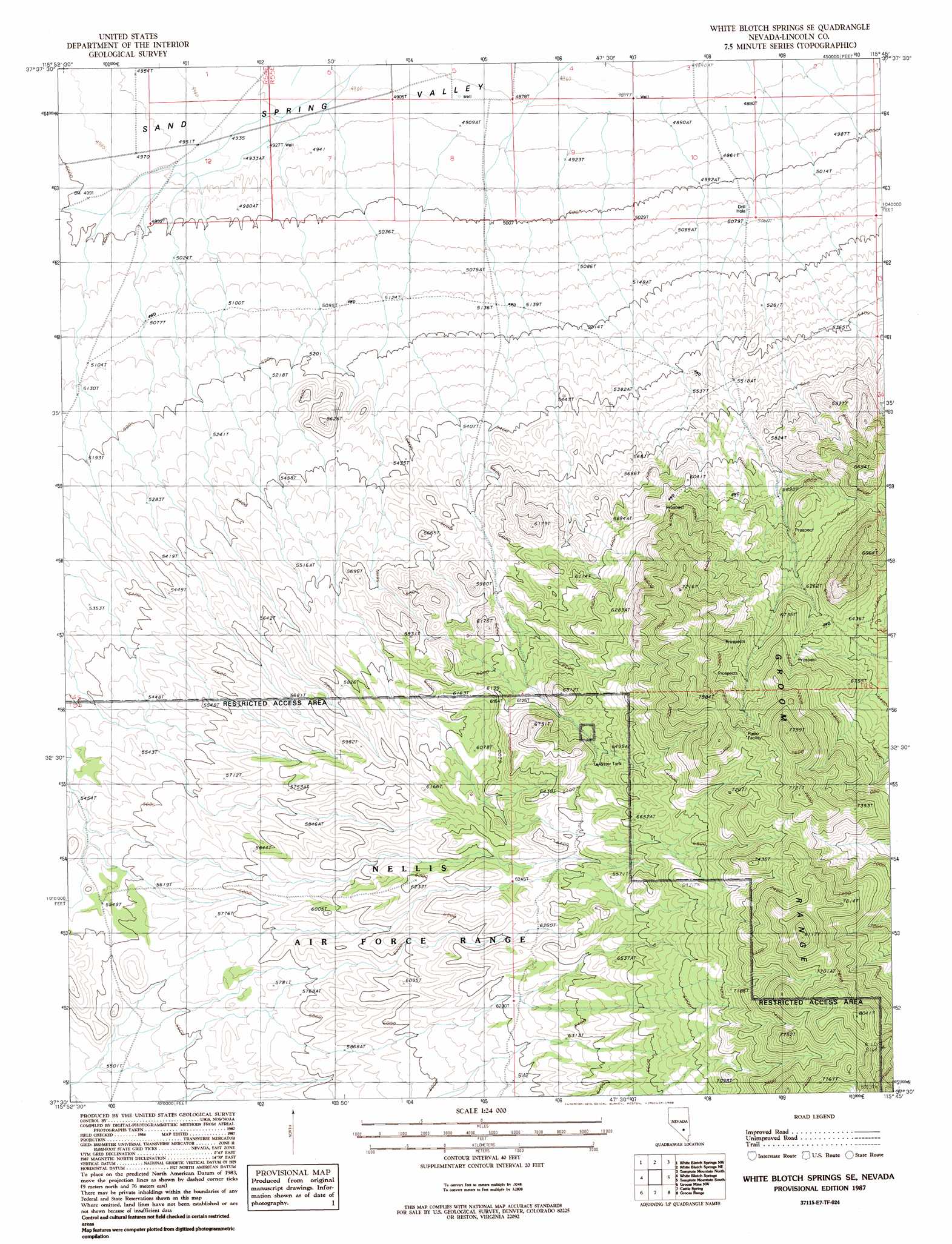
USGS Topo Quad 37115e7 - 1:24,000 scale
| Topo Map Name: | White Blotch Springs Se |
| USGS Topo Quad ID: | 37115e7 |
| Print Size: | ca. 21 1/4" wide x 27" high |
| Southeast Coordinates: | 37.5° N latitude / 115.75° W longitude |
| Map Center Coordinates: | 37.5625° N latitude / 115.8125° W longitude |
| U.S. State: | NV |
| Filename: | o37115e7.jpg |
| Download Map JPG Image: | White Blotch Springs Se topo map 1:24,000 scale |
| Map Type: | Topographic |
| Topo Series: | 7.5´ |
| Map Scale: | 1:24,000 |
| Source of Map Images: | United States Geological Survey (USGS) |
| Alternate Map Versions: |
White Blotch Springs SE NV 1987, updated 1988 Download PDF Buy paper map White Blotch Springs SE NV 2012 Download PDF Buy paper map White Blotch Springs SE NV 2015 Download PDF Buy paper map |
1:24,000 Topo Quads surrounding White Blotch Springs Se
Reveille Peak Se |
Black Top |
Honest John Well |
Worthington Peak Sw |
Meeker Peak |
Monotony Valley |
White Blotch Springs Nw |
White Blotch Springs Ne |
Timpiute Mountain North |
Monte Mountain |
Belted Peak |
White Blotch Springs |
White Blotch Springs Se |
Tempiute Mountain South |
Tempiute Mountain Se |
Wheelbarrow Peak |
Groom Mine Nw |
Cattle Spring |
Groom Range |
Groom Range Ne |
Oak Spring Butte |
Groom Mine Sw |
Groom Mine |
Groom Range Sw |
Groom Range Se |
> Back to 37115e1 at 1:100,000 scale
> Back to 37114a1 at 1:250,000 scale
> Back to U.S. Topo Maps home
White Blotch Springs Se topo map: Gazetteer
White Blotch Springs Se: Wells
Hot Water Well elevation 1505m 4937′Rosebud Well elevation 2167m 7109′
Southeastern Well elevation 1488m 4881′
White Blotch Springs Se digital topo map on disk
Buy this White Blotch Springs Se topo map showing relief, roads, GPS coordinates and other geographical features, as a high-resolution digital map file on DVD: