Fossil Peak Topo Map Nevada
To zoom in, hover over the map of Fossil Peak
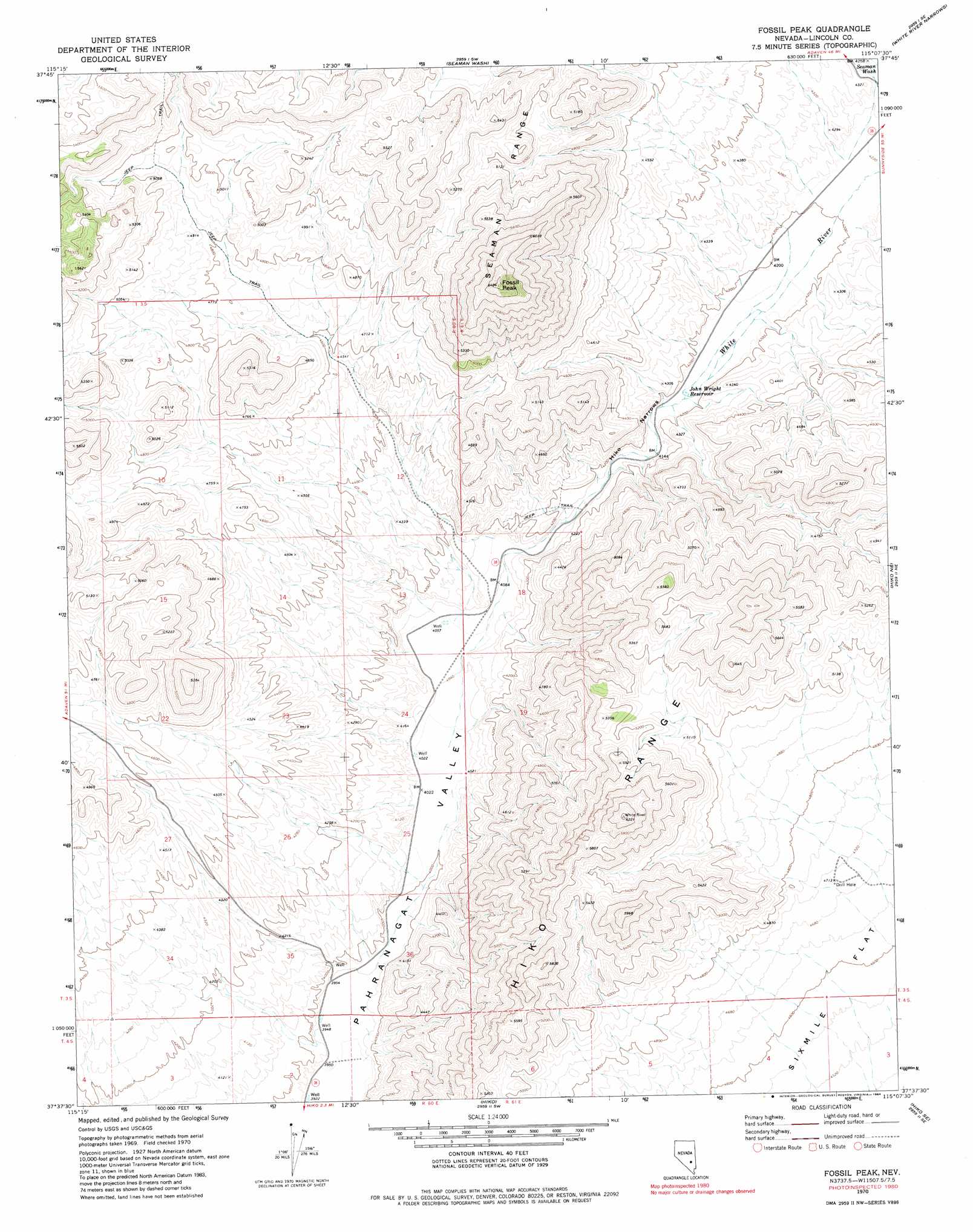
USGS Topo Quad 37115f2 - 1:24,000 scale
| Topo Map Name: | Fossil Peak |
| USGS Topo Quad ID: | 37115f2 |
| Print Size: | ca. 21 1/4" wide x 27" high |
| Southeast Coordinates: | 37.625° N latitude / 115.125° W longitude |
| Map Center Coordinates: | 37.6875° N latitude / 115.1875° W longitude |
| U.S. State: | NV |
| Filename: | o37115f2.jpg |
| Download Map JPG Image: | Fossil Peak topo map 1:24,000 scale |
| Map Type: | Topographic |
| Topo Series: | 7.5´ |
| Map Scale: | 1:24,000 |
| Source of Map Images: | United States Geological Survey (USGS) |
| Alternate Map Versions: |
Fossil Peak NV 1970, updated 1973 Download PDF Buy paper map Fossil Peak NV 1970, updated 1984 Download PDF Buy paper map Fossil Peak NV 2012 Download PDF Buy paper map Fossil Peak NV 2014 Download PDF Buy paper map |
1:24,000 Topo Quads surrounding Fossil Peak
Murphy Gap Nw |
Coal Valley Reservoir |
Oreana Spring |
Weepah Spring |
Deadman Spring |
Murphy Gap |
Murphy Gap Se |
Seaman Wash |
White River Narrows |
Wheatgrass Spring |
Mount Irish |
Mail Summit |
Fossil Peak |
Hiko Ne |
Pahroc Spring |
Crescent Spring |
Mount Irish Se |
Hiko |
Hiko Se |
Pahroc Summit Pass |
Crescent Reservoir |
Hancock Summit |
Ash Springs |
Alamo Ne |
Delamar Nw |
> Back to 37115e1 at 1:100,000 scale
> Back to 37114a1 at 1:250,000 scale
> Back to U.S. Topo Maps home
Fossil Peak topo map: Gazetteer
Fossil Peak: Reservoirs
John Wright Reservoir elevation 1273m 4176′Fossil Peak: Springs
Bird Spring elevation 1503m 4931′Fossil Peak: Streams
White River elevation 1223m 4012′Fossil Peak: Summits
Fossil Peak elevation 1917m 6289′Fossil Peak: Valleys
Hiko Narrows elevation 1251m 4104′Fossil Peak digital topo map on disk
Buy this Fossil Peak topo map showing relief, roads, GPS coordinates and other geographical features, as a high-resolution digital map file on DVD: