West Of Quartzite Mountain Topo Map Nevada
To zoom in, hover over the map of West Of Quartzite Mountain
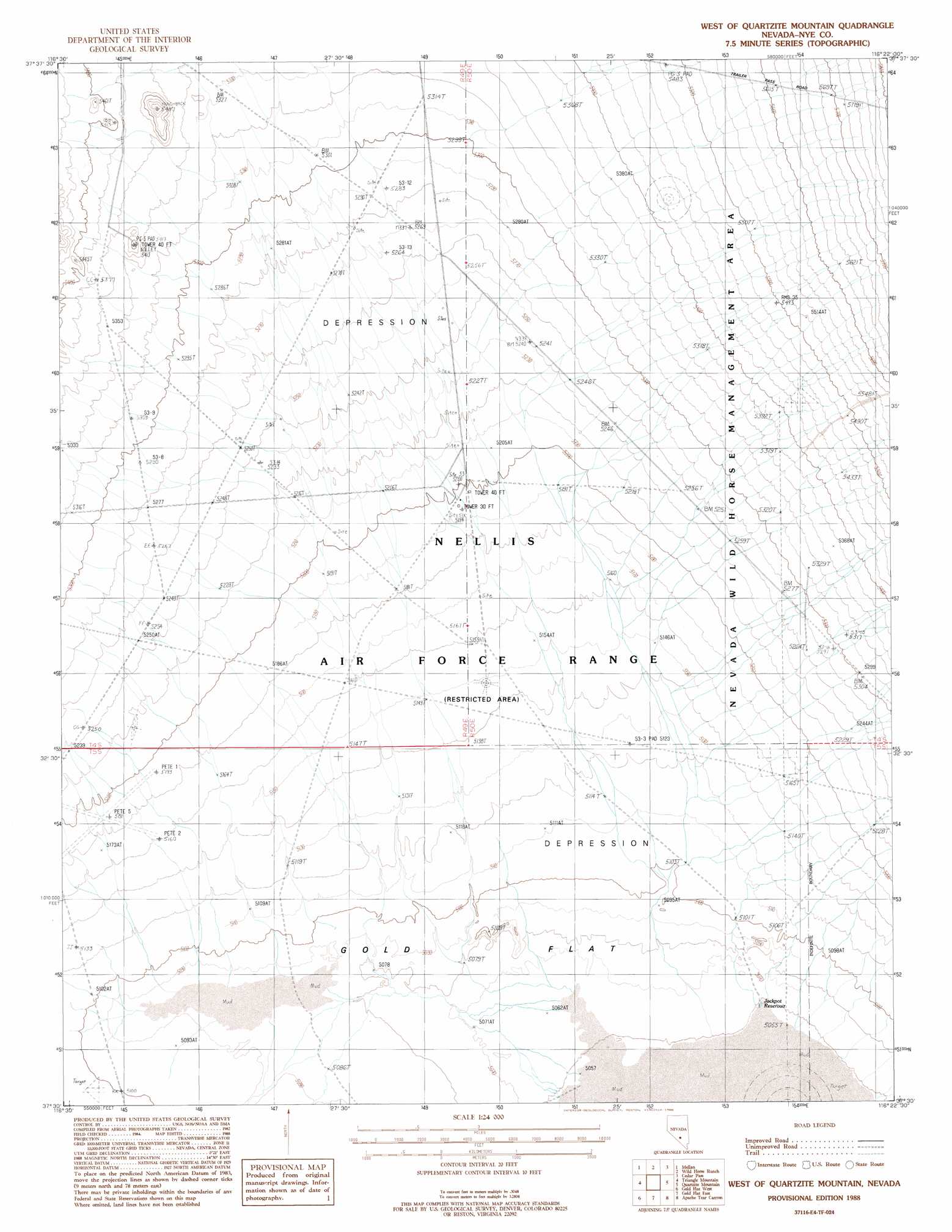
USGS Topo Quad 37116e4 - 1:24,000 scale
| Topo Map Name: | West Of Quartzite Mountain |
| USGS Topo Quad ID: | 37116e4 |
| Print Size: | ca. 21 1/4" wide x 27" high |
| Southeast Coordinates: | 37.5° N latitude / 116.375° W longitude |
| Map Center Coordinates: | 37.5625° N latitude / 116.4375° W longitude |
| U.S. State: | NV |
| Filename: | o37116e4.jpg |
| Download Map JPG Image: | West Of Quartzite Mountain topo map 1:24,000 scale |
| Map Type: | Topographic |
| Topo Series: | 7.5´ |
| Map Scale: | 1:24,000 |
| Source of Map Images: | United States Geological Survey (USGS) |
| Alternate Map Versions: |
West of Quartzite Mountain NV 1988, updated 1988 Download PDF Buy paper map |
1:24,000 Topo Quads surrounding West Of Quartzite Mountain
Stinking Spring Sw |
Breen Creek |
Kawich Peak Sw |
Georges Well |
Reveille Peak |
Roller Coaster Knob |
Mellan |
Wild Horse Ranch |
Cedar Pass |
Rhyolite Knob |
Trappman Hills |
Triangle Mountain |
West Of Quartzite Mountain |
Quartzite Mountain |
Lambs Pond |
Mount Helen |
Gold Flat West |
Gold Flat East |
Apache Tear Canyon |
Sundown Reservoir |
Black Mountain |
Trail Ridge |
Silent Butte |
Dead Horse Flat |
Quartet Dome |
> Back to 37116e1 at 1:100,000 scale
> Back to 37116a1 at 1:250,000 scale
> Back to U.S. Topo Maps home
West Of Quartzite Mountain topo map: Gazetteer
West Of Quartzite Mountain: Reservoirs
Jackpot Reservoir elevation 1543m 5062′West Of Quartzite Mountain digital topo map on disk
Buy this West Of Quartzite Mountain topo map showing relief, roads, GPS coordinates and other geographical features, as a high-resolution digital map file on DVD: