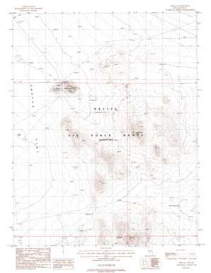
Mellan Topo Map Nevada

To zoom in, hover over the map of Mellan

USGS Topo Quad 37116f5 - 1:24,000 scale

Topo Map Name: Mellan
USGS Topo Quad ID: 37116f5
Print Size: ca. 21 1/4" wide x 27" high
Southeast Coordinates: 37.625° N latitude / 116.5° W longitude
Map Center Coordinates: 37.6875° N latitude / 116.5625° W longitude
U.S. State: NV
Filename: o37116f5.jpg
Download Map JPG Image: Mellan topo map 1:24,000 scale
Map Type: Topographic
Topo Series: 7.5´
Map Scale: 1:24,000
Source of Map Images: United States Geological Survey (USGS)
Alternate Map Versions: Mellan NV 1988, updated 1988 Download PDF Buy paper map

1:24,000 Topo Quads surrounding Mellan

Reeds Ranch
Reeds Ranch USGS topographic map 37116h7
Stinking Spring Nw
Stinking Spring Nw USGS topographic map 37116h6
Stinking Spring
Stinking Spring USGS topographic map 37116h5
Kawich Peak
Kawich Peak USGS topographic map 37116h4
Kawich Peak Ne
Kawich Peak Ne USGS topographic map 37116h3
East Of Cactus Peak
East Of Cactus Peak USGS topographic map 37116g7
Stinking Spring Sw
Stinking Spring Sw USGS topographic map 37116g6
Breen Creek
Breen Creek USGS topographic map 37116g5
Kawich Peak Sw
Kawich Peak Sw USGS topographic map 37116g4
Georges Well
Georges Well USGS topographic map 37116g3
Cactus Spring
Cactus Spring USGS topographic map 37116f7
Roller Coaster Knob
Roller Coaster Knob USGS topographic map 37116f6
Mellan
Mellan USGS topographic map 37116f5
Wild Horse Ranch
Wild Horse Ranch USGS topographic map 37116f4
Cedar Pass
Cedar Pass USGS topographic map 37116f3
Civet Cat Cave
Civet Cat Cave USGS topographic map 37116e7
Trappman Hills
Trappman Hills USGS topographic map 37116e6
Triangle Mountain
Triangle Mountain USGS topographic map 37116e5
West Of Quartzite Mountain
West Of Quartzite Mountain USGS topographic map 37116e4
Quartzite Mountain
Quartzite Mountain USGS topographic map 37116e3
Tolicha Peak Ne
Tolicha Peak Ne USGS topographic map 37116d7
Mount Helen
Mount Helen USGS topographic map 37116d6
Gold Flat West
Gold Flat West USGS topographic map 37116d5
Gold Flat East
Gold Flat East USGS topographic map 37116d4
Apache Tear Canyon
Apache Tear Canyon USGS topographic map 37116d3

> Back to 37116e1 at 1:100,000 scale
> Back to 37116a1 at 1:250,000 scale
> Back to U.S. Topo Maps home

Mellan topo map: Gazetteer

Mellan: Mines

Mellan Gold Mines elevation 1753m 5751′

Mellan: Populated Places

Mellan elevation 1671m 5482′

Mellan: Springs

Small Spring elevation 1682m 5518′

Mellan: Summits

Jack Rabbit Knob elevation 1821m 5974′
Mellan Mountain elevation 1800m 5905′

Mellan digital topo map on disk

Buy this Mellan topo map showing relief, roads, GPS coordinates and other geographical features, as a high-resolution digital map file on DVD:

Mellan topo map