Georges Well Topo Map Nevada
To zoom in, hover over the map of Georges Well
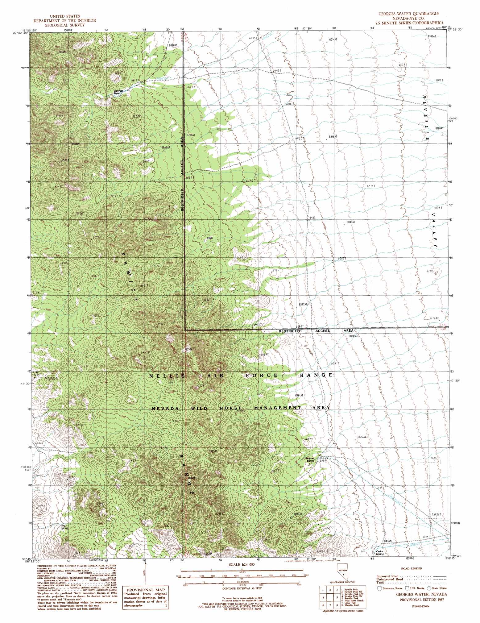
USGS Topo Quad 37116g3 - 1:24,000 scale
| Topo Map Name: | Georges Well |
| USGS Topo Quad ID: | 37116g3 |
| Print Size: | ca. 21 1/4" wide x 27" high |
| Southeast Coordinates: | 37.75° N latitude / 116.25° W longitude |
| Map Center Coordinates: | 37.8125° N latitude / 116.3125° W longitude |
| U.S. State: | NV |
| Filename: | o37116g3.jpg |
| Download Map JPG Image: | Georges Well topo map 1:24,000 scale |
| Map Type: | Topographic |
| Topo Series: | 7.5´ |
| Map Scale: | 1:24,000 |
| Source of Map Images: | United States Geological Survey (USGS) |
| Alternate Map Versions: |
Georges Water NV 1987, updated 1988 Download PDF Buy paper map |
1:24,000 Topo Quads surrounding Georges Well
Stone Cabin Ranch Se |
Bellehelen |
Warm Springs Se |
Reveille |
Reveille Se |
Stinking Spring |
Kawich Peak |
Kawich Peak Ne |
Reveille Peak Nw |
Freds Well |
Breen Creek |
Kawich Peak Sw |
Georges Well |
Reveille Peak |
Reveille Peak Se |
Mellan |
Wild Horse Ranch |
Cedar Pass |
Rhyolite Knob |
Monotony Valley |
Triangle Mountain |
West Of Quartzite Mountain |
Quartzite Mountain |
Lambs Pond |
Belted Peak |
> Back to 37116e1 at 1:100,000 scale
> Back to 37116a1 at 1:250,000 scale
> Back to U.S. Topo Maps home
Georges Well topo map: Gazetteer
Georges Well: Springs
Cedar Spring elevation 1994m 6541′Georges Water elevation 2096m 6876′
Jarboe Spring elevation 2179m 7148′
Log Spring elevation 2068m 6784′
Sumner Spring elevation 2045m 6709′
Georges Well digital topo map on disk
Buy this Georges Well topo map showing relief, roads, GPS coordinates and other geographical features, as a high-resolution digital map file on DVD: