Reveille Peak Nw Topo Map Nevada
To zoom in, hover over the map of Reveille Peak Nw
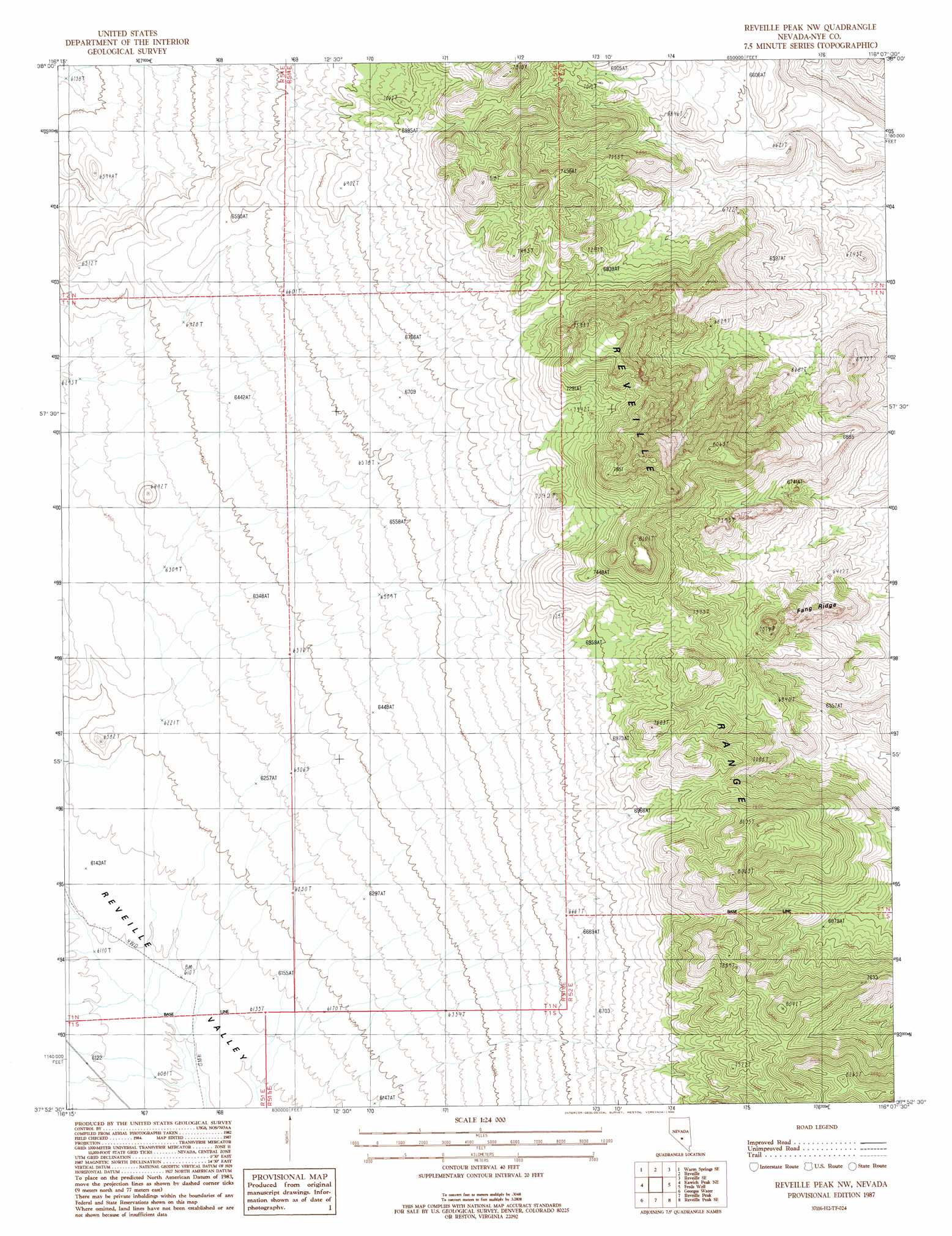
USGS Topo Quad 37116h2 - 1:24,000 scale
| Topo Map Name: | Reveille Peak Nw |
| USGS Topo Quad ID: | 37116h2 |
| Print Size: | ca. 21 1/4" wide x 27" high |
| Southeast Coordinates: | 37.875° N latitude / 116.125° W longitude |
| Map Center Coordinates: | 37.9375° N latitude / 116.1875° W longitude |
| U.S. State: | NV |
| Filename: | o37116h2.jpg |
| Download Map JPG Image: | Reveille Peak Nw topo map 1:24,000 scale |
| Map Type: | Topographic |
| Topo Series: | 7.5´ |
| Map Scale: | 1:24,000 |
| Source of Map Images: | United States Geological Survey (USGS) |
| Alternate Map Versions: |
Reveille Peak NW NV 1987, updated 1988 Download PDF Buy paper map |
1:24,000 Topo Quads surrounding Reveille Peak Nw
Warm Springs Summit |
Warm Springs |
Twin Springs Slough |
Echo Canyon |
Goat Ranch Well |
Bellehelen |
Warm Springs Se |
Reveille |
Reveille Se |
Eds Well |
Kawich Peak |
Kawich Peak Ne |
Reveille Peak Nw |
Freds Well |
Quinn Canyon Springs Nw |
Kawich Peak Sw |
Georges Well |
Reveille Peak |
Reveille Peak Se |
Black Top |
Wild Horse Ranch |
Cedar Pass |
Rhyolite Knob |
Monotony Valley |
White Blotch Springs Nw |
> Back to 37116e1 at 1:100,000 scale
> Back to 37116a1 at 1:250,000 scale
> Back to U.S. Topo Maps home
Reveille Peak Nw topo map: Gazetteer
Reveille Peak Nw: Ridges
Fang Ridge elevation 1912m 6272′Reveille Peak Nw: Summits
Mount Clayton elevation 2446m 8024′Reveille Peak Nw digital topo map on disk
Buy this Reveille Peak Nw topo map showing relief, roads, GPS coordinates and other geographical features, as a high-resolution digital map file on DVD: