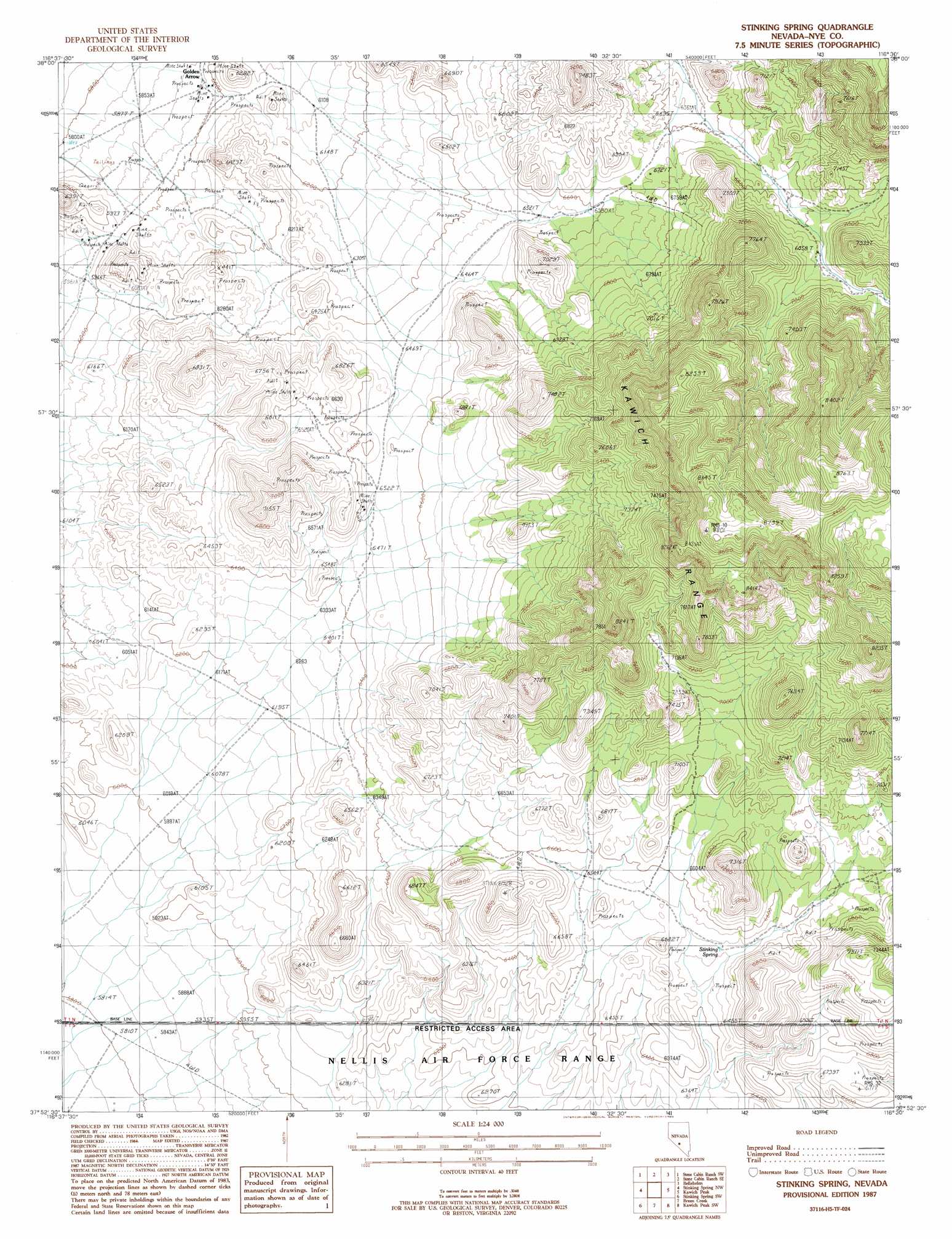
Stinking Spring Topo Map Nevada
To zoom in, hover over the map of Stinking Spring
USGS Topo Quad 37116h5 - 1:24,000 scale
| Topo Map Name: | Stinking Spring |
| USGS Topo Quad ID: | 37116h5 |
| Print Size: | ca. 21 1/4" wide x 27" high |
| Southeast Coordinates: | 37.875° N latitude / 116.5° W longitude |
| Map Center Coordinates: | 37.9375° N latitude / 116.5625° W longitude |
| U.S. State: | NV |
| Filename: | o37116h5.jpg |
| Download Map JPG Image: | Stinking Spring topo map 1:24,000 scale |
| Map Type: | Topographic |
| Topo Series: | 7.5´ |
| Map Scale: | 1:24,000 |
| Source of Map Images: | United States Geological Survey (USGS) |
| Alternate Map Versions: |
Stinking Spring NV 1987, updated 1988 Download PDF Buy paper map |
1:24,000 Topo Quads surrounding Stinking Spring
Mud Spring |
Stone Cabin Ranch |
Stone Cabin Ranch Ne |
Warm Springs Summit |
Warm Springs |
Yellow Cone |
Stone Cabin Ranch Sw |
Stone Cabin Ranch Se |
Bellehelen |
Warm Springs Se |
Reeds Ranch |
Stinking Spring Nw |
Stinking Spring |
Kawich Peak |
Kawich Peak Ne |
East Of Cactus Peak |
Stinking Spring Sw |
Breen Creek |
Kawich Peak Sw |
Georges Well |
Cactus Spring |
Roller Coaster Knob |
Mellan |
Wild Horse Ranch |
Cedar Pass |
> Back to 37116e1 at 1:100,000 scale
> Back to 37116a1 at 1:250,000 scale
> Back to U.S. Topo Maps home
Stinking Spring topo map: Gazetteer
Stinking Spring: Mines
Desert Shaft elevation 1840m 6036′Gold Bar Mine elevation 1819m 5967′
Golden Arrow Mine elevation 1832m 6010′
Jeep Mine elevation 2006m 6581′
Stinking Spring: Populated Places
Golden Arrow elevation 1810m 5938′Stinking Spring: Springs
Stinking Spring elevation 1984m 6509′Stinking Spring digital topo map on disk
Buy this Stinking Spring topo map showing relief, roads, GPS coordinates and other geographical features, as a high-resolution digital map file on DVD: